TopoQuest Logo
Do you find TopoQuest useful?
Help keep TopoQuest running and adding new maps/features by donating!
Bitcoin:  19c7KJd3qBynnjoSw5npx9KScwjBe4ifkT
Litecoin:  LXs6TkuXGGXo1vDsWCkWVdjQX94eUKd6ui
Home View Maps Find Maps Find Places Resources & Links


Olson Coulee North, Montana Topographic Map

USGS Map Title: Olson Coulee North, MT
USGS Map MRC: 47105D3
DRG (GeoTIFF) Download: o47105d3.tif


Neighboring USGS Topographic Map Quads:


  Buffalo Creek, MT  
47105E4
 

  Buffalo Creek SE, MT  
47105E3
 

  Circle Reservoir, MT  
47105E2
 

  Woodworth Hill, MT  
47105D4
 

  Olson Coulee North, MT  
47105D3
 

  Johnson Reservoir NW, MT  
47105D2
 

  Mount Antelope, MT  
47105C4
 

  Olson Coulee South, MT  
47105C3
 

  Deer Creek Church, MT  
47105C2


Map MRC Location:

N48°
W106°
N48°
W105°
H8 H7 H6 H5 H4 H3 H2 H1
G8 G7 G6 G5 G4 G3 G2 G1
F8 F7 F6 F5 F4 F3 F2 F1
E8 E7 E6 E5 E4 E3 E2 E1
D8 D7 D6 D5 D4 D3 D2 D1
C8 C7 C6 C5 C4 C3 C2 C1
B8 B7 B6 B5 B4 B3 B2 B1
A8 A7 A6 A5 A4 A3 A2 A1
N47°
W106°
N47°
W105°

Olson Coulee North, MT USGS 1:24K Topographic Map Preview:
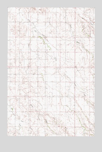
Olson Coulee North, MT USGS Topographic Map
Click on map above to begin viewing in our Map Viewer.

This topographic map contains these locations and features:
Feature Name Type Latitude Longitude GNIS ID View Map
19N50E01CBA_01 WellWellN47.4356°W105.2950°822905View Map
19N50E10AAA_01 WellWellN47.4289°W105.3250°822853View Map
19N50E12DCB_01 WellWellN47.4181°W105.2867°822781View Map
19N50E23ACD_01 WellWellN47.3964°W105.3075°822642View Map
19N51E20BAB_01 WellWellN47.3975°W105.2508°822651View Map
20N50E14CABA01 WellWellN47.4936°W105.3142°823377View Map
20N50E16CACB01 WellWellN47.4911°W105.3575°823368View Map
20N50E22DBBD01 WellWellN47.4781°W105.3300°823282View Map
20N50E24DDCA01 WellWellN47.4731°W105.2822°823250View Map
20N50E26CBCC01 WellWellN47.4620°W105.3203°823133View Map
20N50E28DDDD01 WellWellN47.4583°W105.3433°823098View Map
20N51E18DADB01 WellWellN47.4906°W105.2586°823366View Map
20N51E30CAAD01 WellWellN47.4631°W105.2686°823150View Map
20N51E30CAAD02 WellWellN47.4631°W105.2686°823151View Map
20N51E30CAAD03 WellWellN47.4631°W105.2686°823152View Map
20N51E32CABC01 WellWellN47.4486°W105.2505°822994View Map
20N51E32CABC02 WellWellN47.4486°W105.2505°822995View Map
Arnett CemeteryCemeteryN47.4542°W105.3644°1715597View Map
Buskirk School (historical)SchoolN47.3772°W105.3108°1715508View Map
Corral Creek (historical)Populated PlaceN47.4489°W105.3097°1715379View Map
Jensen Number 2 DamDamN47.4800°W105.3405°795948View Map
Jensen Number 3 DamDamN47.3800°W105.3339°795949View Map
Jensen Reservoir DamDamN47.4517°W105.2972°796090View Map
Jonas Number 2 DamDamN47.4400°W105.2722°797534View Map
Lower Corral Creek School (historical)SchoolN47.4886°W105.3553°1715553View Map
Olson CouleeValleyN47.3953°W105.3611°799777View Map
Upper Corral Creek School (historical)SchoolN47.4128°W105.3205°1715584View Map

Note: Coordinates in the location and feature list above are referenced to NAD83 datum.


Copyright (C) 2008-2025 Ryan Niemi / Sunset Dynamics ... All Rights Reserved