TopoQuest Logo
Do you find TopoQuest useful?
Help keep TopoQuest running and adding new maps/features by donating!
Bitcoin:  19c7KJd3qBynnjoSw5npx9KScwjBe4ifkT
Litecoin:  LXs6TkuXGGXo1vDsWCkWVdjQX94eUKd6ui
Home View Maps Find Maps Find Places Resources & Links


Onaway, Michigan Topographic Map

USGS Map Title: Onaway, MI
USGS Map MRC: 45084C2
DRG (GeoTIFF) Download: o45084c2.tif


Neighboring USGS Topographic Map Quads:


  Hangore Heights, MI  
45084D3
 

  Black Lake Bluffs, MI  
45084D2
 

  Ocqueoc, MI  
45084D1
 

  Tower, MI  
45084C3
 

  Onaway, MI  
45084C2
 

  Millersburg, MI  
45084C1
 

  Silver Lake, MI  
45084B3
 

  Lake Geneva, MI  
45084B2
 

  Cranberry Lake, MI  
45084B1


Map MRC Location:

N46°
W85°
N46°
W84°
H8 H7 H6 H5 H4 H3 H2 H1
G8 G7 G6 G5 G4 G3 G2 G1
F8 F7 F6 F5 F4 F3 F2 F1
E8 E7 E6 E5 E4 E3 E2 E1
D8 D7 D6 D5 D4 D3 D2 D1
C8 C7 C6 C5 C4 C3 C2 C1
B8 B7 B6 B5 B4 B3 B2 B1
A8 A7 A6 A5 A4 A3 A2 A1
N45°
W85°
N45°
W84°

Onaway, MI USGS 1:24K Topographic Map Preview:
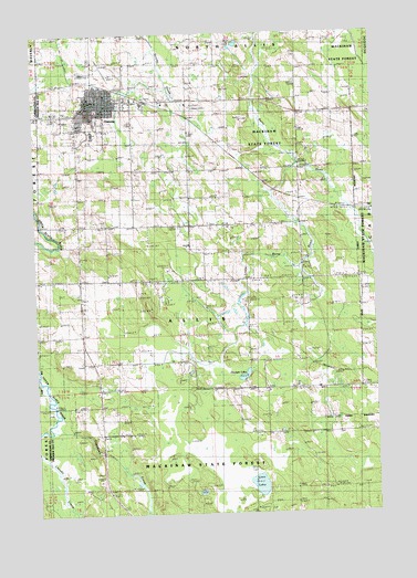
Onaway, MI USGS Topographic Map
Click on map above to begin viewing in our Map Viewer.

This topographic map contains these locations and features:
Feature Name Type Latitude Longitude GNIS ID View Map
Allis CemeteryCemeteryN45.3256°W84.2247°619997View Map
Case Post Office (historical)Post OfficeN45.3292°W84.1311°2374019View Map
Case Station (historical)LocaleN45.3292°W84.1311°2374021View Map
City of OnawayCivilN45.3592°W84.2278°1626846View Map
Community of ChristChurchN45.3514°W84.2333°2374290View Map
East Branch Rainy RiverStreamN45.3253°W84.1317°625145View Map
Edna Lound Recreational ParkParkN45.3611°W84.2328°2374289View Map
Elmwood CemeteryCemeteryN45.3542°W84.2420°625532View Map
First Baptist ChurchChurchN45.3564°W84.2236°2374292View Map
Forest Waverly Fire DepartmentBuildingN45.2783°W84.2269°2374307View Map
Hackett LakeLakeN45.2859°W84.1735°627574View Map
Hackett Lake SchoolSchoolN45.2828°W84.1661°627576View Map
Holy Cross Lutheran ChurchChurchN45.3406°W84.2133°2374297View Map
Leo E Goetz County AirportAirportN45.3652°W84.2266°1624084View Map
Little Rainy RiverStreamN45.3406°W84.1528°630746View Map
Little Traverse Primary CareHospitalN45.3583°W84.2269°2374305View Map
Loon LakeLakeN45.2574°W84.1689°631053View Map
OnawayPopulated PlaceN45.3575°W84.2239°634060View Map
Onaway Area Ambulance ServiceBuildingN45.3638°W84.2284°2662109View Map
Onaway Area Community SchoolsSchoolN45.3489°W84.2281°2374308View Map
Onaway Assembly of God ChurchChurchN45.3458°W84.2339°2374296View Map
Onaway Baptist ChurchChurchN45.3581°W84.2000°2374293View Map
Onaway Branch LibraryBuildingN45.3581°W84.2275°2374304View Map
Onaway Fire DepartmentBuildingN45.3589°W84.2301°2374300View Map
Onaway Fire DepartmentBuildingN45.3575°W84.2269°2374301View Map
Onaway Medical CenterHospitalN45.3544°W84.2344°2374306View Map
Onaway Motor SpeedwayLocaleN45.3450°W84.2361°2374312View Map
Onaway Post Office (historical)Post OfficeN45.3575°W84.2275°2374303View Map
Onaway Station (historical)LocaleN45.3611°W84.2228°2374302View Map
Saint Paul's Catholic CemeteryCemeteryN45.3539°W84.2417°2374333View Map
Saint Paul's Catholic ChurchChurchN45.3564°W84.2297°2374298View Map
Seventh-Day Adventist ChurchChurchN45.3544°W84.2358°2374294View Map
Seventh-Day Adventist SchoolSchoolN45.3544°W84.2358°2374295View Map
Stoney Links Golf CourseLocaleN45.3528°W84.1944°2374316View Map
Tomahawk CreekStreamN45.2750°W84.2414°1614936View Map
Tomahawk SchoolLocaleN45.2703°W84.2256°1614939View Map
Township of AllisCivilN45.2799°W84.1868°1625824View Map
United Methodist ChurchChurchN45.3592°W84.2236°2374291View Map

Note: Coordinates in the location and feature list above are referenced to NAD83 datum.


Copyright (C) 2008-2025 Ryan Niemi / Sunset Dynamics ... All Rights Reserved