TopoQuest Logo
Do you find TopoQuest useful?
Help keep TopoQuest running and adding new maps/features by donating!
Bitcoin:  19c7KJd3qBynnjoSw5npx9KScwjBe4ifkT
Litecoin:  LXs6TkuXGGXo1vDsWCkWVdjQX94eUKd6ui
Home View Maps Find Maps Find Places Resources & Links


Black Lake Bluffs, Michigan Topographic Map

USGS Map Title: Black Lake Bluffs, MI
USGS Map MRC: 45084D2
DRG (GeoTIFF) Download: o45084d2.tif


Neighboring USGS Topographic Map Quads:


  Hangore Heights, MI  
45084D3
 

  Black Lake Bluffs, MI  
45084D2
 

  Ocqueoc, MI  
45084D1
 

  Tower, MI  
45084C3
 

  Onaway, MI  
45084C2
 

  Millersburg, MI  
45084C1


Map MRC Location:

N46°
W85°
N46°
W84°
H8 H7 H6 H5 H4 H3 H2 H1
G8 G7 G6 G5 G4 G3 G2 G1
F8 F7 F6 F5 F4 F3 F2 F1
E8 E7 E6 E5 E4 E3 E2 E1
D8 D7 D6 D5 D4 D3 D2 D1
C8 C7 C6 C5 C4 C3 C2 C1
B8 B7 B6 B5 B4 B3 B2 B1
A8 A7 A6 A5 A4 A3 A2 A1
N45°
W85°
N45°
W84°

Black Lake Bluffs, MI USGS 1:24K Topographic Map Preview:
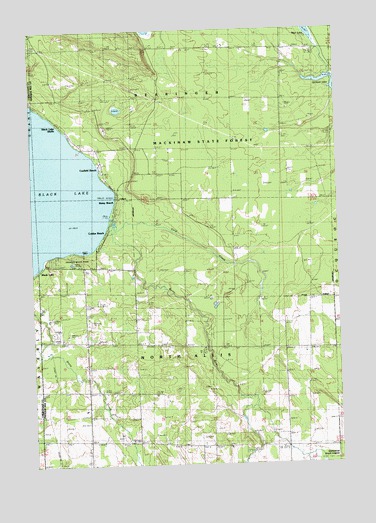
Black Lake Bluffs, MI USGS Topographic Map
Click on map above to begin viewing in our Map Viewer.

This topographic map contains these locations and features:
Feature Name Type Latitude Longitude GNIS ID View Map
Allis Post Office (historical)Post OfficeN45.4097°W84.2472°2374026View Map
Bearinger Union School Historical MarkerParkN45.4944°W84.1478°2374346View Map
Black LakePopulated PlaceN45.4314°W84.2486°621513View Map
Black Lake BluffsPopulated PlaceN45.4722°W84.2370°621516View Map
Canfield BeachPopulated PlaceN45.4606°W84.2217°622686View Map
Coddes BeachPopulated PlaceN45.4428°W84.2192°623530View Map
Cold CreekStreamN45.4464°W84.2181°623557View Map
Grace SchoolLocaleN45.4945°W84.1475°627061View Map
Joy Community ChurchChurchN45.4042°W84.2472°2374299View Map
Michigan Department of Natural Resources Onaway Field OfficeBuildingN45.4149°W84.2308°2626987View Map
North Allis CemeteryCemeteryN45.4214°W84.2267°633469View Map
Onaway State ParkParkN45.4345°W84.2314°634061View Map
Orchard LakeLakeN45.4848°W84.1312°1617390View Map
Rainy BeachPopulated PlaceN45.4506°W84.2153°635606View Map
Rainy RiverStreamN45.4447°W84.2161°635609View Map
Roberts SchoolSchoolN45.4103°W84.2283°636042View Map
Rowe SchoolLocaleN45.3822°W84.2200°636344View Map
Township of North AllisCivilN45.4092°W84.1873°1626810View Map

Note: Coordinates in the location and feature list above are referenced to NAD83 datum.


Copyright (C) 2008-2025 Ryan Niemi / Sunset Dynamics ... All Rights Reserved