TopoQuest Logo
Do you find TopoQuest useful?
Help keep TopoQuest running and adding new maps/features by donating!
Bitcoin:  19c7KJd3qBynnjoSw5npx9KScwjBe4ifkT
Litecoin:  LXs6TkuXGGXo1vDsWCkWVdjQX94eUKd6ui
Home View Maps Find Maps Find Places Resources & Links


Orient, Washington Topographic Map

USGS Map Title: Orient, WA
USGS Map MRC: 48118G2
DRG (GeoTIFF) Download: o48118g2.tif


Neighboring USGS Topographic Map Quads:


  Independent Mountain, WA  
48118H3
 

  Laurier, WA  
48118H2
 

  Churchill Mountain, WA  
48118H1
 

  Bulldog Mountain, WA  
48118G3
 

  Orient, WA  
48118G2
 

  Bossburg, WA  
48118G1
 

  Jackknife Mountain, WA  
48118F3
 

  Boyds, WA  
48118F2
 

  Marcus, WA  
48118F1


Map MRC Location:

N49°
W119°
N49°
W118°
H8 H7 H6 H5 H4 H3 H2 H1
G8 G7 G6 G5 G4 G3 G2 G1
F8 F7 F6 F5 F4 F3 F2 F1
E8 E7 E6 E5 E4 E3 E2 E1
D8 D7 D6 D5 D4 D3 D2 D1
C8 C7 C6 C5 C4 C3 C2 C1
B8 B7 B6 B5 B4 B3 B2 B1
A8 A7 A6 A5 A4 A3 A2 A1
N48°
W119°
N48°
W118°

Orient, WA USGS 1:24K Topographic Map Preview:
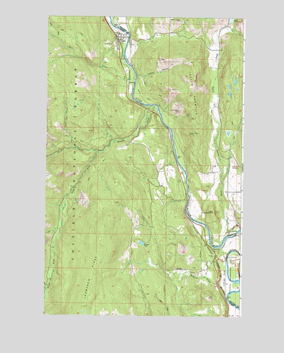
Orient, WA USGS Topographic Map
Click on map above to begin viewing in our Map Viewer.

This topographic map contains these locations and features:
Feature Name Type Latitude Longitude GNIS ID View Map
BarstowPopulated PlaceN48.7771°W118.1428°1516168View Map
Barstow BridgeBridgeN48.7846°W118.1255°2607972View Map
Barstow Census Designated PlaceCensusN48.7783°W118.1329°2631208View Map
Boulder CreekStreamN48.8380°W118.1808°1516830View Map
Cooper Butte MineMineN48.8357°W118.1656°1518053View Map
Doyle CreekStreamN48.8118°W118.1789°1518912View Map
DulwichPopulated PlaceN48.8474°W118.1975°1518998View Map
East Deer CreekStreamN48.8491°W118.1936°1519083View Map
Echo CreekStreamN48.7618°W118.2475°1519167View Map
Globe MineMineN48.8343°W118.1617°1520007View Map
Hidden Treasure MineMineN48.8735°W118.1656°1520764View Map
Hodgson CreekStreamN48.7627°W118.1383°1520830View Map
Joint Protection Ferry County Fire District 3 - Stevens County Fire District 8 BarstowBuildingN48.7735°W118.1422°2643694View Map
Joint Protection Ferry County Fire District 3 - Stevens County Fire District 8 OrientBuildingN48.8663°W118.2053°2643702View Map
Kelly Hill CemeteryCemeteryN48.8131°W118.1268°1521600View Map
Kettle River Community Health CenterBuildingN48.8658°W118.2043°2607892View Map
Liberty CanyonValleyN48.8499°W118.1889°1522054View Map
Little Marble MountainSummitN48.7935°W118.1447°1522258View Map
North Fork Boulder CreekStreamN48.8180°W118.2172°1523739View Map
OrientPopulated PlaceN48.8660°W118.2028°1524070View Map
Orient Census Designated PlaceCensusN48.8638°W118.2059°2586743View Map
Orient Community ChurchChurchN48.8668°W118.2045°2609553View Map
Orient Elementary SchoolSchoolN48.8685°W118.2044°1530552View Map
Orient Post OfficePost OfficeN48.8663°W118.2048°2606999View Map
Renner LakeLakeN48.7805°W118.1888°1525001View Map
Scotia MineMineN48.8268°W118.1556°1525515View Map
Slide CreekStreamN48.8657°W118.2436°1525936View Map
Snow Cap CreekStreamN48.8199°W118.2311°1526025View Map
South Fork Boulder CreekStreamN48.8180°W118.2169°1526161View Map
Thompson RidgeRidgeN48.7538°W118.2228°1527113View Map
Tom CreekStreamN48.7860°W118.2394°1527290View Map
Toulou CreekStreamN48.7843°W118.1342°1527321View Map
Toulou MountainSummitN48.8424°W118.1594°1527322View Map

Note: Coordinates in the location and feature list above are referenced to NAD83 datum.


Copyright (C) 2008-2024 Ryan Niemi / Sunset Dynamics ... All Rights Reserved