TopoQuest Logo
Do you find TopoQuest useful?
Help keep TopoQuest running and adding new maps/features by donating!
Bitcoin:  19c7KJd3qBynnjoSw5npx9KScwjBe4ifkT
Litecoin:  LXs6TkuXGGXo1vDsWCkWVdjQX94eUKd6ui
Home View Maps Find Maps Find Places Resources & Links


Churchill Mountain, Washington Topographic Map

USGS Map Title: Churchill Mountain, WA
USGS Map MRC: 48118H1
DRG (GeoTIFF) Download: o48118h1.tif


Neighboring USGS Topographic Map Quads:


  Laurier, WA  
48118H2
 

  Churchill Mountain, WA  
48118H1
 

  Belshazzar Mountain, WA  
48117H8
 

  Orient, WA  
48118G2
 

  Bossburg, WA  
48118G1
 

  China Bend, WA  
48117G8


Map MRC Location:

N49°
W119°
N49°
W118°
H8 H7 H6 H5 H4 H3 H2 H1
G8 G7 G6 G5 G4 G3 G2 G1
F8 F7 F6 F5 F4 F3 F2 F1
E8 E7 E6 E5 E4 E3 E2 E1
D8 D7 D6 D5 D4 D3 D2 D1
C8 C7 C6 C5 C4 C3 C2 C1
B8 B7 B6 B5 B4 B3 B2 B1
A8 A7 A6 A5 A4 A3 A2 A1
N48°
W119°
N48°
W118°

Churchill Mountain, WA USGS 1:24K Topographic Map Preview:
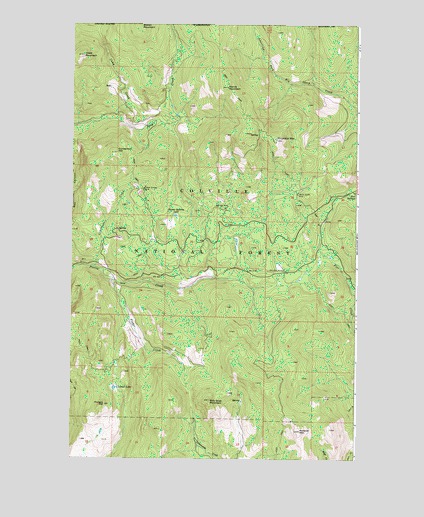
Churchill Mountain, WA USGS Topographic Map
Click on map above to begin viewing in our Map Viewer.

This topographic map contains these locations and features:
Feature Name Type Latitude Longitude GNIS ID View Map
Big Iron MineMineN48.9469°W118.0581°1516523View Map
Billy Goat MountainSummitN48.8916°W118.0644°1516561View Map
Bowen MountainSummitN48.9996°W118.0950°1516886View Map
Camp CreekStreamN48.9721°W118.1056°1517266View Map
Churchill LookoutLocaleN48.9666°W118.0361°1534137View Map
Churchill MineMineN48.9294°W118.0328°1517773View Map
Churchill MountainSummitN48.9666°W118.0361°1517774View Map
Contention HillSummitN48.9627°W118.1058°1518033View Map
Easter Sunday LakeLakeN48.9451°W118.0798°1519149View Map
Easter Sunday MineMineN48.9521°W118.0939°1519150View Map
Fisher CreekStreamN48.9266°W118.1072°1519600View Map
Fisher Creek CabinLocaleN48.9055°W118.0806°1529545View Map
Hope MountainSummitN48.9907°W118.1211°1520908View Map
Horns MountainSummitN48.9813°W118.0575°1520923View Map
Hungry HillSummitN48.8902°W118.1103°1521068View Map
Kiel SpringsSpringN48.9516°W118.0016°1521657View Map
Lamar LakeLakeN48.8952°W118.1060°1521871View Map
Limestone CreekStreamN48.9299°W118.1153°1522117View Map
Mineral MountainSummitN48.8827°W118.0250°1523219View Map
White Horse MineMineN48.9510°W118.0264°1528063View Map

Note: Coordinates in the location and feature list above are referenced to NAD83 datum.


Copyright (C) 2008-2025 Ryan Niemi / Sunset Dynamics ... All Rights Reserved