TopoQuest Logo
Do you find TopoQuest useful?
Help keep TopoQuest running and adding new maps/features by donating!
Bitcoin:  19c7KJd3qBynnjoSw5npx9KScwjBe4ifkT
Litecoin:  LXs6TkuXGGXo1vDsWCkWVdjQX94eUKd6ui
Home View Maps Find Maps Find Places Resources & Links


Oro Valley, Arizona Topographic Map

USGS Map Title: Oro Valley, AZ
USGS Map MRC: 32110D8
DRG (GeoTIFF) Download: o32110d8.tif


Neighboring USGS Topographic Map Quads:


  Tortolita Mountains, AZ  
32111E1
 

  Oracle Junction, AZ  
32110E8
 

  Oracle, AZ  
32110E7
 

  Ruelas Canyon, AZ  
32111D1
 

  Oro Valley, AZ  
32110D8
 

  Mount Lemmon, AZ  
32110D7
 

  Jaynes, AZ  
32111C1
 

  Tucson North, AZ  
32110C8
 

  Sabino Canyon, AZ  
32110C7


Map MRC Location:

N33°
W111°
N33°
W110°
H8 H7 H6 H5 H4 H3 H2 H1
G8 G7 G6 G5 G4 G3 G2 G1
F8 F7 F6 F5 F4 F3 F2 F1
E8 E7 E6 E5 E4 E3 E2 E1
D8 D7 D6 D5 D4 D3 D2 D1
C8 C7 C6 C5 C4 C3 C2 C1
B8 B7 B6 B5 B4 B3 B2 B1
A8 A7 A6 A5 A4 A3 A2 A1
N32°
W111°
N32°
W110°

Oro Valley, AZ USGS 1:24K Topographic Map Preview:
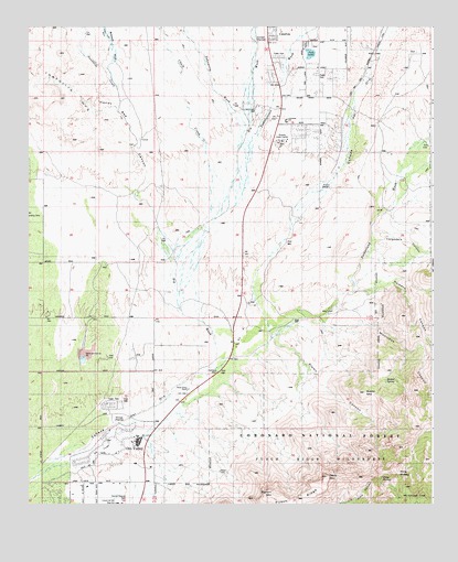
Oro Valley, AZ USGS Topographic Map
Click on map above to begin viewing in our Map Viewer.

This topographic map contains these locations and features:
Feature Name Type Latitude Longitude GNIS ID View Map
Alamo CanyonValleyN32.4176°W110.9243°25558View Map
Arizona Youth CenterBuildingN32.4695°W110.9220°37154View Map
Batamote WashStreamN32.4892°W110.9756°1071View Map
Big WashStreamN32.4134°W110.9420°26310View Map
Bighorn MountainSummitN32.3776°W110.9237°37172View Map
Brave Bull Ranch Resort Airport (historical)AirportN32.4973°W110.8915°45325View Map
Buster MountainSummitN32.4042°W110.8965°37195View Map
Buster SpringSpringN32.4073°W110.8899°27071View Map
Canyon Del Oro High SchoolSchoolN32.3751°W110.9712°37204View Map
Cargodera CanyonValleyN32.4434°W110.8932°27284View Map
Catalina Census Designated PlaceCensusN32.4849°W110.8996°2407989View Map
Catalina Country Manufatured Home CommunityPopulated PlaceN32.4922°W110.9231°2622703View Map
Catalina Lutheran ChurchChurchN32.4929°W110.9161°2623040View Map
Catalina Mountain SchoolSchoolN32.4694°W110.9222°2543754View Map
Catalina Post OfficePost OfficeN32.4987°W110.9266°2622634View Map
Catalina State ParkParkN32.4362°W110.9048°41798View Map
Catchment canyonValleyN32.4034°W110.9470°44765View Map
Chalk CreekStreamN32.4498°W110.9440°27480View Map
Clare Bridge of Oro ValleyBuildingN32.3910°W110.9647°2622867View Map
Copper Creek Elementary SchoolSchoolN32.4181°W110.9863°2544795View Map
Coronado K - 8 SchoolSchoolN32.4755°W110.9206°37251View Map
Cottonwood TankReservoirN32.3951°W110.9262°41796View Map
Cross Community ChurchChurchN32.3848°W110.9622°2623411View Map
Dead Horse CanyonValleyN32.4015°W110.9162°41797View Map
Dennis Weaver ParkParkN32.3759°W110.9690°37269View Map
Desert Point La ReserveBuildingN32.4014°W110.9520°2622869View Map
El Conquistador Golf CourseLocaleN32.3917°W110.9579°43342View Map
First Baptist ChurchChurchN32.4759°W110.9182°2623105View Map
Foothills Business ParkLocaleN32.4035°W110.9474°2622375View Map
Golder Ranch Fire District Station 370BuildingN32.4823°W110.9119°2622544View Map
Golder Ranch Fire District Station 374BuildingN32.4650°W110.9547°2622545View Map
Golder Ranch Fire District Station 375BuildingN32.4257°W110.9679°2622546View Map
Golder Ranch Fire District Station 376BuildingN32.3966°W110.9972°2622547View Map
Golder Ranch Fire District Station 377BuildingN32.3812°W110.9653°2672722View Map
Highlands Mobile Home CommunityPopulated PlaceN32.4008°W110.9750°2622744View Map
Honey Bee CanyonValleyN32.4337°W110.9595°30087View Map
Horizon HeliportAirportN32.4104°W110.9426°45427View Map
Indian Town WashStreamN32.4967°W110.9744°6243View Map
Montrose CanyonValleyN32.4220°W110.9098°31977View Map
Mount KimballSummitN32.3765°W110.8801°30759View Map
Mountain Shadows Presbyterian ChurchChurchN32.4641°W110.9253°2623177View Map
Mountain View Assembly of God ChurchChurchN32.4951°W110.9231°2623178View Map
Orchard Valley Mobile Home ParkPopulated PlaceN32.4882°W110.9093°2622706View Map
Oro ValleyPopulated PlaceN32.3909°W110.9665°37458View Map
Oro Valley Country Club Golf CourseLocaleN32.3898°W110.9743°43379View Map
Oro Valley HospitalHospitalN32.4294°W110.9489°2622849View Map
Oro Valley Police DepartmentBuildingN32.4079°W110.9953°2622614View Map
Oro Valley Post OfficePost OfficeN32.4227°W110.9948°2622639View Map
Oro Valley Public LibraryBuildingN32.4090°W110.9944°2623586View Map
Oro Valley Retail CenterLocaleN32.4224°W110.9626°2622431View Map
Oro Valley Retail CenterLocaleN32.3996°W110.9593°2622432View Map
Oro Valley Town HallBuildingN32.4074°W110.9942°2623629View Map
Oro Valley United Church of ChristChurchN32.3883°W110.9518°2623202View Map
Painted Sky Elementary SchoolSchoolN32.4354°W110.9706°2544767View Map
Pima County Sheriff's Office Catalina SubstationBuildingN32.4904°W110.9253°2751678View Map
Pima SaddleGapN32.3831°W110.8857°37470View Map
Pima SpringSpringN32.3821°W110.8909°37471View Map
Pusch RidgeRidgeN32.3779°W110.9245°33237View Map
Pusch Ridge Golf CourseLocaleN32.3886°W110.9573°2622991View Map
Rancho Vistoso Office ParkLocaleN32.4328°W110.9667°2622398View Map
Resurrection Lutheran ChurchChurchN32.4167°W110.9617°2623224View Map
Romero CanyonValleyN32.4323°W110.8879°33784View Map
Sahuarita WashArroyoN32.4731°W110.9326°37512View Map
Santa Catalina ChurchChurchN32.4661°W110.9234°2623280View Map
Sausaulito CreekStreamN32.4251°W110.9526°34096View Map
Steam Pump RanchLocaleN32.4051°W110.9509°34807View Map
Stone Canyon ClubLocaleN32.4678°W110.9920°2622994View Map
Sun City Vistoso Golf CourseLocaleN32.4623°W110.9466°2622995View Map
Sutherland TrailheadLocaleN32.4431°W110.8753°2611821View Map
Sutherland WashStreamN32.4187°W110.9259°34991View Map
Table MountainSummitN32.3823°W110.9079°37548View Map
The Golf Club at VistosoLocaleN32.4548°W110.9839°2622993View Map
Town of Oro ValleyCivilN32.4223°W110.9767°2413092View Map
Twentyseven WashStreamN32.4564°W110.9339°12923View Map
Twin LakesLakeN32.4931°W110.9129°37569View Map
Vista de La Montana Methodist ChurchChurchN32.4787°W110.9288°2623348View Map
Vistoso Community ChurchChurchN32.4651°W110.9538°2623349View Map
Vistoso Memorial ChapelChurchN32.4425°W110.9390°2623553View Map

Note: Coordinates in the location and feature list above are referenced to NAD83 datum.


Copyright (C) 2008-2025 Ryan Niemi / Sunset Dynamics ... All Rights Reserved