TopoQuest Logo
Do you find TopoQuest useful?
Help keep TopoQuest running and adding new maps/features by donating!
Bitcoin:  19c7KJd3qBynnjoSw5npx9KScwjBe4ifkT
Litecoin:  LXs6TkuXGGXo1vDsWCkWVdjQX94eUKd6ui
Home View Maps Find Maps Find Places Resources & Links


Ortonville, Michigan Topographic Map

USGS Map Title: Ortonville, MI
USGS Map MRC: 42083G4
DRG (GeoTIFF) Download: o42083g4.tif


Neighboring USGS Topographic Map Quads:


  Goodrich, MI  
42083H5
 

  Hadley, MI  
42083H4
 

  Metamora, MI  
42083H3
 

  Davisburg, MI  
42083G5
 

  Ortonville, MI  
42083G4
 

  Oxford, MI  
42083G3
 

  Highland, MI  
42083F5
 

  Clarkston, MI  
42083F4
 

  Pontiac North, MI  
42083F3


Map MRC Location:

N43°
W84°
N43°
W83°
H8 H7 H6 H5 H4 H3 H2 H1
G8 G7 G6 G5 G4 G3 G2 G1
F8 F7 F6 F5 F4 F3 F2 F1
E8 E7 E6 E5 E4 E3 E2 E1
D8 D7 D6 D5 D4 D3 D2 D1
C8 C7 C6 C5 C4 C3 C2 C1
B8 B7 B6 B5 B4 B3 B2 B1
A8 A7 A6 A5 A4 A3 A2 A1
N42°
W84°
N42°
W83°

Ortonville, MI USGS 1:24K Topographic Map Preview:
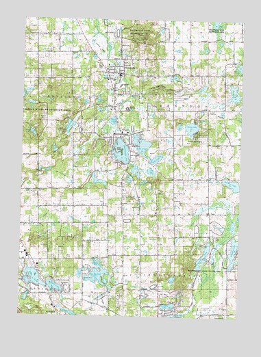
Ortonville, MI USGS Topographic Map
Click on map above to begin viewing in our Map Viewer.

This topographic map contains these locations and features:
Feature Name Type Latitude Longitude GNIS ID View Map
Bald Eagle LakeLakeN42.8175°W83.4439°620496View Map
Bald Eagle Lake CemeteryCemeteryN42.8221°W83.4387°2648740View Map
Bell Anne SchoolSchoolN42.8275°W83.4397°621027View Map
Brandon Fire Department Station 1BuildingN42.8514°W83.4443°2619919View Map
Brandon GardensPopulated PlaceN42.8256°W83.4436°621887View Map
Brandon High SchoolSchoolN42.8375°W83.4411°2649470View Map
Brandon SchoolSchoolN42.8473°W83.4441°621888View Map
Brandon Township CemeteryCemeteryN42.8220°W83.4384°2649545View Map
Bridge LakeLakeN42.7511°W83.4705°621962View Map
Camp ClarkstonLocaleN42.7550°W83.4669°622549View Map
Camp HolidayLocaleN42.8425°W83.4583°622585View Map
Camp NahelluLocaleN42.8323°W83.4008°622609View Map
Camp NarrinLocaleN42.8295°W83.4780°622611View Map
Carmer CemeteryCemeteryN42.8723°W83.4533°622741View Map
Cedar LakeLakeN42.8567°W83.4455°622923View Map
Charles F Sherman Memorial ParkParkN42.8550°W83.4450°2649469View Map
Charter Township of BrandonCivilN42.8377°W83.3933°1625971View Map
Cranberry LakeLakeN42.7546°W83.4148°623972View Map
Crooked LakeLakeN42.7761°W83.3947°624097View Map
Dixie LakeLakeN42.7660°W83.4915°624712View Map
Duck CreekStreamN42.8478°W83.4472°624915View Map
Eagle IslandIslandN42.8192°W83.4433°625077View Map
Eaton CemeteryCemeteryN42.8714°W83.4202°620750View Map
Ed Schulte's Place AirportAirportN42.8083°W83.4524°1624089View Map
Ekelund LakeLakeN42.8411°W83.4567°625417View Map
Enders HillSummitN42.8323°W83.4888°625591View Map
Everest AcademySchoolN42.7514°W83.3930°2342699View Map
Grass LakeLakeN42.8322°W83.4482°627185View Map
Groveland Township Fire Department Station 2BuildingN42.8310°W83.4827°2619977View Map
Harvey-Swanson Elementary SchoolSchoolN42.8449°W83.4469°2343114View Map
Hidden LakeLakeN42.8301°W83.4102°628206View Map
Howard T Burt Elementary SchoolSchoolN42.8449°W83.4469°2344732View Map
Huff LakeLakeN42.8164°W83.4232°1625072View Map
Independence Fire Department Station 2BuildingN42.7525°W83.3809°2620103View Map
Independence Oaks County ParkParkN42.7764°W83.3917°2648738View Map
Jossman AcresPopulated PlaceN42.7648°W83.4708°629404View Map
Knox LakeLakeN42.7620°W83.4477°629830View Map
Lake LouiseLakeN42.8220°W83.4327°631134View Map
Lake Louise ChurchChurchN42.8178°W83.4341°629979View Map
Lake NicholasLakeN42.8364°W83.3975°2062916View Map
Long LakeLakeN42.8114°W83.4343°630929View Map
Mount Bethel CemeteryCemeteryN42.8025°W83.4925°2648739View Map
Mount Bethel ChurchChurchN42.8028°W83.4899°632771View Map
Mud LakeLakeN42.8736°W83.3906°633068View Map
Narrin LakeLakeN42.8301°W83.4729°633215View Map
Oak Hill Post Office (historical)Post OfficeN42.7931°W83.4497°2649091View Map
OrtonvillePopulated PlaceN42.8523°W83.4430°634118View Map
Ortonville CemeteryCemeteryN42.8553°W83.4580°2649546View Map
Ortonville Methodist Episcopal Church Historical MarkerParkN42.8544°W83.4428°2648830View Map
Ortonville Post OfficePost OfficeN42.8512°W83.4435°2649468View Map
Pentecost ChurchChurchN42.8081°W83.3919°634605View Map
Pentecostal ChurchChurchN42.7517°W83.3819°634608View Map
Perry LakeReservoirN42.8298°W83.4032°634674View Map
Perry Lake HeightsPopulated PlaceN42.8278°W83.4011°634675View Map
Saint Anne ChurchChurchN42.8392°W83.4469°636534View Map
Seymour LakeLakeN42.8063°W83.3792°637615View Map
Seymour Lake Post Office (historical)Post OfficeN42.8089°W83.3869°2649084View Map
Sherman Lifelong Learning CenterSchoolN42.8575°W83.4380°2340871View Map
Shurter CemeteryCemeteryN42.8055°W83.3925°2649494View Map
Springfield Plains CemeteryCemeteryN42.7667°W83.4630°638626View Map
Springfield Plains Elementary SchoolSchoolN42.7565°W83.4616°2340933View Map
Springfield Township Fire Department Station 2 HeadquartersBuildingN42.7738°W83.4939°2620210View Map
Susin LakeLakeN42.7624°W83.4799°639121View Map
The High BanksCliffN42.8470°W83.4233°1614713View Map
Truax LakeLakeN42.8510°W83.4130°1615130View Map
Tully LakeLakeN42.8128°W83.4386°1615162View Map
Upper Bushman LakeLakeN42.7892°W83.3777°1615398View Map
Village of OrtonvilleCivilN42.8510°W83.4427°2399588View Map
Wau-Me-Gah LakeLakeN42.7674°W83.4556°1615886View Map
Whipple LakeLakeN42.7792°W83.3777°1616282View Map
Wilson LakeLakeN42.8104°W83.4265°1616579View Map
Young LakeLakeN42.8264°W83.4930°1616898View Map

Note: Coordinates in the location and feature list above are referenced to NAD83 datum.


Copyright (C) 2008-2024 Ryan Niemi / Sunset Dynamics ... All Rights Reserved