TopoQuest Logo
Do you find TopoQuest useful?
Help keep TopoQuest running and adding new maps/features by donating!
Bitcoin:  19c7KJd3qBynnjoSw5npx9KScwjBe4ifkT
Litecoin:  LXs6TkuXGGXo1vDsWCkWVdjQX94eUKd6ui
Home View Maps Find Maps Find Places Resources & Links


Oxford, Michigan Topographic Map

USGS Map Title: Oxford, MI
USGS Map MRC: 42083G3
DRG (GeoTIFF) Download: o42083g3.tif


Neighboring USGS Topographic Map Quads:


  Hadley, MI  
42083H4
 

  Metamora, MI  
42083H3
 

  Thornville, MI  
42083H2
 

  Ortonville, MI  
42083G4
 

  Oxford, MI  
42083G3
 

  Lake Orion, MI  
42083G2
 

  Clarkston, MI  
42083F4
 

  Pontiac North, MI  
42083F3
 

  Rochester, MI  
42083F2


Map MRC Location:

N43°
W84°
N43°
W83°
H8 H7 H6 H5 H4 H3 H2 H1
G8 G7 G6 G5 G4 G3 G2 G1
F8 F7 F6 F5 F4 F3 F2 F1
E8 E7 E6 E5 E4 E3 E2 E1
D8 D7 D6 D5 D4 D3 D2 D1
C8 C7 C6 C5 C4 C3 C2 C1
B8 B7 B6 B5 B4 B3 B2 B1
A8 A7 A6 A5 A4 A3 A2 A1
N42°
W84°
N42°
W83°

Oxford, MI USGS 1:24K Topographic Map Preview:
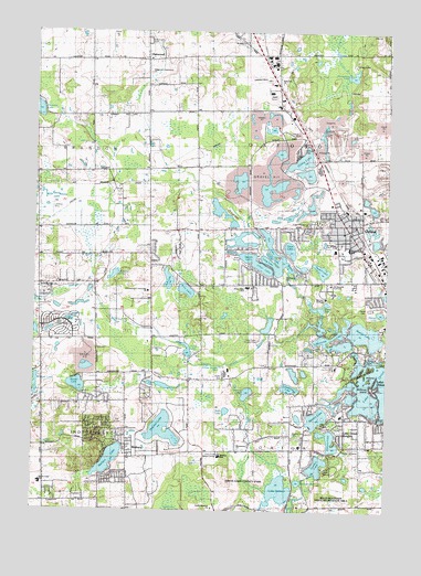
Oxford, MI USGS Topographic Map
Click on map above to begin viewing in our Map Viewer.

This topographic map contains these locations and features:
Feature Name Type Latitude Longitude GNIS ID View Map
Bailey Lake SchoolSchoolN42.7570°W83.3719°620455View Map
Bellevue IslandIslandN42.7825°W83.2527°621065View Map
Berridge CemeteryCemeteryN42.7514°W83.2689°2649527View Map
Boulder Pointe Golf ClubLocaleN42.8342°W83.2789°2649464View Map
Brandon Fire Department Station 3BuildingN42.8669°W83.3543°2620222View Map
Brandon Post Office (historical)Post OfficeN42.8167°W83.3344°2649117View Map
Brandon Township Fire Department Station 2BuildingN42.8077°W83.3725°2620046View Map
Camp AgawamLocaleN42.7611°W83.2688°622538View Map
Case CemeteryCemeteryN42.7917°W83.3530°622830View Map
Cedar LakeLakeN42.8159°W83.2897°622922View Map
Charter Township of OrionCivilN42.7523°W83.2734°1626859View Map
Charter Township of OxfordCivilN42.8404°W83.2772°1626877View Map
Clear LakeLakeN42.8134°W83.2941°623413View Map
Clear Lake CampLocaleN42.8117°W83.2858°623434View Map
Clear Lake SchoolSchoolN42.8084°W83.2999°623437View Map
Cole Post Office (historical)Post OfficeN42.7667°W83.2792°2649113View Map
Cole Station (historical)LocaleN42.7833°W83.2792°2649699View Map
Daniel Axford Elementary SchoolSchoolN42.8189°W83.2636°2649463View Map
Dark LakeLakeN42.7760°W83.3064°624312View Map
Dark LakeLakeN42.7806°W83.3741°624314View Map
Davis LakeLakeN42.8183°W83.2843°624343View Map
DeLima CollegeSchoolN42.8056°W83.2719°624397View Map
Duck LakeLakeN42.7998°W83.2743°624930View Map
Elkhorn LakeLakeN42.7686°W83.2696°625462View Map
Fish LakeLakeN42.8102°W83.3275°626036View Map
Greens LakeLakeN42.7807°W83.2992°627365View Map
Heather LakeLakeN42.7713°W83.3293°624549View Map
Horseshoe LakeLakeN42.8638°W83.2628°628610View Map
Howell LakeLakeN42.8018°W83.2520°628718View Map
Howland LakeSwampN42.8109°W83.3469°628725View Map
Hummer LakeLakeN42.8548°W83.3748°628807View Map
Indianwood ChurchChurchN42.7836°W83.3199°629029View Map
Indianwood Country ClubLocaleN42.7875°W83.2677°1623430View Map
Indianwood LakeLakeN42.7930°W83.2690°629030View Map
Jersey Post Office (historical)Post OfficeN42.7797°W83.3200°2649100View Map
Lake OrionLakeN42.7767°W83.2571°634103View Map
Lake Orion HeightsPopulated PlaceN42.7703°W83.2641°629990View Map
Lake SixteenLakeN42.7556°W83.2871°638036View Map
Lonesome LakeLakeN42.7823°W83.2844°630899View Map
Long LakeLakeN42.8145°W83.2911°630930View Map
Lost LakeSwampN42.7503°W83.3252°631111View Map
Manito LakeLakeN42.7961°W83.2574°631386View Map
Moose Tree Nature Preserve SchoolSchoolN42.7657°W83.3044°2345506View Map
Mount Zion ChurchChurchN42.8725°W83.3016°632847View Map
Northeast Oakland Historical MuseumBuildingN42.8249°W83.2654°2649462View Map
OakwoodPopulated PlaceN42.8675°W83.3366°633908View Map
Oakwood Mount Pleasant CemeteryCemeteryN42.8725°W83.3357°633916View Map
Oakwood Post Office (historical)Post OfficeN42.8675°W83.3367°2649090View Map
Orion Oaks County ParkParkN42.7575°W83.3028°2648748View Map
Orion Oaks Elementary SchoolSchoolN42.7627°W83.2819°2344327View Map
Orion Township Fire Department Station 4 HeadquartersBuildingN42.7754°W83.3187°2620098View Map
Our Lady of Sorrows CemeteryCemeteryN42.8097°W83.2704°2649548View Map
OxfordPopulated PlaceN42.8248°W83.2647°634267View Map
Oxford Christian AcademySchoolN42.8178°W83.2672°2344359View Map
Oxford Fire Department Station 1BuildingN42.8284°W83.2673°2620234View Map
Oxford Fire Department Station 2BuildingN42.8089°W83.2865°2620195View Map
Oxford Market Place Shopping CenterLocaleN42.8204°W83.2588°2344362View Map
Oxford ParkParkN42.8450°W83.2799°634271View Map
Oxford Police DepartmentBuildingN42.8243°W83.2667°2737526View Map
Oxford Post OfficePost OfficeN42.8244°W83.2611°2649461View Map
Oxford Savings Bank Historical MarkerParkN42.8248°W83.2653°2648831View Map
Oxford Station (historical)LocaleN42.8292°W83.2633°2649460View Map
Oxford Township CemeteryCemeteryN42.8248°W83.2763°2649549View Map
Paint Creek Country ClubLocaleN42.7948°W83.2949°1623556View Map
Paint Creek DrainStreamN42.7973°W83.2799°634298View Map
Paint Creek Elementary SchoolSchoolN42.7863°W83.3026°2344367View Map
Pine LakeLakeN42.8076°W83.3212°634961View Map
Powell LakeLakeN42.8129°W83.2731°635374View Map
Pungs LakeLakeN42.7912°W83.3216°635518View Map
Ridgelawn Memorial CemeteryCemeteryN42.8252°W83.2743°2648745View Map
Round LakeLakeN42.7576°W83.2807°636289View Map
Round LakeLakeN42.7826°W83.3595°636290View Map
Saint Josephs ConventChurchN42.8092°W83.2694°636810View Map
Scripter Village ParkParkN42.8203°W83.2567°2649458View Map
Seymour Lake CemeteryCemeteryN42.8074°W83.3712°2649550View Map
Seymour Lake ChurchChurchN42.8078°W83.3736°637616View Map
Seymour Lake Methodist Episcopal Church Historical MarkerParkN42.8078°W83.3728°2648856View Map
Spring LakeLakeN42.8139°W83.2849°638578View Map
Square LakeLakeN42.7745°W83.2736°638657View Map
Square Lake CemeteryCemeteryN42.7703°W83.2827°638660View Map
Squaw LakeLakeN42.8161°W83.2983°638677View Map
Stony LakeLakeN42.8417°W83.2805°638911View Map
Tan LakeLakeN42.8159°W83.2925°1614577View Map
Tommys LakeLakeN42.7618°W83.2738°1614945View Map
Victoria IslandIslandN42.7850°W83.2555°1615575View Map
Village of OxfordCivilN42.8218°W83.2566°2399605View Map
WaltersPopulated PlaceN42.7639°W83.3413°1615742View Map
Walters LakeLakeN42.7631°W83.3478°1615744View Map
WaterstonePopulated PlaceN42.8365°W83.2851°2680600View Map
Waterstone LakeLakeN42.8350°W83.2880°2649465View Map
Webber Elementary SchoolSchoolN42.7642°W83.3087°1615937View Map
Whisper LakeLakeN42.8284°W83.3119°1888892View Map
Willie Run AirportAirportN42.8292°W83.3683°1624090View Map

Note: Coordinates in the location and feature list above are referenced to NAD83 datum.


Copyright (C) 2008-2024 Ryan Niemi / Sunset Dynamics ... All Rights Reserved