TopoQuest Logo
Do you find TopoQuest useful?
Help keep TopoQuest running and adding new maps/features by donating!
Bitcoin:  19c7KJd3qBynnjoSw5npx9KScwjBe4ifkT
Litecoin:  LXs6TkuXGGXo1vDsWCkWVdjQX94eUKd6ui
Home View Maps Find Maps Find Places Resources & Links


Osceola, Nebraska Topographic Map

USGS Map Title: Osceola, NE
USGS Map MRC: 41097B5
DRG (GeoTIFF) Download: o41097b5.tif


Neighboring USGS Topographic Map Quads:


  Silver Creek, NE  
41097C6
 

  Silver Creek SE, NE  
41097C5
 

  Columbus SW, NE  
41097C4
 

  Swedehome, NE  
41097B6
 

  Osceola, NE  
41097B5
 

  Shelby, NE  
41097B4
 

  Durant, NE  
41097A6
 

  Stromsburg, NE  
41097A5
 

  Gresham, NE  
41097A4


Map MRC Location:

N42°
W98°
N42°
W97°
H8 H7 H6 H5 H4 H3 H2 H1
G8 G7 G6 G5 G4 G3 G2 G1
F8 F7 F6 F5 F4 F3 F2 F1
E8 E7 E6 E5 E4 E3 E2 E1
D8 D7 D6 D5 D4 D3 D2 D1
C8 C7 C6 C5 C4 C3 C2 C1
B8 B7 B6 B5 B4 B3 B2 B1
A8 A7 A6 A5 A4 A3 A2 A1
N41°
W98°
N41°
W97°

Osceola, NE USGS 1:24K Topographic Map Preview:
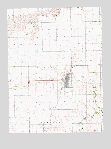
Osceola, NE USGS Topographic Map
Click on map above to begin viewing in our Map Viewer.

This topographic map contains these locations and features:
Feature Name Type Latitude Longitude GNIS ID View Map
Anderson DamDamN41.1383°W97.5287°1767037View Map
Anderson ReservoirReservoirN41.1383°W97.5287°1767038View Map
Annie Jeffrey Family MedicineHospitalN41.1697°W97.5487°1881557View Map
Annie Jeffrey Memorial County Health CenterHospitalN41.1698°W97.5488°1881555View Map
Burritt DamDamN41.2419°W97.6040°1770114View Map
Burritt ReservoirReservoirN41.2413°W97.6041°1770115View Map
City of OsceolaCivilN41.1782°W97.5498°2396093View Map
Davis CreekStreamN41.1478°W97.5043°828593View Map
Husker Co-op ElevatorLocaleN41.1786°W97.5498°1881543View Map
Mentink DamDamN41.2247°W97.5911°1770108View Map
Mentink ReservoirReservoirN41.2258°W97.5922°1770109View Map
Norman Leach DamDamN41.1878°W97.6073°1766785View Map
Norman Leach ReservoirLakeN41.1898°W97.6066°1766786View Map
OsceolaPopulated PlaceN41.1797°W97.5476°831907View Map
OsceolaLocaleN41.1783°W97.5526°1881548View Map
Osceola and the Early Pioneer: 1867-1967 Historical MarkerParkN41.1836°W97.5434°1881560View Map
Osceola Drive InnLocaleN41.1797°W97.5476°1881542View Map
Osceola Elementary SchoolSchoolN41.1750°W97.5448°1881559View Map
Osceola Good Samaritan CenterHospitalN41.1797°W97.5476°1881541View Map
Osceola High SchoolSchoolN41.1722°W97.5448°1881558View Map
Osceola Lutheran ChurchChurchN41.1725°W97.5487°1881553View Map
Osceola Post OfficePost OfficeN41.1794°W97.5466°1881547View Map
Osceola Public LibraryBuildingN41.1783°W97.5470°1881544View Map
Osceola Volunteer Fire and RescueBuildingN41.1801°W97.5504°2553388View Map
Pioneer Mental Health CenterHospitalN41.1697°W97.5487°1881556View Map
Pleasant View Retirement VillageHospitalN41.1836°W97.5492°1881545View Map
Polk CountyCivilN41.1869°W97.5684°835893View Map
Polk County CourthouseBuildingN41.1803°W97.5473°1881549View Map
Polk County Fair GroundsLocaleN41.1320°W97.5495°1881554View Map
Polk County Sheriff's OfficeBuildingN41.1796°W97.5466°1881546View Map
Ransom DamDamN41.1484°W97.5340°1769206View Map
Ransom ReservoirLakeN41.1497°W97.5342°1769207View Map
Rosenquist DamDamN41.1290°W97.5835°1769590View Map
Rosenquist ReservoirLakeN41.1303°W97.5844°1769591View Map
Ryan Hill Country ClubLocaleN41.1806°W97.5614°1881550View Map
Saint Vincent Ferrer Catholic ChurchChurchN41.1706°W97.5506°1881551View Map
South Osceola Election PrecinctCivilN41.1774°W97.5795°1929293View Map
Stromsburg Municipal Airport (historical)AirportN41.1292°W97.5778°837724View Map
Township of OsceolaCivilN41.1667°W97.5837°1881475View Map
United Methodist ChurchChurchN41.1778°W97.5476°1881552View Map

Note: Coordinates in the location and feature list above are referenced to NAD83 datum.


Copyright (C) 2008-2025 Ryan Niemi / Sunset Dynamics ... All Rights Reserved