TopoQuest Logo
Do you find TopoQuest useful?
Help keep TopoQuest running and adding new maps/features by donating!
Bitcoin:  19c7KJd3qBynnjoSw5npx9KScwjBe4ifkT
Litecoin:  LXs6TkuXGGXo1vDsWCkWVdjQX94eUKd6ui
Home View Maps Find Maps Find Places Resources & Links


Silver Creek, Nebraska Topographic Map

USGS Map Title: Silver Creek, NE
USGS Map MRC: 41097C6
DRG (GeoTIFF) Download: o41097c6.tif


Neighboring USGS Topographic Map Quads:


  Fullerton NE, NE  
41097D7
 

  Genoa, NE  
41097D6
 

  Monroe, NE  
41097D5
 

  Havens, NE  
41097C7
 

  Silver Creek, NE  
41097C6
 

  Silver Creek SE, NE  
41097C5
 

  Clarks, NE  
41097B7
 

  Swedehome, NE  
41097B6
 

  Osceola, NE  
41097B5


Map MRC Location:

N42°
W98°
N42°
W97°
H8 H7 H6 H5 H4 H3 H2 H1
G8 G7 G6 G5 G4 G3 G2 G1
F8 F7 F6 F5 F4 F3 F2 F1
E8 E7 E6 E5 E4 E3 E2 E1
D8 D7 D6 D5 D4 D3 D2 D1
C8 C7 C6 C5 C4 C3 C2 C1
B8 B7 B6 B5 B4 B3 B2 B1
A8 A7 A6 A5 A4 A3 A2 A1
N41°
W98°
N41°
W97°

Silver Creek, NE USGS 1:24K Topographic Map Preview:
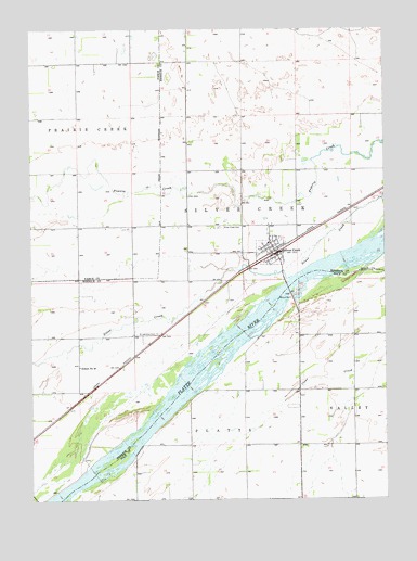
Silver Creek, NE USGS Topographic Map
Click on map above to begin viewing in our Map Viewer.

This topographic map contains these locations and features:
Feature Name Type Latitude Longitude GNIS ID View Map
Annie Jeffrey Family MedicineHospitalN41.3089°W97.6578°1881312View Map
Fishers Cove CampgroundLocaleN41.3108°W97.6642°1881314View Map
HavensPopulated PlaceN41.2653°W97.7498°829862View Map
Husker Co-op ElevatorLocaleN41.3089°W97.6578°1881316View Map
Saint Lawrence Catholic ChurchChurchN41.3089°W97.6578°1881310View Map
Saint Lawrence CemeteryCemeteryN41.2942°W97.7056°832960View Map
SchaferLocaleN41.3306°W97.6303°1881244View Map
School Number 40SchoolN41.2853°W97.7331°836695View Map
Silver CreekStreamN41.3089°W97.6581°833430View Map
Silver CreekPopulated PlaceN41.3089°W97.6578°833434View Map
Silver CreekLocaleN41.3167°W97.6628°1881313View Map
Silver Creek CemeteryCemeteryN41.3222°W97.6834°833443View Map
Silver Creek Post OfficePost OfficeN41.3153°W97.6633°1881315View Map
Silver Creek Township LibraryBuildingN41.3089°W97.6578°1881311View Map
Silver Creek Volunteer Fire DepartmentBuildingN41.3146°W97.6652°2553370View Map
Sunny Hollow State Wildlife Management AreaParkN41.3736°W97.7378°1881052View Map
Township of Silver CreekCivilN41.3343°W97.6698°838255View Map
United Methodist ChurchChurchN41.3089°W97.6578°1881317View Map
Village of Silver CreekCivilN41.3153°W97.6651°2399823View Map

Note: Coordinates in the location and feature list above are referenced to NAD83 datum.


Copyright (C) 2008-2025 Ryan Niemi / Sunset Dynamics ... All Rights Reserved