TopoQuest Logo
Do you find TopoQuest useful?
Help keep TopoQuest running and adding new maps/features by donating!
Bitcoin:  19c7KJd3qBynnjoSw5npx9KScwjBe4ifkT
Litecoin:  LXs6TkuXGGXo1vDsWCkWVdjQX94eUKd6ui
Home View Maps Find Maps Find Places Resources & Links


Oso, Washington Topographic Map

USGS Map Title: Oso, WA
USGS Map MRC: 48121C8
DRG (GeoTIFF) Download: o48121c8.tif


Neighboring USGS Topographic Map Quads:


  Haystack Mountain, WA  
48122D1
 

  Day Lake, WA  
48121D8
 

  Gee Point, WA  
48121D7
 

  Stimson Hill, WA  
48122C1
 

  Oso, WA  
48121C8
 

  Mount Higgins, WA  
48121C7
 

  Arlington East, WA  
48122B1
 

  Riley Lake, WA  
48121B8
 

  Meadow Mountain, WA  
48121B7


Map MRC Location:

N49°
W122°
N49°
W121°
H8 H7 H6 H5 H4 H3 H2 H1
G8 G7 G6 G5 G4 G3 G2 G1
F8 F7 F6 F5 F4 F3 F2 F1
E8 E7 E6 E5 E4 E3 E2 E1
D8 D7 D6 D5 D4 D3 D2 D1
C8 C7 C6 C5 C4 C3 C2 C1
B8 B7 B6 B5 B4 B3 B2 B1
A8 A7 A6 A5 A4 A3 A2 A1
N48°
W122°
N48°
W121°

Oso, WA USGS 1:24K Topographic Map Preview:
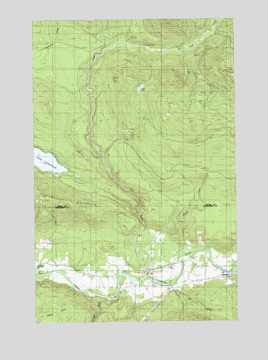
Oso, WA USGS Topographic Map
Click on map above to begin viewing in our Map Viewer.

This topographic map contains these locations and features:
Feature Name Type Latitude Longitude GNIS ID View Map
Arlington HatcheryLocaleN48.2827°W121.9909°2605541View Map
Brooks CreekStreamN48.2759°W121.9121°1528545View Map
Cavanaugh-Oso Truck TrailTrailN48.2982°W121.9471°1517508View Map
County Line PondLakeN48.3143°W121.8951°1530492View Map
Deer CreekStreamN48.2679°W121.9329°1518613View Map
Deer Creek Truck TrailTrailN48.3429°W121.9721°1518626View Map
Frailey MountainSummitN48.3020°W121.9971°1519762View Map
Fry CreekStreamN48.2659°W121.9146°1528546View Map
HaltermanPopulated PlaceN48.2693°W121.8837°1520474View Map
Hell CreekStreamN48.2598°W121.9593°1520690View Map
Larch LakeLakeN48.3462°W121.9348°1528544View Map
Montague CreekStreamN48.2698°W121.8812°1528539View Map
OsoPopulated PlaceN48.2707°W121.9296°1524091View Map
Oso Census Designated PlaceCensusN48.2836°W121.9237°2409003View Map
Oso Community ChapelChurchN48.2708°W121.9274°2609920View Map
Oso Gravel QuarryMineN48.2741°W121.9743°2605598View Map
Oso Truck TrailTrailN48.3073°W121.9318°1524092View Map
Rick CreekStreamN48.3612°W121.9088°1525031View Map
Russell SpringSpringN48.2857°W121.9437°1525294View Map
Skagit County Fire District 7 Lake Cavanaugh Fire DepartmentBuildingN48.3098°W121.9867°2643664View Map
Snohomish County Fire District 25 Station 37 Oso Fire DepartmentBuildingN48.2696°W121.9346°2606015View Map

Note: Coordinates in the location and feature list above are referenced to NAD83 datum.


Copyright (C) 2008-2024 Ryan Niemi / Sunset Dynamics ... All Rights Reserved