TopoQuest Logo
Do you find TopoQuest useful?
Help keep TopoQuest running and adding new maps/features by donating!
Bitcoin:  19c7KJd3qBynnjoSw5npx9KScwjBe4ifkT
Litecoin:  LXs6TkuXGGXo1vDsWCkWVdjQX94eUKd6ui
Home View Maps Find Maps Find Places Resources & Links


Riley Lake, Washington Topographic Map

USGS Map Title: Riley Lake, WA
USGS Map MRC: 48121B8
DRG (GeoTIFF) Download: o48121b8.tif


Neighboring USGS Topographic Map Quads:


  Stimson Hill, WA  
48122C1
 

  Oso, WA  
48121C8
 

  Mount Higgins, WA  
48121C7
 

  Arlington East, WA  
48122B1
 

  Riley Lake, WA  
48121B8
 

  Meadow Mountain, WA  
48121B7
 

  Lake Stevens, WA  
48122A1
 

  Granite Falls, WA  
48121A8
 

  Verlot, WA  
48121A7


Map MRC Location:

N49°
W122°
N49°
W121°
H8 H7 H6 H5 H4 H3 H2 H1
G8 G7 G6 G5 G4 G3 G2 G1
F8 F7 F6 F5 F4 F3 F2 F1
E8 E7 E6 E5 E4 E3 E2 E1
D8 D7 D6 D5 D4 D3 D2 D1
C8 C7 C6 C5 C4 C3 C2 C1
B8 B7 B6 B5 B4 B3 B2 B1
A8 A7 A6 A5 A4 A3 A2 A1
N48°
W122°
N48°
W121°

Riley Lake, WA USGS 1:24K Topographic Map Preview:
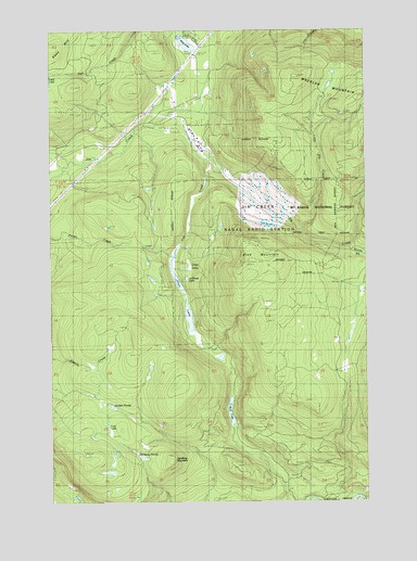
Riley Lake, WA USGS Topographic Map
Click on map above to begin viewing in our Map Viewer.

This topographic map contains these locations and features:
Feature Name Type Latitude Longitude GNIS ID View Map
Arlington DivisionCivilN48.1886°W122.0000°1939442View Map
Big Jim CreekStreamN48.1965°W121.9004°1516524View Map
Blue MountainSummitN48.1865°W121.9257°1516707View Map
Chain LakesLakeN48.1873°W121.9451°1517608View Map
Cub CreekStreamN48.2159°W121.9393°1518387View Map
Dahlberg MountainSummitN48.1354°W121.9540°1528538View Map
Dahlbero PondsLakeN48.1380°W121.9679°1528537View Map
Jim Creek Naval Radio StationTowerN48.1998°W121.9179°1530763View Map
Jordan PondsLakeN48.1502°W121.9767°1528535View Map
Jordan RidgeRidgeN48.1356°W121.9855°2740529View Map
La Barge LakeLakeN48.1841°W121.9472°1528534View Map
Little Jim CreekStreamN48.1973°W121.9012°1522243View Map
Lost LakeLakeN48.1452°W121.9789°1528536View Map
Mud LakeLakeN48.1488°W121.9301°1523475View Map
Riley LakeLakeN48.2473°W121.9437°1525053View Map
Twin LakesLakeN48.1809°W121.9482°1527541View Map
Walter R. Briggs Old Growth Forest AreaReserveN48.1917°W121.9500°2079529View Map
Wheeler MountainSummitN48.2376°W121.9015°1528023View Map

Note: Coordinates in the location and feature list above are referenced to NAD83 datum.


Copyright (C) 2008-2024 Ryan Niemi / Sunset Dynamics ... All Rights Reserved