TopoQuest Logo
Do you find TopoQuest useful?
Help keep TopoQuest running and adding new maps/features by donating!
Bitcoin:  19c7KJd3qBynnjoSw5npx9KScwjBe4ifkT
Litecoin:  LXs6TkuXGGXo1vDsWCkWVdjQX94eUKd6ui
Home View Maps Find Maps Find Places Resources & Links


Oswegatchie, New York Topographic Map

USGS Map Title: Oswegatchie, NY
USGS Map MRC: 44075B1
DRG (GeoTIFF) Download: o44075b1.tif


Neighboring USGS Topographic Map Quads:


  South Edwards, NY  
44075C2
 

  Degrasse, NY  
44075C1
 

  Tooley Pond, NY  
44074C8
 

  Fine, NY  
44075B2
 

  Oswegatchie, NY  
44075B1
 

  Newton Falls, NY  
44074B8
 

  Oswegatchie SW, NY  
44075A2
 

  Oswegatchie SE, NY  
44075A1
 

  Five Ponds, NY  
44074A8


Map MRC Location:

N45°
W76°
N45°
W75°
H8 H7 H6 H5 H4 H3 H2 H1
G8 G7 G6 G5 G4 G3 G2 G1
F8 F7 F6 F5 F4 F3 F2 F1
E8 E7 E6 E5 E4 E3 E2 E1
D8 D7 D6 D5 D4 D3 D2 D1
C8 C7 C6 C5 C4 C3 C2 C1
B8 B7 B6 B5 B4 B3 B2 B1
A8 A7 A6 A5 A4 A3 A2 A1
N44°
W76°
N44°
W75°

Oswegatchie, NY USGS 1:24K Topographic Map Preview:
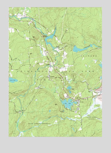
Oswegatchie, NY USGS Topographic Map
Click on map above to begin viewing in our Map Viewer.

This topographic map contains these locations and features:
Feature Name Type Latitude Longitude GNIS ID View Map
AldrichPopulated PlaceN44.1487°W75.1113°975884View Map
Alice BrookStreamN44.1465°W75.0207°975885View Map
Benson MinesPopulated PlaceN44.1698°W75.0155°975955View Map
Blue MountainSummitN44.2215°W75.0896°975993View Map
Browns Fall PowerplantBuildingN44.2115°W75.0591°976040View Map
Bundy PondLakeN44.1711°W75.0406°976061View Map
Clifton - Fine Municipal Golf CourseLocaleN44.1658°W75.0334°2599046View Map
Clifton Fine HospitalHospitalN44.1625°W75.0564°2599032View Map
Coffins MillsPopulated PlaceN44.1723°W75.0852°976157View Map
Colton HillSummitN44.2051°W75.0966°976171View Map
First Baptist ChurchChurchN44.1945°W75.0688°2598305View Map
Flat Rock PowerplantBuildingN44.2217°W75.0735°976318View Map
Little RiverStreamN44.2106°W75.0649°976573View Map
Lower OswegatchiePopulated PlaceN44.1948°W75.0685°976611View Map
Maple MountainSummitN44.1562°W75.0627°976624View Map
Mud CreekStreamN44.1295°W75.1096°976694View Map
OswegatchiePopulated PlaceN44.1828°W75.0702°976778View Map
Oswegatchie Gap Filler Annex (historical)MilitaryN44.1667°W75.1181°2091586View Map
Panther MountainSummitN44.1670°W75.1183°976792View Map
Readway PondsLakeN44.1498°W75.0511°976878View Map
Saint Huberts ChurchChurchN44.1609°W75.0543°2597606View Map
Saint Michaels CemeteryCemeteryN44.2436°W75.1109°976950View Map
Scotts BridgeBridgeN44.2384°W75.0930°976969View Map
Skate CreekStreamN44.2212°W75.0705°977005View Map
Star LakeLakeN44.1573°W75.0451°977056View Map
Star LakePopulated PlaceN44.1598°W75.0316°977057View Map
Star Lake Census Designated PlaceCensusN44.1613°W75.0363°2390354View Map
Star Lake Fire DepartmentBuildingN44.1611°W75.0371°2718631View Map
Sucker LakeLakeN44.1796°W75.1195°977083View Map
Tamarack CreekStreamN44.1409°W75.0357°977096View Map
Town of FineCivilN44.1623°W75.0736°978957View Map
Twin Lake StreamStreamN44.1931°W75.0655°977150View Map
Twin LakesLakeN44.1724°W75.0439°977151View Map
Vrooman RidgeRidgeN44.2012°W75.1219°977172View Map
Welch CreekStreamN44.2417°W75.1169°977195View Map
Woodland CemeteryCemeteryN44.2427°W75.1090°977302View Map

Note: Coordinates in the location and feature list above are referenced to NAD83 datum.


Copyright (C) 2008-2025 Ryan Niemi / Sunset Dynamics ... All Rights Reserved