TopoQuest Logo
Do you find TopoQuest useful?
Help keep TopoQuest running and adding new maps/features by donating!
Bitcoin:  19c7KJd3qBynnjoSw5npx9KScwjBe4ifkT
Litecoin:  LXs6TkuXGGXo1vDsWCkWVdjQX94eUKd6ui
Home View Maps Find Maps Find Places Resources & Links


Degrasse, New York Topographic Map

USGS Map Title: Degrasse, NY
USGS Map MRC: 44075C1
DRG (GeoTIFF) Download: o44075c1.tif


Neighboring USGS Topographic Map Quads:


  Hermon, NY  
44075D2
 

  West Pierrepont, NY  
44075D1
 

  Albert Marsh, NY  
44074D8
 

  South Edwards, NY  
44075C2
 

  Degrasse, NY  
44075C1
 

  Tooley Pond, NY  
44074C8
 

  Fine, NY  
44075B2
 

  Oswegatchie, NY  
44075B1
 

  Newton Falls, NY  
44074B8


Map MRC Location:

N45°
W76°
N45°
W75°
H8 H7 H6 H5 H4 H3 H2 H1
G8 G7 G6 G5 G4 G3 G2 G1
F8 F7 F6 F5 F4 F3 F2 F1
E8 E7 E6 E5 E4 E3 E2 E1
D8 D7 D6 D5 D4 D3 D2 D1
C8 C7 C6 C5 C4 C3 C2 C1
B8 B7 B6 B5 B4 B3 B2 B1
A8 A7 A6 A5 A4 A3 A2 A1
N44°
W76°
N44°
W75°

Degrasse, NY USGS 1:24K Topographic Map Preview:
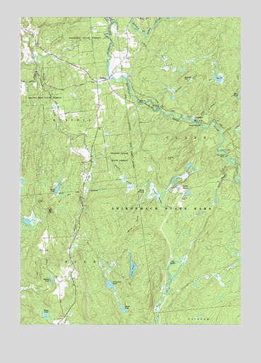
Degrasse, NY USGS Topographic Map
Click on map above to begin viewing in our Map Viewer.

This topographic map contains these locations and features:
Feature Name Type Latitude Longitude GNIS ID View Map
Allen BrookStreamN44.3342°W75.0263°975886View Map
Allen Pond OutletStreamN44.3273°W75.0105°975892View Map
Basford FallsFallsN44.3403°W75.0580°975927View Map
Berry BrookStreamN44.2998°W75.0571°975957View Map
Berry SwampSwampN44.3042°W75.0544°975958View Map
Big MarshLakeN44.2744°W75.0392°975967View Map
Camp Flat-RockLocaleN44.3203°W75.0052°976073View Map
ClarksboroPopulated PlaceN44.3345°W75.0260°976145View Map
Clifton Furnace RuinsLocaleN44.3053°W75.0341°976154View Map
Clifton Hunt Club Airport (historical)AirportN44.3045°W75.0316°977982View Map
Colton CreekStreamN44.3731°W75.0721°976170View Map
DegrassePopulated PlaceN44.3498°W75.0758°976240View Map
Degrasse Clare and South Russell Volunteer Fire DepartmentBuildingN44.3553°W75.0702°2735273View Map
Degrasse State ForestForestN44.3678°W75.0927°977220View Map
Dodge PondLakeN44.2536°W75.1106°976251View Map
Flat Rock FallsFallsN44.3184°W75.0077°976317View Map
Greenfield PondLakeN44.2653°W75.0736°976374View Map
Huftle HillSummitN44.3176°W75.0419°976463View Map
Long PondLakeN44.2733°W75.0613°976588View Map
Orebed CreekStreamN44.3187°W75.0841°976772View Map
Orebed Creek State ForestForestN44.3184°W75.0685°976773View Map
Orebed PondsLakeN44.3035°W75.0296°976774View Map
Orebed SwampSwampN44.3023°W75.0471°976775View Map
Pine MarshLakeN44.3500°W75.0123°976823View Map
Pleasant View CemeteryCemeteryN44.3589°W75.0661°976838View Map
Randall BrookStreamN44.3398°W75.0496°976869View Map
Randall HillSummitN44.3501°W75.0319°976870View Map
Round PondLakeN44.2567°W75.0670°976912View Map
Shingle PondLakeN44.2684°W75.1073°976987View Map
Silver Hill State ForestForestN44.3465°W75.1113°976991View Map
Sinclair FallsFallsN44.3378°W75.0469°976997View Map
Steep Bank BrookStreamN44.3162°W75.0066°977064View Map
Stewart RapidsRapidsN44.3315°W75.0224°977068View Map
Sweet PondLakeN44.3053°W75.1037°977091View Map
Twin FallsFallsN44.3326°W75.0266°977149View Map

Note: Coordinates in the location and feature list above are referenced to NAD83 datum.


Copyright (C) 2008-2025 Ryan Niemi / Sunset Dynamics ... All Rights Reserved