TopoQuest Logo
Do you find TopoQuest useful?
Help keep TopoQuest running and adding new maps/features by donating!
Bitcoin:  19c7KJd3qBynnjoSw5npx9KScwjBe4ifkT
Litecoin:  LXs6TkuXGGXo1vDsWCkWVdjQX94eUKd6ui
Home View Maps Find Maps Find Places Resources & Links


Otay Mesa, California Topographic Map

USGS Map Title: Otay Mesa, CA
USGS Map MRC: 32116E8
DRG (GeoTIFF) Download: o32116e8.tif


Neighboring USGS Topographic Map Quads:


  National City, CA  
32117F1
 

  Jamul Mountains, CA  
32116F8
 

  Dulzura, CA  
32116F7
 

  Imperial Beach, CA  
32117E1
 

  Otay Mesa, CA  
32116E8
 

  Otay Mountain, CA  
32116E7


Map MRC Location:

N33°
W117°
N33°
W116°
H8 H7 H6 H5 H4 H3 H2 H1
G8 G7 G6 G5 G4 G3 G2 G1
F8 F7 F6 F5 F4 F3 F2 F1
E8 E7 E6 E5 E4 E3 E2 E1
D8 D7 D6 D5 D4 D3 D2 D1
C8 C7 C6 C5 C4 C3 C2 C1
B8 B7 B6 B5 B4 B3 B2 B1
A8 A7 A6 A5 A4 A3 A2 A1
N32°
W117°
N32°
W116°

Otay Mesa, CA USGS 1:24K Topographic Map Preview:
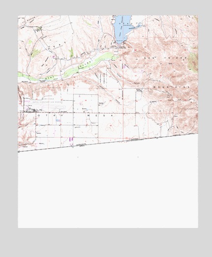
Otay Mesa, CA USGS Topographic Map
Click on map above to begin viewing in our Map Viewer.

This topographic map contains these locations and features:
Feature Name Type Latitude Longitude GNIS ID View Map
Alta SchoolSchoolN32.5684°W116.9711°238559View Map
Bird RanchLocaleN32.5859°W116.9934°239337View Map
Britannia Commerce CenterLocaleN32.5509°W116.9789°1870465View Map
Brown Field Municipal AirportAirportN32.5708°W116.9870°1653939View Map
Buschalaugh CoveBayN32.6178°W116.9181°239898View Map
California Department of Forestry and Fire Protection Otay Fire Station 38BuildingN32.5900°W116.9221°2665008View Map
California Department of Forestry and Fire Protection Station 26 DonovanBuildingN32.5792°W116.9194°2664996View Map
Chula Vista Fire Department Station 7BuildingN32.6210°W116.9850°2664895View Map
Coronado WyeDamN32.5995°W116.9728°240936View Map
De la Fuente Business ParkLocaleN32.5562°W116.9595°1870474View Map
East Mesa Detention FacilityBuildingN32.5892°W116.9192°1870475View Map
Empire CenterLocaleN32.5628°W116.9672°1870477View Map
George F Bailey Detention FacilityBuildingN32.5906°W116.9225°1870481View Map
Johnson CanyonValleyN32.5914°W116.9584°244101View Map
Kuebler RanchLocaleN32.5812°W116.9153°244373View Map
La Media Business ParkLocaleN32.5770°W116.9559°1870484View Map
Lower Otay Camping AreaLocaleN32.6076°W116.9295°245267View Map
Lower Otay Filtration PlantLocaleN32.6064°W116.9311°1654717View Map
Martinez RanchLocaleN32.5514°W116.9836°1870489View Map
O'Neal CanyonValleyN32.5984°W116.9397°246699View Map
OtayCivilN32.6214°W116.9247°238344View Map
OtayCivilN32.6081°W116.9739°247001View Map
Otay County Open Space PreserveParkN32.6137°W116.9139°1870494View Map
Otay la Mesa Business CenterLocaleN32.5662°W116.9639°1870496View Map
Otay Lake County ParkParkN32.6064°W116.9303°1870497View Map
Otay MesaSummitN32.5601°W116.9361°1661161View Map
Otay Mesa Industrial ParkLocaleN32.5695°W116.9597°1870499View Map
Otay Mesa International CenterLocaleN32.5584°W116.9425°1870500View Map
Otay QuarryMineN32.5911°W116.9883°2726377View Map
Otay RanchLocaleN32.6167°W116.9853°247004View Map
Piper Ranch Business ParkLocaleN32.5728°W116.9481°1870510View Map
Richard J Donovan Correctional FacilityBuildingN32.5834°W116.9344°1870513View Map
River Botton ReservoirReservoirN32.5868°W116.9804°248231View Map
Rock MountainSummitN32.5962°W116.9814°248280View Map
Salt CreekStreamN32.5987°W116.9486°248758View Map
San Diego Business ParkLocaleN32.5648°W116.9411°1870514View Map
San Diego City JailBuildingN32.5931°W116.9245°1870515View Map
San Diego Correctional FacilityBuildingN32.5921°W116.9232°1869971View Map
San Diego Fire - Rescue Department Station 43BuildingN32.5688°W116.9629°2665158View Map
Savage DamDamN32.6106°W116.9247°249167View Map
Siempre Viva Business ParkLocaleN32.5523°W116.9589°1870523View Map
Siempre Viva Industrial CenterLocaleN32.5523°W116.9639°1870524View Map
Wolf CanyonValleyN32.5903°W116.9947°251755View Map

Note: Coordinates in the location and feature list above are referenced to NAD83 datum.


Copyright (C) 2008-2025 Ryan Niemi / Sunset Dynamics ... All Rights Reserved