TopoQuest Logo
Do you find TopoQuest useful?
Help keep TopoQuest running and adding new maps/features by donating!
Bitcoin:  19c7KJd3qBynnjoSw5npx9KScwjBe4ifkT
Litecoin:  LXs6TkuXGGXo1vDsWCkWVdjQX94eUKd6ui
Home View Maps Find Maps Find Places Resources & Links


Otay Mountain, California Topographic Map

USGS Map Title: Otay Mountain, CA
USGS Map MRC: 32116E7
DRG (GeoTIFF) Download: o32116e7.tif


Neighboring USGS Topographic Map Quads:


  Jamul Mountains, CA  
32116F8
 

  Dulzura, CA  
32116F7
 

  Barrett Lake, CA  
32116F6
 

  Otay Mesa, CA  
32116E8
 

  Otay Mountain, CA  
32116E7
 

  Tecate, CA  
32116E6


Map MRC Location:

N33°
W117°
N33°
W116°
H8 H7 H6 H5 H4 H3 H2 H1
G8 G7 G6 G5 G4 G3 G2 G1
F8 F7 F6 F5 F4 F3 F2 F1
E8 E7 E6 E5 E4 E3 E2 E1
D8 D7 D6 D5 D4 D3 D2 D1
C8 C7 C6 C5 C4 C3 C2 C1
B8 B7 B6 B5 B4 B3 B2 B1
A8 A7 A6 A5 A4 A3 A2 A1
N32°
W117°
N32°
W116°

Otay Mountain, CA USGS 1:24K Topographic Map Preview:
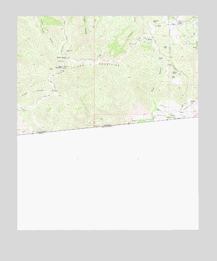
Otay Mountain, CA USGS Topographic Map
Click on map above to begin viewing in our Map Viewer.

This topographic map contains these locations and features:
Feature Name Type Latitude Longitude GNIS ID View Map
California Department of Forestry and Fire Protection Dulzura Fire Station 35BuildingN32.6212°W116.7688°2665299View Map
Cottonwood CreekStreamN32.5673°W116.7653°1654981View Map
Doghouse JunctionPopulated PlaceN32.6003°W116.8411°252881View Map
Donohoe MineMineN32.5962°W116.7686°241563View Map
Donohoe MountainSummitN32.6217°W116.7811°1660563View Map
Donohoe SpringSpringN32.5918°W116.7688°241564View Map
Dulzura Community CemeteryLocaleN32.6201°W116.7667°241666View Map
Echo SpringSpringN32.6067°W116.7722°241823View Map
Lupe SpringSpringN32.5893°W116.7692°245300View Map
Marron ValleyValleyN32.5670°W116.7731°245547View Map
Mine CanyonValleyN32.5701°W116.7803°245949View Map
Minnewawa Truck TrailTrailN32.6139°W116.8417°245971View Map
Otay MountainSummitN32.5948°W116.8439°247002View Map
Otay Mountain Truck TrailTrailN32.5801°W116.8514°247003View Map
Otay Mountain WildernessReserveN32.5950°W116.8386°2035237View Map
San Diego County Sheriff's OfficeBuildingN32.6213°W116.7688°2756595View Map
San Ysidro MountainsRangeN32.5967°W116.8234°273521View Map
Tecate CreekStreamN32.5673°W116.7664°250289View Map

Note: Coordinates in the location and feature list above are referenced to NAD83 datum.


Copyright (C) 2008-2025 Ryan Niemi / Sunset Dynamics ... All Rights Reserved