TopoQuest Logo
Do you find TopoQuest useful?
Help keep TopoQuest running and adding new maps/features by donating!
Bitcoin:  19c7KJd3qBynnjoSw5npx9KScwjBe4ifkT
Litecoin:  LXs6TkuXGGXo1vDsWCkWVdjQX94eUKd6ui
Home View Maps Find Maps Find Places Resources & Links


Ottine, Texas Topographic Map

USGS Map Title: Ottine, TX
USGS Map MRC: 29097E5
DRG (GeoTIFF) Download: o29097e5.tif


Neighboring USGS Topographic Map Quads:


  Luling, TX  
29097F6
 

  Harwood, TX  
29097F5
 

  Sandy Fork, TX  
29097F4
 

  Belmont, TX  
29097E6
 

  Ottine, TX  
29097E5
 

  Gonzales North, TX  
29097E4
 

  Leesville, TX  
29097D6
 

  Cost, TX  
29097D5
 

  Gonzales South, TX  
29097D4


Map MRC Location:

N30°
W98°
N30°
W97°
H8 H7 H6 H5 H4 H3 H2 H1
G8 G7 G6 G5 G4 G3 G2 G1
F8 F7 F6 F5 F4 F3 F2 F1
E8 E7 E6 E5 E4 E3 E2 E1
D8 D7 D6 D5 D4 D3 D2 D1
C8 C7 C6 C5 C4 C3 C2 C1
B8 B7 B6 B5 B4 B3 B2 B1
A8 A7 A6 A5 A4 A3 A2 A1
N29°
W98°
N29°
W97°

Ottine, TX USGS 1:24K Topographic Map Preview:
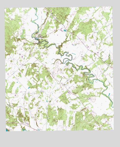
Ottine, TX USGS Topographic Map
Click on map above to begin viewing in our Map Viewer.

This topographic map contains these locations and features:
Feature Name Type Latitude Longitude GNIS ID View Map
Artesia CreekStreamN29.5913°W97.5542°1329776View Map
Benke LakeReservoirN29.6016°W97.5555°1858025View Map
Benke Lake DamDamN29.6019°W97.5536°1858024View Map
Canoe CreekStreamN29.5625°W97.5300°1332102View Map
Clemens CreekStreamN29.5016°W97.6031°1332970View Map
Ellis CemeteryCemeteryN29.5397°W97.5833°1335328View Map
Foster CemeteryCemeteryN29.5163°W97.6106°1336077View Map
Glasscock LakeReservoirN29.6212°W97.5826°1864931View Map
Glasscock Lake DamDamN29.6219°W97.5836°1864930View Map
Gonzales Warm Springs Rehabilitation FoundationBuildingN29.5947°W97.5839°1336679View Map
Greenwood CemeteryCemeteryN29.5319°W97.5306°1336991View Map
Greenwood ChurchChurchN29.5472°W97.5578°1336998View Map
Harwood-Ottine DivisionCivilN29.5808°W97.5478°1938791View Map
Hodge CemeteryCemeteryN29.5086°W97.5581°1337864View Map
Hoods Point ChurchChurchN29.5394°W97.5811°1338035View Map
King CemeteryCemeteryN29.5047°W97.5975°1339130View Map
Little Hill ChurchChurchN29.5936°W97.5881°1340115View Map
McKeller CemeteryCemeteryN29.5675°W97.5064°1341228View Map
Mule CreekStreamN29.5841°W97.5628°1342251View Map
OttinePopulated PlaceN29.5980°W97.5842°1343338View Map
Palmetto State ParkParkN29.5872°W97.5822°1343473View Map
Palmetto State ParkParkN29.6030°W97.5789°2029666View Map
Palmetto State Park - Lake TrailTrailN29.5880°W97.5853°2033256View Map
Palmetto State Park - Nature and Hiking TrailTrailN29.5897°W97.5831°2033257View Map
Palmetto State Park - Palmetto TrailTrailN29.5877°W97.5844°2033258View Map
Palmetto State Park - River TrailTrailN29.5902°W97.5828°2033259View Map
Princeville CemeteryCemeteryN29.5444°W97.5364°1344572View Map
Princeville ChurchChurchN29.5372°W97.5464°1344573View Map
Randle CemeteryCemeteryN29.5297°W97.5744°1344783View Map
Red HillSummitN29.6186°W97.5753°1344925View Map
Saint JamesPopulated PlaceN29.5672°W97.6047°1379003View Map
Saint Luke ChurchChurchN29.5994°W97.5217°1345989View Map
SlaydenPopulated PlaceN29.5755°W97.5339°1347230View Map
SmithvillePopulated PlaceN29.5241°W97.6081°1379087View Map
Texas Elks HospitalHospitalN29.5952°W97.5825°1348411View Map
Zedler DamDamN29.6003°W97.5873°1863192View Map
Zedler LakeReservoirN29.6002°W97.5869°1863193View Map

Note: Coordinates in the location and feature list above are referenced to NAD83 datum.


Copyright (C) 2008-2025 Ryan Niemi / Sunset Dynamics ... All Rights Reserved