TopoQuest Logo
Do you find TopoQuest useful?
Help keep TopoQuest running and adding new maps/features by donating!
Bitcoin:  19c7KJd3qBynnjoSw5npx9KScwjBe4ifkT
Litecoin:  LXs6TkuXGGXo1vDsWCkWVdjQX94eUKd6ui
Home View Maps Find Maps Find Places Resources & Links


Leesville, Texas Topographic Map

USGS Map Title: Leesville, TX
USGS Map MRC: 29097D6
DRG (GeoTIFF) Download: o29097d6.tif


Neighboring USGS Topographic Map Quads:


  Darst Creek, TX  
29097E7
 

  Belmont, TX  
29097E6
 

  Ottine, TX  
29097E5
 

  Dewville, TX  
29097D7
 

  Leesville, TX  
29097D6
 

  Cost, TX  
29097D5
 

  Nixon, TX  
29097C7
 

  Smiley, TX  
29097C6
 

  Pilgrim, TX  
29097C5


Map MRC Location:

N30°
W98°
N30°
W97°
H8 H7 H6 H5 H4 H3 H2 H1
G8 G7 G6 G5 G4 G3 G2 G1
F8 F7 F6 F5 F4 F3 F2 F1
E8 E7 E6 E5 E4 E3 E2 E1
D8 D7 D6 D5 D4 D3 D2 D1
C8 C7 C6 C5 C4 C3 C2 C1
B8 B7 B6 B5 B4 B3 B2 B1
A8 A7 A6 A5 A4 A3 A2 A1
N29°
W98°
N29°
W97°

Leesville, TX USGS 1:24K Topographic Map Preview:
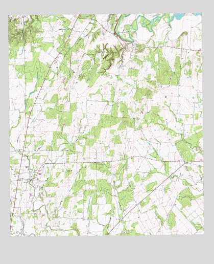
Leesville, TX USGS Topographic Map
Click on map above to begin viewing in our Map Viewer.

This topographic map contains these locations and features:
Feature Name Type Latitude Longitude GNIS ID View Map
Antioch CemeteryCemeteryN29.3808°W97.7225°1329590View Map
Askey CemeteryCemeteryN29.3880°W97.7344°1329807View Map
Baker BranchStreamN29.4205°W97.7386°1329941View Map
BebePopulated PlaceN29.4152°W97.6372°1330277View Map
Caraway CemeteryCemeteryN29.3861°W97.7206°1332151View Map
Dullnig CreekStreamN29.4958°W97.6456°1765050View Map
Ellis-Nance CemeteryCemeteryN29.4655°W97.6872°1335332View Map
Foster BranchStreamN29.4844°W97.6708°1336076View Map
Greater Palestine ChurchChurchN29.4919°W97.7133°1336899View Map
Hausler BranchStreamN29.4844°W97.6497°1765051View Map
Holmes CemeteryCemeteryN29.4297°W97.6750°1337975View Map
Lake H-4ReservoirN29.4952°W97.6253°1858015View Map
Lake PruettReservoirN29.3771°W97.7463°1344609View Map
LeesvillePopulated PlaceN29.4069°W97.7450°1339796View Map
Leesville Post OfficePost OfficeN29.4086°W97.7452°2731540View Map
Leesville SchoolhouseSchoolN29.4066°W97.7328°2031843View Map
Liberty CemeteryCemeteryN29.4319°W97.6380°1339867View Map
Luling Public LibraryBuildingN29.4208°W97.6506°2014851View Map
Nixon DivisionCivilN29.3906°W97.7143°1939033View Map
Oak Valley ChurchChurchN29.3847°W97.6786°1343006View Map
Oneill CemeteryCemeteryN29.4205°W97.7411°1343277View Map
Salt BranchStreamN29.3794°W97.7419°1375924View Map
Stroman CemeteryCemeteryN29.4550°W97.6606°1348005View Map
Talley BranchStreamN29.4033°W97.7350°1348206View Map

Note: Coordinates in the location and feature list above are referenced to NAD83 datum.


Copyright (C) 2008-2024 Ryan Niemi / Sunset Dynamics ... All Rights Reserved