TopoQuest Logo
Do you find TopoQuest useful?
Help keep TopoQuest running and adding new maps/features by donating!
Bitcoin:  19c7KJd3qBynnjoSw5npx9KScwjBe4ifkT
Litecoin:  LXs6TkuXGGXo1vDsWCkWVdjQX94eUKd6ui
Home View Maps Find Maps Find Places Resources & Links


Owyhee Ridge, Oregon Topographic Map

USGS Map Title: Owyhee Ridge, OR
USGS Map MRC: 43117E2
DRG (GeoTIFF) Download: o43117e2.tif


Neighboring USGS Topographic Map Quads:


  Grassy Mountain, OR  
43117F3
 

  Owyhee Dam, OR  
43117F2
 

  Adrian, OR  
43117F1
 

  The Elbow, OR  
43117E3
 

  Owyhee Ridge, OR  
43117E2
 

  Graveyard Point, ID  
43117E1
 

  Pelican Point, OR  
43117D3
 

  Three Fingers Rock, OR  
43117D2
 

  Pole Creek Top, OR  
43117D1


Map MRC Location:

N44°
W118°
N44°
W117°
H8 H7 H6 H5 H4 H3 H2 H1
G8 G7 G6 G5 G4 G3 G2 G1
F8 F7 F6 F5 F4 F3 F2 F1
E8 E7 E6 E5 E4 E3 E2 E1
D8 D7 D6 D5 D4 D3 D2 D1
C8 C7 C6 C5 C4 C3 C2 C1
B8 B7 B6 B5 B4 B3 B2 B1
A8 A7 A6 A5 A4 A3 A2 A1
N43°
W118°
N43°
W117°

Owyhee Ridge, OR USGS 1:24K Topographic Map Preview:
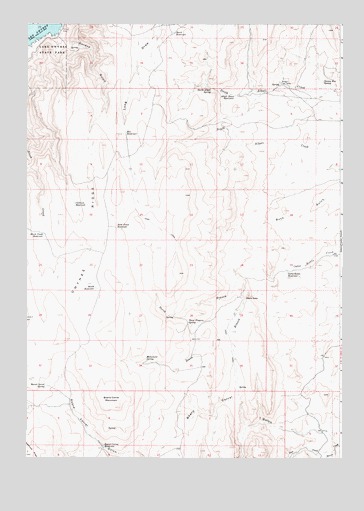
Owyhee Ridge, OR USGS Topographic Map
Click on map above to begin viewing in our Map Viewer.

This topographic map contains these locations and features:
Feature Name Type Latitude Longitude GNIS ID View Map
Alkali Draw ReservoirReservoirN43.6045°W117.1676°1116860View Map
Bas ReservoirReservoirN43.5938°W117.2110°1117285View Map
Bench ReservoirReservoirN43.5489°W117.2225°1117515View Map
Birch Creek ReservoirReservoirN43.5643°W117.2435°1117729View Map
Board Corral MountainSummitN43.5146°W117.2132°1117877View Map
Board Corral ReservoirReservoirN43.5034°W117.2195°1117878View Map
Board Corral SpringSpringN43.5207°W117.2427°1117879View Map
Cabin SpringsSpringN43.6181°W117.2332°1130106View Map
Calhoun ReservoirReservoirN43.5730°W117.2314°1118463View Map
Camp Kettle ReservoirReservoirN43.5535°W117.1466°1118520View Map
Danny Boy SpringSpringN43.6086°W117.1326°1119684View Map
Devils GateGapN43.5465°W117.1621°1119904View Map
Gordon CreekStreamN43.6221°W117.2385°1130105View Map
Gordon GulchValleyN43.6221°W117.2382°1121258View Map
Lake Owyhee Gordon Gulch Day Use Boat RampLocaleN43.6226°W117.2397°2700036View Map
Lake Owyhee State ParkParkN43.6199°W117.2374°1122905View Map
Monument SpringSpringN43.5284°W117.2028°1124309View Map
North Alkali SpringSpringN43.6065°W117.1775°1124719View Map
North Branch Camp Kettle CreekStreamN43.5543°W117.1471°1124722View Map
Rock Fence ReservoirReservoirN43.5661°W117.2146°1126187View Map
Sage CreekStreamN43.5024°W117.1282°1126435View Map
South Branch Camp Kettle CreekStreamN43.5543°W117.1474°1127232View Map
Stark ReservoirReservoirN43.6224°W117.1921°1135933View Map
Swigert Cow CampLocaleN43.6077°W117.1496°1127839View Map
The TongueCliffN43.6054°W117.2288°1131222View Map
Three Fingers SpringSpringN43.5391°W117.1824°1128063View Map

Note: Coordinates in the location and feature list above are referenced to NAD83 datum.


Copyright (C) 2008-2024 Ryan Niemi / Sunset Dynamics ... All Rights Reserved