TopoQuest Logo
Do you find TopoQuest useful?
Help keep TopoQuest running and adding new maps/features by donating!
Bitcoin:  19c7KJd3qBynnjoSw5npx9KScwjBe4ifkT
Litecoin:  LXs6TkuXGGXo1vDsWCkWVdjQX94eUKd6ui
Home View Maps Find Maps Find Places Resources & Links


Oxley Peak, Nevada Topographic Map

USGS Map Title: Oxley Peak, NV
USGS Map MRC: 41114B8
DRG (GeoTIFF) Download: o41114b8.tif


Neighboring USGS Topographic Map Quads:


  Black Butte, NV  
41115C1
 

  Summer Camp, NV  
41114C8
 

  Melandco, NV  
41114C7
 

  Metropolis, NV  
41115B1
 

  Oxley Peak, NV  
41114B8
 

  Wells Peak, NV  
41114B7
 

  Welcome, NV  
41115A1
 

  Wells, NV  
41114A8
 

  Moor Summit, NV  
41114A7


Map MRC Location:

N42°
W115°
N42°
W114°
H8 H7 H6 H5 H4 H3 H2 H1
G8 G7 G6 G5 G4 G3 G2 G1
F8 F7 F6 F5 F4 F3 F2 F1
E8 E7 E6 E5 E4 E3 E2 E1
D8 D7 D6 D5 D4 D3 D2 D1
C8 C7 C6 C5 C4 C3 C2 C1
B8 B7 B6 B5 B4 B3 B2 B1
A8 A7 A6 A5 A4 A3 A2 A1
N41°
W115°
N41°
W114°

Oxley Peak, NV USGS 1:24K Topographic Map Preview:
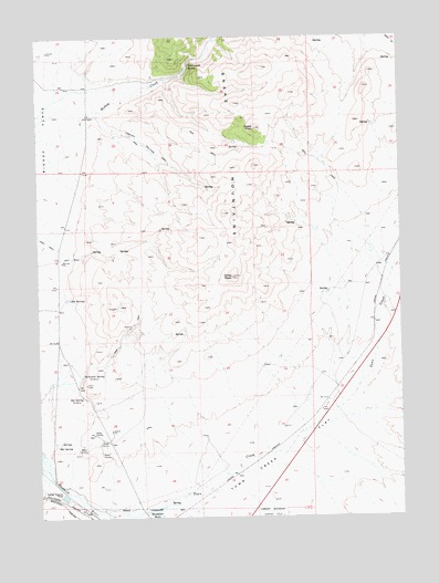
Oxley Peak, NV USGS Topographic Map
Click on map above to begin viewing in our Map Viewer.

This topographic map contains these locations and features:
Feature Name Type Latitude Longitude GNIS ID View Map
Bishop Creek CanyonValleyN41.2313°W114.9778°856536View Map
Bishop Flat Spring Number FortySpringN41.2436°W114.8810°850061View Map
Cedar PeakSummitN41.2260°W114.9248°839393View Map
Chicken Seep SpringSpringN41.1813°W114.9814°850055View Map
Chicken SpringSpringN41.2008°W114.9014°850059View Map
Cottonwood SpringSpringN41.2273°W114.8859°850060View Map
Hopkins RanchLocaleN41.1927°W114.8800°849871View Map
Hot SpringSpringN41.1435°W114.9947°841142View Map
Hot SpringSpringN41.1568°W114.9860°841148View Map
Hot SpringsSpringN41.1820°W114.9899°841157View Map
Indian HollowValleyN41.2302°W114.9798°841261View Map
Oxley PeakSummitN41.1874°W114.9328°842669View Map
Single Tree RanchLocaleN41.1641°W114.9231°858282View Map
Threemile SpringSpringN41.1619°W114.9859°856406View Map
Town CreekStreamN41.1308°W114.9878°844382View Map
Town CreekLocaleN41.1946°W114.8773°849866View Map
Town Creek FlatFlatN41.1288°W114.9484°854652View Map
Town Creek SpringSpringN41.1836°W114.9010°849863View Map
Town Creek WellWellN41.1291°W114.9200°850057View Map
Twelvemile SpringSpringN41.2424°W114.9470°844467View Map
Weeks WellWellN41.1460°W114.9434°850056View Map
Winchell SpringSpringN41.2485°W114.9044°855761View Map
Wood Ranch Well Number Fifty ThreeWellN41.1810°W114.8970°850058View Map

Note: Coordinates in the location and feature list above are referenced to NAD83 datum.


Copyright (C) 2008-2025 Ryan Niemi / Sunset Dynamics ... All Rights Reserved