TopoQuest Logo
Do you find TopoQuest useful?
Help keep TopoQuest running and adding new maps/features by donating!
Bitcoin:  19c7KJd3qBynnjoSw5npx9KScwjBe4ifkT
Litecoin:  LXs6TkuXGGXo1vDsWCkWVdjQX94eUKd6ui
Home View Maps Find Maps Find Places Resources & Links


Welcome, Nevada Topographic Map

USGS Map Title: Welcome, NV
USGS Map MRC: 41115A1
DRG (GeoTIFF) Download: o41115a1.tif


Neighboring USGS Topographic Map Quads:


  Tabor Flats, NV  
41115B2
 

  Metropolis, NV  
41115B1
 

  Oxley Peak, NV  
41114B8
 

  Herder Creek, NV  
41115A2
 

  Welcome, NV  
41115A1
 

  Wells, NV  
41114A8
 

  Tent Mountain, NV  
40115H2
 

  Humboldt Peak, NV  
40115H1
 

  Tobar, NV  
40114H8


Map MRC Location:

N42°
W116°
N42°
W115°
H8 H7 H6 H5 H4 H3 H2 H1
G8 G7 G6 G5 G4 G3 G2 G1
F8 F7 F6 F5 F4 F3 F2 F1
E8 E7 E6 E5 E4 E3 E2 E1
D8 D7 D6 D5 D4 D3 D2 D1
C8 C7 C6 C5 C4 C3 C2 C1
B8 B7 B6 B5 B4 B3 B2 B1
A8 A7 A6 A5 A4 A3 A2 A1
N41°
W116°
N41°
W115°

Welcome, NV USGS 1:24K Topographic Map Preview:
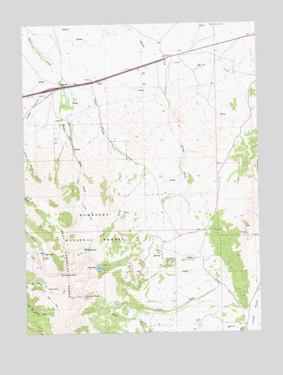
Welcome, NV USGS Topographic Map
Click on map above to begin viewing in our Map Viewer.

This topographic map contains these locations and features:
Feature Name Type Latitude Longitude GNIS ID View Map
Angel CreekStreamN41.0091°W115.0073°858716View Map
Angel Creek CampgroundLocaleN41.0274°W115.0503°858717View Map
Angel LakeReservoirN41.0264°W115.0870°863314View Map
Angel Lake DamDamN41.0266°W115.0859°863496View Map
Angel Lake Recreation SiteLocaleN41.0266°W115.0845°862285View Map
Cazier RanchLocaleN41.1016°W115.1062°862699View Map
Chimney RockSummitN41.0149°W115.0950°859232View Map
Clover CreekStreamN41.0991°W115.0964°859270View Map
Clover Guard StationLocaleN41.0766°W115.0778°862700View Map
Deeth / Starr Valley Volunteer Fire Summer StationBuildingN41.0958°W115.1122°2581413View Map
Greys LakeLakeN41.0329°W115.1171°859907View Map
Greys PeakSummitN41.0238°W115.1048°859908View Map
Greys SpringSpringN41.0181°W115.1144°859909View Map
Hylton Well Number OneWellN41.1241°W115.0242°860084View Map
Hylton Well Number TwoWellN41.1249°W115.0423°841212View Map
North Fork Angel CreekStreamN41.0230°W115.0278°860750View Map
Penstock SiphonLocaleN41.0816°W115.1034°860916View Map
Silver Star Queens MineMineN41.0396°W115.0075°862705View Map
Smith LakeLakeN41.0340°W115.0939°861423View Map
South Fork Angel CreekStreamN41.0185°W115.0206°861458View Map
WelcomePopulated PlaceN41.1002°W115.1045°861933View Map
Welcome InterchangeCrossingN41.0988°W115.1103°862704View Map
Wells TownshipCivilN41.0077°W115.0200°857616View Map

Note: Coordinates in the location and feature list above are referenced to NAD83 datum.


Copyright (C) 2008-2024 Ryan Niemi / Sunset Dynamics ... All Rights Reserved