TopoQuest Logo
Do you find TopoQuest useful?
Help keep TopoQuest running and adding new maps/features by donating!
Bitcoin:  19c7KJd3qBynnjoSw5npx9KScwjBe4ifkT
Litecoin:  LXs6TkuXGGXo1vDsWCkWVdjQX94eUKd6ui
Home View Maps Find Maps Find Places Resources & Links


Packsaddle Canyon, Wyoming Topographic Map

USGS Map Title: Packsaddle Canyon, WY
USGS Map MRC: 43106H8
DRG (GeoTIFF) Download: o43106h8.tif


Neighboring USGS Topographic Map Quads:


  Hazelton Peak, WY  
44107A1
 

  Hazelton, WY  
44106A8
 

  Robinson Canyon, WY  
44106A7
 

  Beartrap Meadows, WY  
43107H1
 

  Packsaddle Canyon, WY  
43106H8
 

  The Horn, WY  
43106H7
 

  Tabletop, WY  
43107G1
 

  Fraker Mountain, WY  
43106G8
 

  Mayoworth, WY  
43106G7


Map MRC Location:

N44°
W107°
N44°
W106°
H8 H7 H6 H5 H4 H3 H2 H1
G8 G7 G6 G5 G4 G3 G2 G1
F8 F7 F6 F5 F4 F3 F2 F1
E8 E7 E6 E5 E4 E3 E2 E1
D8 D7 D6 D5 D4 D3 D2 D1
C8 C7 C6 C5 C4 C3 C2 C1
B8 B7 B6 B5 B4 B3 B2 B1
A8 A7 A6 A5 A4 A3 A2 A1
N43°
W107°
N43°
W106°

Packsaddle Canyon, WY USGS 1:24K Topographic Map Preview:
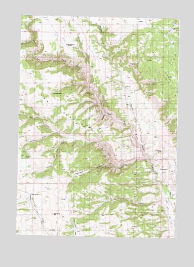
Packsaddle Canyon, WY USGS Topographic Map
Click on map above to begin viewing in our Map Viewer.

This topographic map contains these locations and features:
Feature Name Type Latitude Longitude GNIS ID View Map
Armstrong CabinLocaleN43.9972°W106.9639°1584936View Map
Brack CabinLocaleN43.9514°W106.9964°1585873View Map
Cash TrailTrailN43.8805°W106.9017°1586423View Map
Charlie Brown SpringSpringN43.9824°W106.9584°1586587View Map
Corral CreekStreamN43.9536°W106.9126°1586992View Map
Cottonwood SpringSpringN43.9244°W106.8870°1587081View Map
Dancehall FlatsFlatN43.9139°W106.8873°1587341View Map
Emerald Park MineMineN43.9941°W106.8801°1588287View Map
Everson CabinLocaleN43.9686°W106.9953°1588353View Map
Gardner CreekStreamN43.9708°W106.9512°1599907View Map
Gibbs CabinLocaleN43.9914°W106.9092°1588889View Map
Gordons CampLocaleN43.9302°W106.9628°1588982View Map
Gordons CowcampLocaleN43.9089°W106.9731°1588983View Map
Hammond SpringSpringN43.9589°W106.9748°1589271View Map
Hat RanchLocaleN43.8977°W106.8809°1589369View Map
Horseshoe CanyonValleyN43.8961°W106.8853°1589731View Map
Johnson CreekStreamN43.9850°W106.9903°1600639View Map
Lindar CabinLocaleN43.9894°W106.8984°1590700View Map
Mud SpringSpringN43.8983°W106.9887°1591848View Map
Packsaddle CanyonValleyN43.9150°W106.9237°1592541View Map
Pass CreekStreamN43.9191°W106.8964°1592597View Map
Red SpringSpringN43.8786°W106.9692°1593334View Map
Red Spring HillSummitN43.8875°W106.9712°1593337View Map
Red Spring ReservoirsReservoirN43.9202°W106.9942°1593338View Map
Simmons CreekStreamN43.9244°W106.9014°1602930View Map
Smith CabinLocaleN43.9850°W106.9434°1594469View Map
Smith CabinsLocaleN43.8916°W106.9595°1594470View Map
Snowdrift DrawValleyN43.9341°W106.9723°1594520View Map
Spring RunStreamN43.9308°W106.9623°1594922View Map
Webb Perkins DitchCanalN43.8902°W106.8812°1596106View Map

Note: Coordinates in the location and feature list above are referenced to NAD83 datum.


Copyright (C) 2008-2024 Ryan Niemi / Sunset Dynamics ... All Rights Reserved