TopoQuest Logo
Do you find TopoQuest useful?
Help keep TopoQuest running and adding new maps/features by donating!
Bitcoin:  19c7KJd3qBynnjoSw5npx9KScwjBe4ifkT
Litecoin:  LXs6TkuXGGXo1vDsWCkWVdjQX94eUKd6ui
Home View Maps Find Maps Find Places Resources & Links


The Horn, Wyoming Topographic Map

USGS Map Title: The Horn, WY
USGS Map MRC: 43106H7
DRG (GeoTIFF) Download: o43106h7.tif


Neighboring USGS Topographic Map Quads:


  Hazelton, WY  
44106A8
 

  Robinson Canyon, WY  
44106A7
 

  Purdy Reservoir, WY  
44106A6
 

  Packsaddle Canyon, WY  
43106H8
 

  The Horn, WY  
43106H7
 

  Schlicht Draw, WY  
43106H6
 

  Fraker Mountain, WY  
43106G8
 

  Mayoworth, WY  
43106G7
 

  Hibbard Draw, WY  
43106G6


Map MRC Location:

N44°
W107°
N44°
W106°
H8 H7 H6 H5 H4 H3 H2 H1
G8 G7 G6 G5 G4 G3 G2 G1
F8 F7 F6 F5 F4 F3 F2 F1
E8 E7 E6 E5 E4 E3 E2 E1
D8 D7 D6 D5 D4 D3 D2 D1
C8 C7 C6 C5 C4 C3 C2 C1
B8 B7 B6 B5 B4 B3 B2 B1
A8 A7 A6 A5 A4 A3 A2 A1
N43°
W107°
N43°
W106°

The Horn, WY USGS 1:24K Topographic Map Preview:
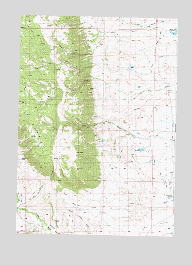
The Horn, WY USGS Topographic Map
Click on map above to begin viewing in our Map Viewer.

This topographic map contains these locations and features:
Feature Name Type Latitude Longitude GNIS ID View Map
Adrian RanchLocaleN43.9852°W106.8156°1584711View Map
Burdick RanchLocaleN43.9302°W106.8078°1586143View Map
Cerlew DitchCanalN43.9277°W106.7609°1586534View Map
Close Call DitchCanalN43.9297°W106.7617°1586781View Map
Coachy CreekStreamN43.8897°W106.8728°1586787View Map
Dancehall SpringSpringN43.9175°W106.8720°1587342View Map
Dwight DamDamN43.9700°W106.7873°1607028View Map
Dwight ReservoirReservoirN43.9717°W106.7857°1607029View Map
Dwite DamDamN43.9683°W106.7856°1607184View Map
Frances DitchCanalN43.8802°W106.8528°1588713View Map
Frenchy SpringsSpringN43.9180°W106.8445°1588754View Map
Harris and Spang DitchCanalN43.9986°W106.7731°1589330View Map
Hesse DitchCanalN43.9730°W106.7737°1589506View Map
Horn Creek DitchCanalN43.9144°W106.7612°1589674View Map
Horn Creek ReservoirReservoirN43.8967°W106.7504°1589675View Map
Horse CreekStreamN43.9950°W106.7762°1589686View Map
Lyle DamDamN43.9233°W106.7773°1607026View Map
Lyle ReservoirReservoirN43.9246°W106.7761°1591134View Map
Noland CabinLocaleN43.8958°W106.7973°1592081View Map
North Horse CreekStreamN43.9908°W106.8078°1592228View Map
Osborn RanchLocaleN43.8805°W106.7664°1592485View Map
Rambler DitchCanalN43.9286°W106.7803°1593148View Map
Ramsbottom CowcampLocaleN43.9311°W106.8448°1593152View Map
Ramsbottom RanchLocaleN43.9344°W106.7892°1593153View Map
Red SpringSpringN43.9219°W106.8276°1593335View Map
Simmons DitchCanalN43.9272°W106.8001°1594359View Map
Simmons HomesteadLocaleN43.9052°W106.8064°1594361View Map
South Fork Crazy Woman MineMineN43.9402°W106.7934°1726526View Map
Specimen HillSummitN43.9125°W106.8278°1594771View Map
The HornRidgeN43.9472°W106.8398°1595433View Map
Willow Glen RanchLocaleN43.9941°W106.7745°1596460View Map
Willow Glen ReservoirReservoirN43.9917°W106.7526°1596461View Map
Winingar CabinLocaleN43.9727°W106.8145°1596551View Map

Note: Coordinates in the location and feature list above are referenced to NAD83 datum.


Copyright (C) 2008-2025 Ryan Niemi / Sunset Dynamics ... All Rights Reserved