TopoQuest Logo
Do you find TopoQuest useful?
Help keep TopoQuest running and adding new maps/features by donating!
Bitcoin:  19c7KJd3qBynnjoSw5npx9KScwjBe4ifkT
Litecoin:  LXs6TkuXGGXo1vDsWCkWVdjQX94eUKd6ui
Home View Maps Find Maps Find Places Resources & Links


Pagosa Springs, Colorado Topographic Map

USGS Map Title: Pagosa Springs, CO
USGS Map MRC: 37107C1
DRG (GeoTIFF) Download: o37107c1.tif


Neighboring USGS Topographic Map Quads:


  Oakbrush Ridge, CO  
37107D2
 

  Pagosa Peak, CO  
37107D1
 

  Saddle Mountain, CO  
37106D8
 

  Chris Mountain, CO  
37107C2
 

  Pagosa Springs, CO  
37107C1
 

  Jackson Mountain, CO  
37106C8
 

  Lonetree Canyon, CO  
37107B2
 

  Oakbrush Hill, CO  
37107B1
 

  Serviceberry Mountain, CO  
37106B8


Map MRC Location:

N38°
W108°
N38°
W107°
H8 H7 H6 H5 H4 H3 H2 H1
G8 G7 G6 G5 G4 G3 G2 G1
F8 F7 F6 F5 F4 F3 F2 F1
E8 E7 E6 E5 E4 E3 E2 E1
D8 D7 D6 D5 D4 D3 D2 D1
C8 C7 C6 C5 C4 C3 C2 C1
B8 B7 B6 B5 B4 B3 B2 B1
A8 A7 A6 A5 A4 A3 A2 A1
N37°
W108°
N37°
W107°

Pagosa Springs, CO USGS 1:24K Topographic Map Preview:
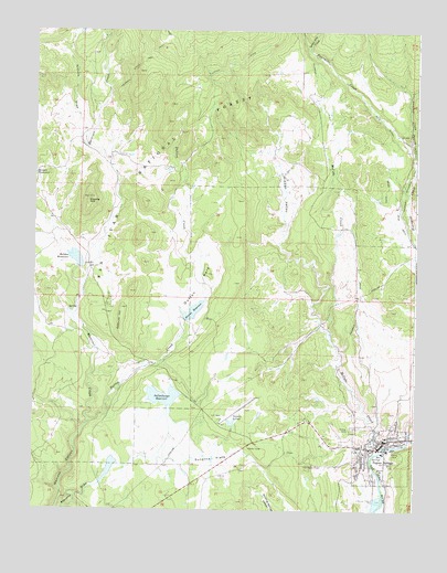
Pagosa Springs, CO USGS Topographic Map
Click on map above to begin viewing in our Map Viewer.

This topographic map contains these locations and features:
Feature Name Type Latitude Longitude GNIS ID View Map
Archuleta County Sheriff's OfficeBuildingN37.2662°W107.0114°2736083View Map
Axis Health System Pagosa Springs OfficeBuildingN37.2669°W107.0129°2695671View Map
Bennett ReservoirReservoirN37.2694°W107.0098°2710756View Map
Borns Lake ReservoirReservoirN37.2600°W107.1056°201001View Map
Bramwell Reservoir Number 2ReservoirN37.2567°W107.1073°200085View Map
Briar DitchCanalN37.3333°W107.0100°184352View Map
Colorado State Patrol Pagosa Springs PostBuildingN37.2575°W107.0775°2736085View Map
Copper Queen MineMineN37.2653°W107.0103°1734988View Map
Coyote HillSummitN37.3306°W107.1075°184350View Map
Dutton CreekStreamN37.2719°W107.1078°184341View Map
Dutton DitchCanalN37.3528°W107.0687°202980View Map
Dutton ParkFlatN37.3083°W107.0714°184343View Map
Fourmile DitchCanalN37.3250°W107.0214°202979View Map
Hatcher DamDamN37.3131°W107.1106°200142View Map
Hersch DitchCanalN37.2534°W107.1081°2722790View Map
Hidden ValleyValleyN37.3189°W107.0448°184349View Map
Highline DitchCanalN37.3472°W107.0017°184355View Map
Hilltop CemeteryCemeteryN37.2714°W107.0206°184344View Map
Hot SpringsSpringN37.2647°W107.0109°184339View Map
Iceland Spar MineMineN37.3708°W107.0098°1734989View Map
KPAG-AM (Pagosa Springs)TowerN37.2567°W107.0189°204047View Map
Lake ForestReservoirN37.2572°W107.1026°2519286View Map
Lake Forest DamDamN37.2572°W107.1026°201000View Map
Lake HatcherReservoirN37.3162°W107.1130°184348View Map
Lake PagosaReservoirN37.2795°W107.0825°184336View Map
Linn and Clark DamDamN37.2783°W107.0839°200762View Map
McCabe CreekStreamN37.2653°W107.0137°184340View Map
Meadows Property MineMineN37.3717°W107.1181°1734990View Map
Mesa DitchCanalN37.3333°W107.0073°184353View Map
Nichols DrawValleyN37.3447°W107.1090°184351View Map
Oakbrush HillSummitN37.3031°W107.0962°184346View Map
Pagosa Fire Protection District Station 1 HeadquartersBuildingN37.2568°W107.0799°2666935View Map
Pagosa Fire Protection District Station 2 Pagosa HighlandsBuildingN37.3247°W107.1205°2667174View Map
Pagosa Fire Protection District Station 6 Hidden ValleyBuildingN37.3265°W107.0355°2667178View Map
Pagosa SpringsSpringN37.2631°W107.0117°1794694View Map
Pagosa SpringsPopulated PlaceN37.2694°W107.0098°184338View Map
Pagosa Springs District Ranger OfficeLocaleN37.2695°W107.0039°197193View Map
Pagosa Springs Job CorpsLocaleN37.3039°W107.0995°184347View Map
Pagosa Springs Medical CenterHospitalN37.2521°W107.0784°2695672View Map
Pagosa Springs Police DepartmentBuildingN37.2597°W107.0102°2736092View Map
Pagosa Springs Post OfficePost OfficeN37.2639°W107.0088°2736003View Map
Piedra Forest Service FacilityLocaleN37.3036°W107.1012°197192View Map
Pinon Lake DamDamN37.2617°W107.0689°200804View Map
Pinon Lake ReservoirReservoirN37.2630°W107.0665°200805View Map
Quien Sabe CreekStreamN37.3703°W107.0362°184156View Map
Snowball CreekStreamN37.3442°W107.0020°184332View Map
Snowball Extension DitchCanalN37.3333°W107.0042°184354View Map
Snowball Extention DitchCanalN37.2700°W107.0017°1947443View Map
Stevens DamDamN37.3000°W107.0756°200146View Map
Stevens FieldAirportN37.2889°W107.0572°204544View Map
Stevens ReservoirReservoirN37.3020°W107.0730°184345View Map
Sunetha FlatsFlatN37.2639°W107.0673°184335View Map
Town Center DamDamN37.2567°W107.1073°200084View Map
Town of Pagosa SpringsCivilN37.2606°W107.0138°2413099View Map
Treasure-Comstock MineMineN37.2653°W107.0103°1734991View Map
Village LakeReservoirN37.2683°W107.0785°2519287View Map

Note: Coordinates in the location and feature list above are referenced to NAD83 datum.


Copyright (C) 2008-2025 Ryan Niemi / Sunset Dynamics ... All Rights Reserved