TopoQuest Logo
Do you find TopoQuest useful?
Help keep TopoQuest running and adding new maps/features by donating!
Bitcoin:  19c7KJd3qBynnjoSw5npx9KScwjBe4ifkT
Litecoin:  LXs6TkuXGGXo1vDsWCkWVdjQX94eUKd6ui
Home View Maps Find Maps Find Places Resources & Links


Painted Hill, Montana Topographic Map

USGS Map Title: Painted Hill, MT
USGS Map MRC: 45106E7
DRG (GeoTIFF) Download: o45106e7.tif


Neighboring USGS Topographic Map Quads:


  Chalky Point, MT  
45106F8
 

  Black Spring, MT  
45106F7
 

  Jimtown, MT  
45106F6
 

  Busby, MT  
45106E8
 

  Painted Hill, MT  
45106E7
 

  Lame Deer, MT  
45106E6
 

  Birdseye Spring, MT  
45106D8
 

  Bull Creek Lookout, MT  
45106D7
 

  Cook Creek Butte, MT  
45106D6


Map MRC Location:

N46°
W107°
N46°
W106°
H8 H7 H6 H5 H4 H3 H2 H1
G8 G7 G6 G5 G4 G3 G2 G1
F8 F7 F6 F5 F4 F3 F2 F1
E8 E7 E6 E5 E4 E3 E2 E1
D8 D7 D6 D5 D4 D3 D2 D1
C8 C7 C6 C5 C4 C3 C2 C1
B8 B7 B6 B5 B4 B3 B2 B1
A8 A7 A6 A5 A4 A3 A2 A1
N45°
W107°
N45°
W106°

Painted Hill, MT USGS 1:24K Topographic Map Preview:
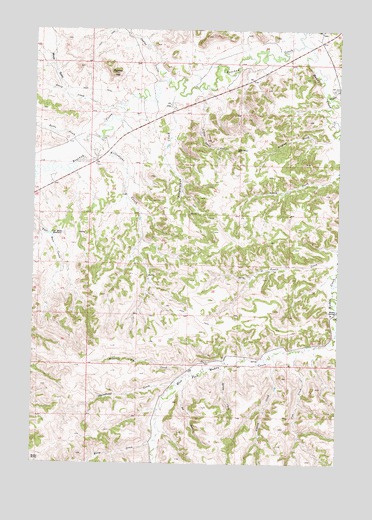
Painted Hill, MT USGS Topographic Map
Click on map above to begin viewing in our Map Viewer.

This topographic map contains these locations and features:
Feature Name Type Latitude Longitude GNIS ID View Map
03S40E04ACD_01 WellWellN45.6094°W106.7970°810492View Map
03S40E04ACD_02 WellWellN45.6094°W106.7970°810493View Map
03S40E04ADB_01 WellWellN45.6030°W106.8056°810434View Map
03S40E05CBC_01 WellWellN45.6044°W106.8220°810452View Map
03S40E05CBC_02 WellWellN45.6044°W106.8220°810453View Map
03S40E05DBA_01 WellWellN45.6072°W106.8189°810469View Map
03S40E07BDD_01 WellWellN45.5953°W106.8434°810367View Map
03S40E07CAB_01 WellWellN45.5930°W106.8467°810343View Map
03S40E07CCA_01 WellWellN45.5897°W106.8487°810314View Map
03S40E07CCA_02 WellWellN45.5880°W106.8495°810288View Map
03S40E18DBA_01 WellWellN45.5772°W106.8378°810233View Map
03S40E33DDC_01 WellWellN45.5289°W106.7948°809984View Map
03S40E34CDA_01 WellWellN45.5305°W106.7812°809993View Map
Bear CreekStreamN45.5014°W106.8250°768578View Map
Bee CreekStreamN45.5253°W106.8106°768660View Map
Butte CreekStreamN45.5928°W106.8542°769446View Map
Cow CreekStreamN45.5333°W106.7659°770227View Map
David CreekStreamN45.6025°W106.8431°770465View Map
East Fork Muddy CreekStreamN45.5380°W106.7512°771056View Map
Horse CreekStreamN45.5080°W106.8237°772540View Map
Indian CouleeValleyN45.6108°W106.8231°772684View Map
Killsnight CreekStreamN45.5930°W106.8489°773033View Map
Little Chief CreekStreamN45.6089°W106.8075°773425View Map
Medicine Elk CreekStreamN45.5255°W106.8087°774072View Map
MuddyPopulated PlaceN45.6219°W106.7603°1716505View Map
Muddy Census Designated PlaceCensusN45.5798°W106.7753°2408887View Map
Muddy CreekStreamN45.5947°W106.7506°774484View Map
Muddy DistrictCivilN45.5438°W106.7941°2492537View Map
Muddy Post Office (historical)Post OfficeN45.6219°W106.7603°1716504View Map
Muddy SpringsSpringN45.5436°W106.7512°774492View Map
Painted HillSummitN45.6122°W106.8445°775062View Map
Ridgewalker CreekStreamN45.6067°W106.8131°775761View Map
Shavedhead CreekStreamN45.5247°W106.8131°776407View Map
Slocum CreekStreamN45.5319°W106.7764°776653View Map
Spring CreekStreamN45.5283°W106.7962°776996View Map
Two Moon ReservoirReservoirN45.5658°W106.8690°777883View Map
West Fork Muddy CreekStreamN45.5380°W106.7514°778260View Map
Whitedirt CreekStreamN45.6067°W106.7553°778416View Map
Wilfred CreekStreamN45.5947°W106.7528°778502View Map
Wood GulchValleyN45.6075°W106.8637°778664View Map

Note: Coordinates in the location and feature list above are referenced to NAD83 datum.


Copyright (C) 2008-2025 Ryan Niemi / Sunset Dynamics ... All Rights Reserved