TopoQuest Logo
Do you find TopoQuest useful?
Help keep TopoQuest running and adding new maps/features by donating!
Bitcoin:  19c7KJd3qBynnjoSw5npx9KScwjBe4ifkT
Litecoin:  LXs6TkuXGGXo1vDsWCkWVdjQX94eUKd6ui
Home View Maps Find Maps Find Places Resources & Links


Palo Pinto, Texas Topographic Map

USGS Map Title: Palo Pinto, TX
USGS Map MRC: 32098G3
DRG (GeoTIFF) Download: o32098g3.tif


Neighboring USGS Topographic Map Quads:


  Costello Island, TX  
32098H4
 

  Graford West, TX  
32098H3
 

  Graford East, TX  
32098H2
 

  Fortune Bend, TX  
32098G4
 

  Palo Pinto, TX  
32098G3
 

  Mineral Wells West, TX  
32098G2
 

  Metcalf Gap, TX  
32098F4
 

  Lone Camp, TX  
32098F3
 

  Brazos West, TX  
32098F2


Map MRC Location:

N33°
W99°
N33°
W98°
H8 H7 H6 H5 H4 H3 H2 H1
G8 G7 G6 G5 G4 G3 G2 G1
F8 F7 F6 F5 F4 F3 F2 F1
E8 E7 E6 E5 E4 E3 E2 E1
D8 D7 D6 D5 D4 D3 D2 D1
C8 C7 C6 C5 C4 C3 C2 C1
B8 B7 B6 B5 B4 B3 B2 B1
A8 A7 A6 A5 A4 A3 A2 A1
N32°
W99°
N32°
W98°

Palo Pinto, TX USGS 1:24K Topographic Map Preview:
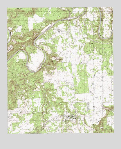
Palo Pinto, TX USGS Topographic Map
Click on map above to begin viewing in our Map Viewer.

This topographic map contains these locations and features:
Feature Name Type Latitude Longitude GNIS ID View Map
B C Harris BendBendN32.8707°W98.2759°1329896View Map
Chick BendBendN32.8160°W98.3451°1332730View Map
Costello LakeReservoirN32.7761°W98.2806°1861829View Map
Costello Lake DamDamN32.7785°W98.2803°1861828View Map
Crawford BendBendN32.8285°W98.3587°1333634View Map
Crawford MountainSummitN32.7810°W98.3720°1333638View Map
Dalton BendBendN32.8404°W98.3398°1333889View Map
Dark Valley CreekStreamN32.8637°W98.3034°1334049View Map
Eagle CreekStreamN32.8110°W98.3462°1334841View Map
Elm CreekStreamN32.8657°W98.2895°1335359View Map
Kyle MountainSummitN32.8215°W98.3203°1339261View Map
Little Keechi CreekStreamN32.8740°W98.2820°1340124View Map
McMurrey LakeReservoirN32.8535°W98.3153°1861831View Map
McMurrey Lake DamDamN32.8535°W98.3153°1861830View Map
Mill BranchStreamN32.8451°W98.2845°1341611View Map
Mill BranchStreamN32.7518°W98.3414°1341615View Map
Palo PintoPopulated PlaceN32.7673°W98.2987°1343494View Map
Palo Pinto Census Designated PlaceCensusN32.7691°W98.3008°2584712View Map
Palo Pinto CountyCivilN32.7532°W98.3130°1383967View Map
Palo Pinto County Constable's Office Precinct 3BuildingN32.7683°W98.2980°2750745View Map
Palo Pinto County Constable's Office Precinct 4BuildingN32.7684°W98.2982°2750746View Map
Palo Pinto County JailBuildingN32.7685°W98.2984°2738723View Map
Palo Pinto County JailBuildingN32.7568°W98.2984°2031754View Map
Palo Pinto County Old Jail MuseumBuildingN32.7660°W98.2987°2014519View Map
Palo Pinto County Sheriff's OfficeBuildingN32.7684°W98.2979°2750464View Map
Palo Pinto Elementary SchoolSchoolN32.7673°W98.3034°2008225View Map
Palo Pinto Emergency MedicalBuildingN32.7675°W98.3000°2655921View Map
Palo Pinto Fire DepartmentBuildingN32.7673°W98.2999°2551970View Map
Palo Pinto Post OfficePost OfficeN32.7684°W98.2991°2731634View Map
Post Oak BendBendN32.8482°W98.2600°1344393View Map
Rocky PrairieAreaN32.8736°W98.3564°1889683View Map
Town BranchStreamN32.7915°W98.3300°1348679View Map
Wolf BranchStreamN32.7973°W98.3528°1350457View Map
Worth RanchLocaleN32.8179°W98.3292°1350594View Map
Wynn MountainSummitN32.7598°W98.2684°1350624View Map

Note: Coordinates in the location and feature list above are referenced to NAD83 datum.


Copyright (C) 2008-2025 Ryan Niemi / Sunset Dynamics ... All Rights Reserved