TopoQuest Logo
Do you find TopoQuest useful?
Help keep TopoQuest running and adding new maps/features by donating!
Bitcoin:  19c7KJd3qBynnjoSw5npx9KScwjBe4ifkT
Litecoin:  LXs6TkuXGGXo1vDsWCkWVdjQX94eUKd6ui
Home View Maps Find Maps Find Places Resources & Links


Palouse Falls, Washington Topographic Map

USGS Map Title: Palouse Falls, WA
USGS Map MRC: 46118F2
DRG (GeoTIFF) Download: o46118f2.tif


Neighboring USGS Topographic Map Quads:


  Washtucna North, WA  
46118G3
 

  Hooper, WA  
46118G2
 

  Rattlesnake Canyon, WA  
46118G1
 

  Washtucna South, WA  
46118F3
 

  Palouse Falls, WA  
46118F2
 

  Hooper Lake, WA  
46118F1
 

  Ayer, WA  
46118E3
 

  Starbuck West, WA  
46118E2
 

  Starbuck East, WA  
46118E1


Map MRC Location:

N47°
W119°
N47°
W118°
H8 H7 H6 H5 H4 H3 H2 H1
G8 G7 G6 G5 G4 G3 G2 G1
F8 F7 F6 F5 F4 F3 F2 F1
E8 E7 E6 E5 E4 E3 E2 E1
D8 D7 D6 D5 D4 D3 D2 D1
C8 C7 C6 C5 C4 C3 C2 C1
B8 B7 B6 B5 B4 B3 B2 B1
A8 A7 A6 A5 A4 A3 A2 A1
N46°
W119°
N46°
W118°

Palouse Falls, WA USGS 1:24K Topographic Map Preview:
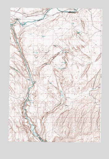
Palouse Falls, WA USGS Topographic Map
Click on map above to begin viewing in our Map Viewer.

This topographic map contains these locations and features:
Feature Name Type Latitude Longitude GNIS ID View Map
Devils LakeLakeN46.6975°W118.2013°1504458View Map
Dyer LakeLakeN46.7357°W118.1658°1509798View Map
Falls SpringSpringN46.6610°W118.2214°1510547View Map
Findley LakeLakeN46.6799°W118.1956°1510550View Map
Fryxell OverlookSummitN46.6638°W118.2275°1510435View Map
Gildersleeve SpringSpringN46.7255°W118.2233°1510089View Map
Green LakeLakeN46.7151°W118.1898°1510022View Map
Holliday CouleeValleyN46.7382°W118.2400°1505560View Map
Indian SpringSpringN46.6810°W118.2161°1510551View Map
Johns Camp LakeLakeN46.7091°W118.1725°1510020View Map
Layman CanyonValleyN46.7404°W118.1527°1510088View Map
Little Palouse FallsRapidsN46.7343°W118.2488°1506219View Map
Little Petes Camp LakeLakeN46.6940°W118.1747°1510018View Map
Long LakeLakeN46.6918°W118.2424°1506284View Map
McGregorBuildingN46.7457°W118.2414°1514781View Map
McGregor LakesAreaN46.7163°W118.1694°1510546View Map
McGregory DamDamN46.6665°W118.1594°1531966View Map
Palouse FallsFallsN46.6635°W118.2236°1510548View Map
Palouse Falls State ParkParkN46.6668°W118.2239°1513181View Map
ParkLocaleN46.6990°W118.2272°1514632View Map
Petes Camp LakeLakeN46.6991°W118.1734°1510019View Map
Railroad SpringSpringN46.6828°W118.2224°1510017View Map
Rustin Hole LakeLakeN46.7080°W118.2125°1510021View Map
Wildcat LakeLakeN46.7272°W118.1581°1510656View Map
Winn LakeLakeN46.6687°W118.1775°1509587View Map
Winn Lake CanyonValleyN46.6432°W118.2039°1510549View Map

Note: Coordinates in the location and feature list above are referenced to NAD83 datum.


Copyright (C) 2008-2024 Ryan Niemi / Sunset Dynamics ... All Rights Reserved