TopoQuest Logo
Do you find TopoQuest useful?
Help keep TopoQuest running and adding new maps/features by donating!
Bitcoin:  19c7KJd3qBynnjoSw5npx9KScwjBe4ifkT
Litecoin:  LXs6TkuXGGXo1vDsWCkWVdjQX94eUKd6ui
Home View Maps Find Maps Find Places Resources & Links


Starbuck West, Washington Topographic Map

USGS Map Title: Starbuck West, WA
USGS Map MRC: 46118E2
DRG (GeoTIFF) Download: o46118e2.tif


Neighboring USGS Topographic Map Quads:


  Washtucna South, WA  
46118F3
 

  Palouse Falls, WA  
46118F2
 

  Hooper Lake, WA  
46118F1
 

  Ayer, WA  
46118E3
 

  Starbuck West, WA  
46118E2
 

  Starbuck East, WA  
46118E1
 

  Pleasant View, WA  
46118D3
 

  Waitsburg NW, WA  
46118D2
 

  Kellogg Creek, WA  
46118D1


Map MRC Location:

N47°
W119°
N47°
W118°
H8 H7 H6 H5 H4 H3 H2 H1
G8 G7 G6 G5 G4 G3 G2 G1
F8 F7 F6 F5 F4 F3 F2 F1
E8 E7 E6 E5 E4 E3 E2 E1
D8 D7 D6 D5 D4 D3 D2 D1
C8 C7 C6 C5 C4 C3 C2 C1
B8 B7 B6 B5 B4 B3 B2 B1
A8 A7 A6 A5 A4 A3 A2 A1
N46°
W119°
N46°
W118°

Starbuck West, WA USGS 1:24K Topographic Map Preview:
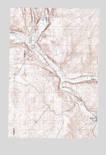
Starbuck West, WA USGS Topographic Map
Click on map above to begin viewing in our Map Viewer.

This topographic map contains these locations and features:
Feature Name Type Latitude Longitude GNIS ID View Map
Choke Cherry CanyonValleyN46.5474°W118.1263°1531676View Map
Choke Cherry SpringSpringN46.5548°W118.1392°1510474View Map
Columbia County Fire District 1BuildingN46.5195°W118.1268°2643385View Map
Fletcher FarmLocaleN46.5515°W118.2258°1504933View Map
Grange City (historical)Populated PlaceN46.5499°W118.1800°1514858View Map
JosoPopulated PlaceN46.6115°W118.2186°1511061View Map
Kellogg CreekStreamN46.5160°W118.1291°1505929View Map
Lake Herbert G West Reservation AreaAreaN46.5940°W118.2189°1534120View Map
Lyons DamDamN46.5921°W118.2261°1534124View Map
Lyons FerryLocaleN46.5913°W118.2250°1502910View Map
Lyons Ferry BridgeBridgeN46.5899°W118.2194°1510476View Map
Lyons Ferry Fish HatcheryParkN46.5990°W118.2303°2765381View Map
Lyons Ferry MarinaLocaleN46.5860°W118.2197°1510475View Map
Lyons Ferry State ParkParkN46.6207°W118.2344°1502908View Map
Marmes Rock ShelterLocaleN46.6146°W118.2033°1511580View Map
Old Bones CemeteryCemeteryN46.6040°W118.2152°1510477View Map
Palouse RiverStreamN46.5899°W118.2152°1513182View Map
PerryPopulated PlaceN46.5957°W118.2289°1510762View Map
PowersPopulated PlaceN46.5379°W118.1525°1511240View Map
StarbuckPopulated PlaceN46.5196°W118.1288°1508695View Map
Starbuck Post OfficePost OfficeN46.5201°W118.1278°2781651View Map
TucannonLocaleN46.5629°W118.1895°1513227View Map
Tucannon RiverStreamN46.5576°W118.1763°1509099View Map
Tucker FarmLocaleN46.5157°W118.2091°1509103View Map

Note: Coordinates in the location and feature list above are referenced to NAD83 datum.


Copyright (C) 2008-2024 Ryan Niemi / Sunset Dynamics ... All Rights Reserved