TopoQuest Logo
Do you find TopoQuest useful?
Help keep TopoQuest running and adding new maps/features by donating!
Bitcoin:  19c7KJd3qBynnjoSw5npx9KScwjBe4ifkT
Litecoin:  LXs6TkuXGGXo1vDsWCkWVdjQX94eUKd6ui
Home View Maps Find Maps Find Places Resources & Links


Panther, Iowa Topographic Map

USGS Map Title: Panther, IA
USGS Map MRC: 41094F1
DRG (GeoTIFF) Download: o41094f1.tif


Neighboring USGS Topographic Map Quads:


  Dawson, IA  
41094G2
 

  Perry, IA  
41094G1
 

  Woodward, IA  
41093G8
 

  Adel NW, IA  
41094F2
 

  Panther, IA  
41094F1
 

  Dallas Center, IA  
41093F8
 

  Redfield, IA  
41094E2
 

  Adel, IA  
41094E1
 

  Waukee, IA  
41093E8


Map MRC Location:

N42°
W95°
N42°
W94°
H8 H7 H6 H5 H4 H3 H2 H1
G8 G7 G6 G5 G4 G3 G2 G1
F8 F7 F6 F5 F4 F3 F2 F1
E8 E7 E6 E5 E4 E3 E2 E1
D8 D7 D6 D5 D4 D3 D2 D1
C8 C7 C6 C5 C4 C3 C2 C1
B8 B7 B6 B5 B4 B3 B2 B1
A8 A7 A6 A5 A4 A3 A2 A1
N41°
W95°
N41°
W94°

Panther, IA USGS 1:24K Topographic Map Preview:
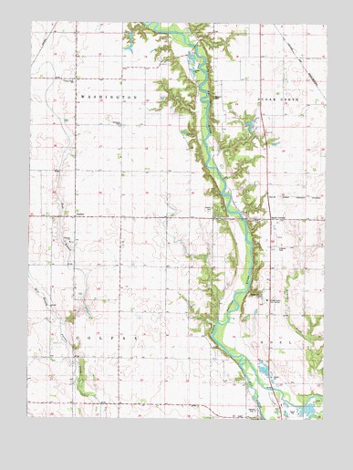
Panther, IA USGS Topographic Map
Click on map above to begin viewing in our Map Viewer.

This topographic map contains these locations and features:
Feature Name Type Latitude Longitude GNIS ID View Map
Black CornersPopulated PlaceN41.6883°W94.0233°464464View Map
Central Dallas SchoolSchoolN41.7314°W94.1075°1823074View Map
Crellin Wildlife RefugeParkN41.7278°W94.0688°1996187View Map
Dallas CountyCivilN41.6849°W94.0398°465213View Map
Dallas County Care FacilityBuildingN41.6628°W94.0247°463318View Map
Dallas County Farm CemeteryCemeteryN41.6616°W94.0276°1996391View Map
East Branch Panther CreekStreamN41.6550°W94.1113°456126View Map
Highway Forty-Four AccessLocaleN41.6883°W94.0350°1996186View Map
Husband FieldAirportN41.6794°W94.0202°466765View Map
Jenkins CemeteryCemeteryN41.6919°W94.0480°457943View Map
King CemeteryCemeteryN41.6881°W94.0279°458083View Map
Minburn CemeteryCemeteryN41.7273°W94.0474°1823073View Map
Oakdale CemeteryCemeteryN41.6268°W94.0271°459740View Map
PantherPopulated PlaceN41.6883°W94.1063°460012View Map
Panther Creek ChurchChurchN41.6833°W94.1002°1996378View Map
Panther Creek Church of the BrethrenChurchN41.6805°W94.1077°1823072View Map
Panther Creek Church of the Brethren CemeteryCemeteryN41.6805°W94.1097°1996390View Map
Panther Post Office (historical)Post OfficeN41.6883°W94.1063°1996197View Map
Pierce Point (historical)LocaleN41.7058°W94.0458°466126View Map
River Valley Golf CourseLocaleN41.6442°W94.0277°1996362View Map
Snyder AccessLocaleN41.7430°W94.0558°1996188View Map
Township of ColfaxCivilN41.6445°W94.1058°467633View Map
Township of WashingtonCivilN41.7326°W94.1059°468913View Map
Washington ChapelChurchN41.7178°W94.0875°462692View Map
Washington SchoolSchoolN41.7314°W94.1080°462715View Map
West Branch Panther CreekStreamN41.6550°W94.1116°462818View Map

Note: Coordinates in the location and feature list above are referenced to NAD83 datum.


Copyright (C) 2008-2025 Ryan Niemi / Sunset Dynamics ... All Rights Reserved