TopoQuest Logo
Do you find TopoQuest useful?
Help keep TopoQuest running and adding new maps/features by donating!
Bitcoin:  19c7KJd3qBynnjoSw5npx9KScwjBe4ifkT
Litecoin:  LXs6TkuXGGXo1vDsWCkWVdjQX94eUKd6ui
Home View Maps Find Maps Find Places Resources & Links


Woodward, Iowa Topographic Map

USGS Map Title: Woodward, IA
USGS Map MRC: 41093G8
DRG (GeoTIFF) Download: o41093g8.tif


Neighboring USGS Topographic Map Quads:


  Berkley, IA  
41094H1
 

  Madrid NW, IA  
41093H8
 

  Luther, IA  
41093H7
 

  Perry, IA  
41094G1
 

  Woodward, IA  
41093G8
 

  Granger, IA  
41093G7
 

  Panther, IA  
41094F1
 

  Dallas Center, IA  
41093F8
 

  Grimes, IA  
41093F7


Map MRC Location:

N42°
W94°
N42°
W93°
H8 H7 H6 H5 H4 H3 H2 H1
G8 G7 G6 G5 G4 G3 G2 G1
F8 F7 F6 F5 F4 F3 F2 F1
E8 E7 E6 E5 E4 E3 E2 E1
D8 D7 D6 D5 D4 D3 D2 D1
C8 C7 C6 C5 C4 C3 C2 C1
B8 B7 B6 B5 B4 B3 B2 B1
A8 A7 A6 A5 A4 A3 A2 A1
N41°
W94°
N41°
W93°

Woodward, IA USGS 1:24K Topographic Map Preview:
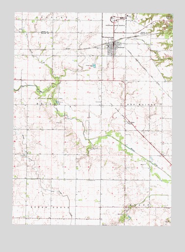
Woodward, IA USGS Topographic Map
Click on map above to begin viewing in our Map Viewer.

This topographic map contains these locations and features:
Feature Name Type Latitude Longitude GNIS ID View Map
Assembly of God ChurchChurchN41.8511°W93.9250°1996236View Map
Beaver CemeteryCemeteryN41.7570°W93.9125°454435View Map
Beulah SchoolSchoolN41.8208°W93.9111°463947View Map
Branett School (historical)SchoolN41.7597°W93.9133°463954View Map
Christian ChurchChurchN41.8539°W93.9219°1996234View Map
City of WoodwardCivilN41.8528°W93.9208°2397375View Map
East Beaver School (historical)SchoolN41.8000°W93.8830°463866View Map
Greenwood CemeteryCemeteryN41.7767°W93.9413°457132View Map
Lake Robbins BallroomBuildingN41.8208°W93.9627°1996232View Map
Little Beaver CreekStreamN41.8322°W93.9655°458443View Map
MoranPopulated PlaceN41.8108°W93.9077°459221View Map
Moran (historical)LocaleN41.8108°W93.9077°1996191View Map
Moran Post Office (historical)Post OfficeN41.8108°W93.9077°1996190View Map
School Number 3SchoolN41.7667°W93.9119°463950View Map
Township of BeaverCivilN41.8201°W93.9895°467424View Map
United Methodist ChurchChurchN41.8539°W93.9244°1996235View Map
West Beaver School (historical)SchoolN41.7878°W93.9094°463867View Map
WoodwardPopulated PlaceN41.8569°W93.9219°463199View Map
WoodwardLocaleN41.8578°W93.9216°1996237View Map
Woodward - Granger Grandwood Special Education CenterSchoolN41.8721°W93.9147°2719889View Map
Woodward - Granger High SchoolSchoolN41.8552°W93.9265°1996238View Map
Woodward - Granger Middle SchoolSchoolN41.8560°W93.9260°2719728View Map
Woodward AcademySchoolN41.8724°W93.9148°1996451View Map
Woodward CemeteryCemeteryN41.8542°W93.9327°463200View Map
Woodward City HallBuildingN41.8578°W93.9213°1996227View Map
Woodward Golf and RecreationLocaleN41.8486°W93.9294°1996231View Map
Woodward Post OfficePost OfficeN41.8562°W93.9223°1996230View Map
Woodward Public LibraryBuildingN41.8569°W93.9225°1996228View Map
Woodward State HospitalHospitalN41.8718°W93.9146°463202View Map
Woodward State Hospital HeliportAirportN41.8717°W93.9144°466983View Map
Woodward USA Health Care CenterHospitalN41.8514°W93.9208°1996233View Map
Woodward Volunteer Fire DepartmentBuildingN41.8555°W93.9217°1996229View Map
XeniaPopulated PlaceN41.8569°W93.8933°464207View Map
Xenia CemeteryCemeteryN41.8530°W93.8891°463228View Map

Note: Coordinates in the location and feature list above are referenced to NAD83 datum.


Copyright (C) 2008-2025 Ryan Niemi / Sunset Dynamics ... All Rights Reserved