TopoQuest Logo
Do you find TopoQuest useful?
Help keep TopoQuest running and adding new maps/features by donating!
Bitcoin:  19c7KJd3qBynnjoSw5npx9KScwjBe4ifkT
Litecoin:  LXs6TkuXGGXo1vDsWCkWVdjQX94eUKd6ui
Home View Maps Find Maps Find Places Resources & Links


Paola East, Kansas Topographic Map

USGS Map Title: Paola East, KS
USGS Map MRC: 38094E7
DRG (GeoTIFF) Download: o38094e7.tif


Neighboring USGS Topographic Map Quads:


  Antioch, KS  
38094F8
 

  Spring Hill, KS  
38094F7
 

  Bucyrus, KS  
38094F6
 

  Paola West, KS  
38094E8
 

  Paola East, KS  
38094E7
 

  Louisburg, KS  
38094E6
 

  Osawatomie, KS  
38094D8
 

  Fontana, KS  
38094D7
 

  New Lancaster, KS  
38094D6


Map MRC Location:

N39°
W95°
N39°
W94°
H8 H7 H6 H5 H4 H3 H2 H1
G8 G7 G6 G5 G4 G3 G2 G1
F8 F7 F6 F5 F4 F3 F2 F1
E8 E7 E6 E5 E4 E3 E2 E1
D8 D7 D6 D5 D4 D3 D2 D1
C8 C7 C6 C5 C4 C3 C2 C1
B8 B7 B6 B5 B4 B3 B2 B1
A8 A7 A6 A5 A4 A3 A2 A1
N38°
W95°
N38°
W94°

Paola East, KS USGS 1:24K Topographic Map Preview:
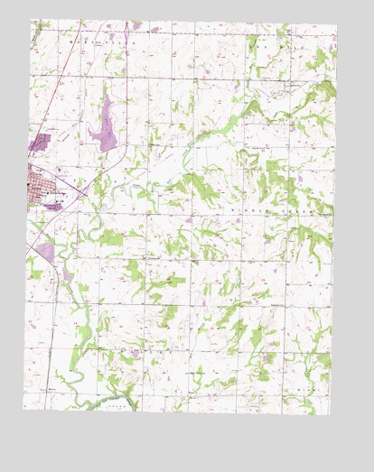
Paola East, KS USGS Topographic Map
Click on map above to begin viewing in our Map Viewer.

This topographic map contains these locations and features:
Feature Name Type Latitude Longitude GNIS ID View Map
Baker School (historical)SchoolN38.5853°W94.8261°479733View Map
Beaver Creek School (historical)SchoolN38.5850°W94.7786°479734View Map
BlockPopulated PlaceN38.5050°W94.8080°479741View Map
Bull CreekStreamN38.5017°W94.8469°479723View Map
City of PaolaCivilN38.5782°W94.8627°485640View Map
Cloud 9 AirportAirportN38.5662°W94.7824°2651073View Map
Cottonwood Elementary SchoolSchoolN38.5793°W94.8529°2506477View Map
Cross Point Assembly of God ChurchChurchN38.5854°W94.8738°2690537View Map
Davenport School (historical)SchoolN38.5639°W94.7505°479735View Map
Dorsey BranchStreamN38.5647°W94.8455°479410View Map
East Valley SchoolSchoolN38.5125°W94.8077°479740View Map
First Lutheran ChurchChurchN38.5726°W94.8726°2689963View Map
HensonPopulated PlaceN38.5056°W94.8658°479742View Map
Highland CemeteryCemeteryN38.5341°W94.7685°2574895View Map
Highland School (historical)SchoolN38.5345°W94.7700°479736View Map
Hodges CemeteryCemeteryN38.5956°W94.7875°479739View Map
Holy Cross CemeteryCemeteryN38.5627°W94.8484°479731View Map
Holy Trinity Catholic ChurchChurchN38.5678°W94.8725°2690540View Map
Holy Trinity Catholic SchoolSchoolN38.5677°W94.8716°479728View Map
Kansas Highway Patrol Troop A MiamiBuildingN38.6199°W94.7508°2504277View Map
Lakemary CenterSchoolN38.5690°W94.8603°2506589View Map
LentoPopulated PlaceN38.6167°W94.8461°484901View Map
Lighthouse Presbyterian ChurchChurchN38.5821°W94.8631°2690542View Map
Miami CountyCivilN38.5636°W94.8381°485025View Map
Miami County FairgroundsLocaleN38.5626°W94.8749°2692833View Map
Miami County Health DepartmentBuildingN38.5678°W94.8632°2695035View Map
Miami County Medical CenterHospitalN38.5693°W94.8491°2499166View Map
Miami County Public WorksBuildingN38.5331°W94.8623°2692251View Map
Miola LakeReservoirN38.5902°W94.8439°479744View Map
Miola Lake DamDamN38.5839°W94.8419°479953View Map
North Wea CreekStreamN38.6028°W94.7841°479423View Map
Northridge Business ParkLocaleN38.5844°W94.8743°2692230View Map
Paola Business ParkLocaleN38.5845°W94.8566°2692194View Map
Paola Carrier Annex Post OfficePost OfficeN38.5839°W94.8585°2693906View Map
Paola Christian ChurchChurchN38.5724°W94.8738°2690541View Map
Paola Community CenterBuildingN38.5698°W94.8679°2692870View Map
Paola Country ClubLocaleN38.5900°W94.8666°485426View Map
Paola High SchoolSchoolN38.5753°W94.8570°480715View Map
Paola Middle SchoolSchoolN38.5764°W94.8624°480714View Map
Paola North Elementary School (historical)SchoolN38.5752°W94.8740°479730View Map
Paola Police DepartmentBuildingN38.5805°W94.8741°2503909View Map
Paola Public WorksBuildingN38.5952°W94.8686°2693153View Map
Paola Wastewater Treatment FacilityLocaleN38.5464°W94.8660°2691946View Map
Pendleton (historical)LocaleN38.5056°W94.7544°481971View Map
SomersetPopulated PlaceN38.6050°W94.7688°479737View Map
Somerset CemeteryCemeteryN38.6072°W94.7808°479738View Map
South Wea CreekStreamN38.5483°W94.8600°479726View Map
Sunflower Elementary SchoolSchoolN38.5771°W94.8561°2506506View Map
The Church of Jesus Christ of Latter Day SaintsChurchN38.6057°W94.8643°2690404View Map
Township of ValleyCivilN38.5152°W94.8554°479746View Map
Ursula CemeteryCemeteryN38.5678°W94.8675°2575132View Map
Ursuline Academy (historical)SchoolN38.5689°W94.8666°479729View Map
Vickers School (historical)SchoolN38.5489°W94.8255°479732View Map
Whispering Oaks Dam Number OneDamN38.5717°W94.7636°480018View Map

Note: Coordinates in the location and feature list above are referenced to NAD83 datum.


Copyright (C) 2008-2025 Ryan Niemi / Sunset Dynamics ... All Rights Reserved