TopoQuest Logo
Do you find TopoQuest useful?
Help keep TopoQuest running and adding new maps/features by donating!
Bitcoin:  19c7KJd3qBynnjoSw5npx9KScwjBe4ifkT
Litecoin:  LXs6TkuXGGXo1vDsWCkWVdjQX94eUKd6ui
Home View Maps Find Maps Find Places Resources & Links


Osawatomie, Kansas Topographic Map

USGS Map Title: Osawatomie, KS
USGS Map MRC: 38094D8
DRG (GeoTIFF) Download: o38094d8.tif


Neighboring USGS Topographic Map Quads:


  Rantoul, KS  
38095E1
 

  Paola West, KS  
38094E8
 

  Paola East, KS  
38094E7
 

  Lane, KS  
38095D1
 

  Osawatomie, KS  
38094D8
 

  Fontana, KS  
38094D7
 

  Garnett SE, KS  
38095C1
 

  Parker, KS  
38094C8
 

  La Cygne, KS  
38094C7


Map MRC Location:

N39°
W95°
N39°
W94°
H8 H7 H6 H5 H4 H3 H2 H1
G8 G7 G6 G5 G4 G3 G2 G1
F8 F7 F6 F5 F4 F3 F2 F1
E8 E7 E6 E5 E4 E3 E2 E1
D8 D7 D6 D5 D4 D3 D2 D1
C8 C7 C6 C5 C4 C3 C2 C1
B8 B7 B6 B5 B4 B3 B2 B1
A8 A7 A6 A5 A4 A3 A2 A1
N38°
W95°
N38°
W94°

Osawatomie, KS USGS 1:24K Topographic Map Preview:
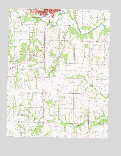
Osawatomie, KS USGS Topographic Map
Click on map above to begin viewing in our Map Viewer.

This topographic map contains these locations and features:
Feature Name Type Latitude Longitude GNIS ID View Map
BangorLocaleN38.4839°W94.9269°477626View Map
BeaglePopulated PlaceN38.4181°W94.9550°477619View Map
Beagle CemeteryCemeteryN38.4178°W94.9492°2574864View Map
Beagle United Methodist ChurchChurchN38.4181°W94.9533°2689353View Map
Brown CemeteryCemeteryN38.4981°W94.9567°2574867View Map
Church of ChristChurchN38.4984°W94.9551°2690201View Map
Community of ChristChurchN38.4976°W94.9609°2689764View Map
East Upper Elementary SchoolSchoolN38.4975°W94.9136°480768View Map
Faith Baptist ChurchChurchN38.4991°W94.9378°2688653View Map
First Baptist ChurchChurchN38.4969°W94.9548°2689958View Map
First Christian ChurchChurchN38.4984°W94.9485°2689833View Map
First Presbyterian ChurchChurchN38.4998°W94.9469°2690581View Map
First United Methodist ChurchChurchN38.4974°W94.9489°2689412View Map
John Brown MuseumBuildingN38.4989°W94.9596°2625054View Map
Jordan BranchStreamN38.4758°W94.9111°477628View Map
Lessenden CemeteryCemeteryN38.4582°W94.9690°2574898View Map
Memorial HallBuildingN38.4979°W94.9605°2692861View Map
Mound CreekStreamN38.3925°W94.9591°477618View Map
Mound Creek (historical)LocaleN38.3945°W94.9925°482374View Map
Mound Creek CemeteryCemeteryN38.3961°W94.9761°477620View Map
Mount Nebo CemeteryCemeteryN38.4529°W94.9192°2574905View Map
Osage Valley School (historical)SchoolN38.4983°W94.8916°477625View Map
OsawatomiePopulated PlaceN38.4972°W94.9505°479709View Map
Osawatomie Chamber of CommerceBuildingN38.4991°W94.9518°2692860View Map
Osawatomie Church of the NazareneChurchN38.4969°W94.9669°2690388View Map
Osawatomie City AuditoriumBuildingN38.4990°W94.9484°2693201View Map
Osawatomie City HallBuildingN38.4989°W94.9486°2693199View Map
Osawatomie Fire DepartmentBuildingN38.4956°W94.9529°2111695View Map
Osawatomie High SchoolSchoolN38.4992°W94.9630°480767View Map
Osawatomie Middle SchoolSchoolN38.4976°W94.9473°480769View Map
Osawatomie Police DepartmentBuildingN38.4989°W94.9484°2504004View Map
Osawatomie Post OfficePost OfficeN38.5000°W94.9494°2693898View Map
Osawatomie Public LibraryBuildingN38.4977°W94.9499°2694754View Map
Osawatomie Railroad MuseumBuildingN38.4991°W94.9518°2692862View Map
Osawatomie Southern Baptist ChurchChurchN38.4981°W94.9417°2690188View Map
Osawatomie Unified School District OfficeSchoolN38.4992°W94.9627°2506476View Map
Plum Creek Road Church of ChristChurchN38.4706°W94.9566°2690211View Map
Pottawatomie CreekStreamN38.4967°W94.9272°477627View Map
Swenson Early Education CenterSchoolN38.4961°W94.9583°477624View Map
Township of MoundCivilN38.4186°W94.9920°477616View Map
Township of OsawatomieCivilN38.4809°W94.9976°477615View Map
Trojan Elementary SchoolSchoolN38.4973°W94.9764°2506362View Map
Union Valley School (historical)SchoolN38.4767°W94.9741°477622View Map
Whiteford CemeteryCemeteryN38.4619°W94.8993°477621View Map

Note: Coordinates in the location and feature list above are referenced to NAD83 datum.


Copyright (C) 2008-2025 Ryan Niemi / Sunset Dynamics ... All Rights Reserved