TopoQuest Logo
Do you find TopoQuest useful?
Help keep TopoQuest running and adding new maps/features by donating!
Bitcoin:  19c7KJd3qBynnjoSw5npx9KScwjBe4ifkT
Litecoin:  LXs6TkuXGGXo1vDsWCkWVdjQX94eUKd6ui
Home View Maps Find Maps Find Places Resources & Links


Paradox, Colorado Topographic Map

USGS Map Title: Paradox, CO
USGS Map MRC: 38108C8
DRG (GeoTIFF) Download: o38108c8.tif


Neighboring USGS Topographic Map Quads:


  Buckeye Reservoir, CO  
38109D1
 

  Roc Creek, CO  
38108D8
 

  Red Canyon, CO  
38108D7
 

  Ray Mesa, UT  
38109C1
 

  Paradox, CO  
38108C8
 

  Davis Mesa, CO  
38108C7
 

  Lisbon Gap, UT  
38109B1
 

  Anderson Mesa, CO  
38108B8
 

  Bull Canyon, CO  
38108B7


Map MRC Location:

N39°
W109°
N39°
W108°
H8 H7 H6 H5 H4 H3 H2 H1
G8 G7 G6 G5 G4 G3 G2 G1
F8 F7 F6 F5 F4 F3 F2 F1
E8 E7 E6 E5 E4 E3 E2 E1
D8 D7 D6 D5 D4 D3 D2 D1
C8 C7 C6 C5 C4 C3 C2 C1
B8 B7 B6 B5 B4 B3 B2 B1
A8 A7 A6 A5 A4 A3 A2 A1
N38°
W109°
N38°
W108°

Paradox, CO USGS 1:24K Topographic Map Preview:
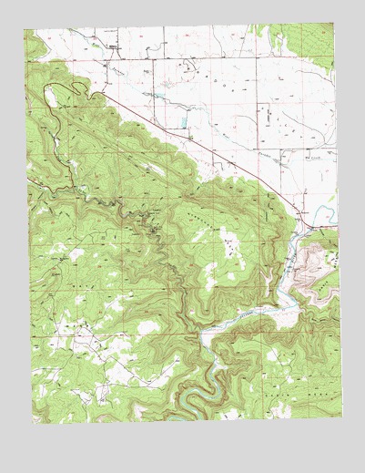
Paradox, CO USGS Topographic Map
Click on map above to begin viewing in our Map Viewer.

This topographic map contains these locations and features:
Feature Name Type Latitude Longitude GNIS ID View Map
Aperture ArchArchN38.3194°W108.9378°2677655View Map
BedrockPopulated PlaceN38.3150°W108.8909°185822View Map
Bedrock Post OfficePost OfficeN38.3170°W108.8935°2750968View Map
Cashin MineMineN38.3108°W108.9495°185826View Map
Cliff Dweller MineMineN38.3100°W108.9534°1735655View Map
Cliff Willow MineMineN38.2928°W108.9882°1735656View Map
Cliffdweller MineMineN38.3158°W108.9523°185827View Map
Denver MineMineN38.3189°W108.9418°1735657View Map
Ketchumup Stock TrailTrailN38.3064°W108.8807°185821View Map
La Sal CreekStreamN38.2785°W108.9315°201773View Map
Long Park MineMineN38.3108°W108.9876°1735545View Map
Mesa Three MineMineN38.3744°W108.9709°1735274View Map
Morning Glory MineMineN38.3019°W108.9879°185824View Map
Nyswonger MesaSummitN38.3155°W108.9232°185830View Map
Nyswonger TrailTrailN38.3167°W108.9034°185823View Map
ParadoxPopulated PlaceN38.3683°W108.9623°185829View Map
Paradox CemeteryCemeteryN38.3608°W108.9496°185828View Map
Paradox Post OfficePost OfficeN38.3722°W108.9625°2750969View Map
Paradox Valley Fire DepartmentBuildingN38.3720°W108.9628°2666860View Map
Radium King MineMineN38.3689°W108.9632°1735523View Map
Saint Patrick MineMineN38.3689°W108.9632°1735561View Map
Sego Lily Lou MineMineN38.2869°W108.9948°1735665View Map
Sharp CanyonValleyN38.3240°W108.9930°185686View Map
Sharp Canyon Stock TrailTrailN38.3164°W108.9898°185825View Map
Spring CreekStreamN38.3242°W108.9801°201771View Map
Wild Steer CanyonValleyN38.2855°W108.8937°185820View Map

Note: Coordinates in the location and feature list above are referenced to NAD83 datum.


Copyright (C) 2008-2025 Ryan Niemi / Sunset Dynamics ... All Rights Reserved