TopoQuest Logo
Do you find TopoQuest useful?
Help keep TopoQuest running and adding new maps/features by donating!
Bitcoin:  19c7KJd3qBynnjoSw5npx9KScwjBe4ifkT
Litecoin:  LXs6TkuXGGXo1vDsWCkWVdjQX94eUKd6ui
Home View Maps Find Maps Find Places Resources & Links


Buckeye Reservoir, Colorado Topographic Map

USGS Map Title: Buckeye Reservoir, CO
USGS Map MRC: 38109D1
DRG (GeoTIFF) Download: o38109d1.tif


Neighboring USGS Topographic Map Quads:


  Mount Waas, UT  
38109E2
 

  Dolores Point South, CO  
38109E1
 

  Juanita Arch, CO  
38108E8
 

  Mount Peale, UT  
38109D2
 

  Buckeye Reservoir, CO  
38109D1
 

  Roc Creek, CO  
38108D8
 

  La Sal East, UT  
38109C2
 

  Ray Mesa, UT  
38109C1
 

  Paradox, CO  
38108C8


Map MRC Location:

N39°
W110°
N39°
W109°
H8 H7 H6 H5 H4 H3 H2 H1
G8 G7 G6 G5 G4 G3 G2 G1
F8 F7 F6 F5 F4 F3 F2 F1
E8 E7 E6 E5 E4 E3 E2 E1
D8 D7 D6 D5 D4 D3 D2 D1
C8 C7 C6 C5 C4 C3 C2 C1
B8 B7 B6 B5 B4 B3 B2 B1
A8 A7 A6 A5 A4 A3 A2 A1
N38°
W110°
N38°
W109°

Buckeye Reservoir, CO USGS 1:24K Topographic Map Preview:
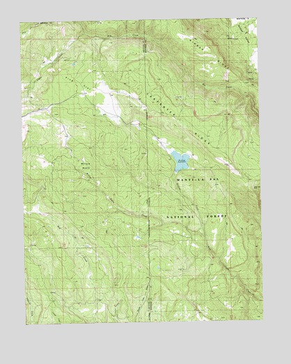
Buckeye Reservoir, CO USGS Topographic Map
Click on map above to begin viewing in our Map Viewer.

This topographic map contains these locations and features:
Feature Name Type Latitude Longitude GNIS ID View Map
Buckeye CampgroundLocaleN38.4389°W109.0454°197677View Map
Buckeye CreekStreamN38.4103°W109.0307°185666View Map
Buckeye Number 1 DamDamN38.4383°W109.0457°198562View Map
Buckeye Ranger StationLocaleN38.4447°W109.0521°197676View Map
Buckeye ReservoirReservoirN38.4414°W109.0424°185664View Map
Gateway MineMineN38.4147°W109.0076°1735789View Map
Geyser CreekStreamN38.4947°W109.0915°1441307View Map
Jackpot MineMineN38.4494°W109.0387°1735779View Map
Manti-La Sal National ForestForestN38.3833°W109.0173°203045View Map
Mellenthin CreekStreamN38.4100°W109.0307°1443300View Map
Mitchells Coal MineMineN38.3853°W109.0257°1735792View Map
Pine FlatFlatN38.4739°W109.0948°1444381View Map
Sinbad RidgeRidgeN38.4836°W109.0198°203046View Map
Valley View MineMineN38.4280°W109.0026°1735786View Map
Willow BasinBasinN38.4369°W109.0912°1447391View Map
Willow Basin CreekStreamN38.4100°W109.0307°185667View Map
Yankee MineMineN38.3839°W109.0543°1735755View Map

Note: Coordinates in the location and feature list above are referenced to NAD83 datum.


Copyright (C) 2008-2025 Ryan Niemi / Sunset Dynamics ... All Rights Reserved