TopoQuest Logo
Do you find TopoQuest useful?
Help keep TopoQuest running and adding new maps/features by donating!
Bitcoin:  19c7KJd3qBynnjoSw5npx9KScwjBe4ifkT
Litecoin:  LXs6TkuXGGXo1vDsWCkWVdjQX94eUKd6ui
Home View Maps Find Maps Find Places Resources & Links


Parker, Arizona Topographic Map

USGS Map Title: Parker, AZ
USGS Map MRC: 34114B3
DRG (GeoTIFF) Download: o34114b3.tif


Neighboring USGS Topographic Map Quads:


  Whipple Mountains SW, CA  
34114C4
 

  Whipple Wash, CA  
34114C3
 

  Gene Wash, CA  
34114C2
 

  Parker NW, CA  
34114B4
 

  Parker, AZ  
34114B3
 

  Cross Roads, CA  
34114B2
 

  Parker SW, CA  
34114A4
 

  Parker SE, AZ  
34114A3
 

  Black Peak, AZ  
34114A2


Map MRC Location:

N35°
W115°
N35°
W114°
H8 H7 H6 H5 H4 H3 H2 H1
G8 G7 G6 G5 G4 G3 G2 G1
F8 F7 F6 F5 F4 F3 F2 F1
E8 E7 E6 E5 E4 E3 E2 E1
D8 D7 D6 D5 D4 D3 D2 D1
C8 C7 C6 C5 C4 C3 C2 C1
B8 B7 B6 B5 B4 B3 B2 B1
A8 A7 A6 A5 A4 A3 A2 A1
N34°
W115°
N34°
W114°

Parker, AZ USGS 1:24K Topographic Map Preview:
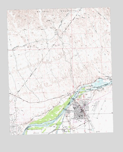
Parker, AZ USGS Topographic Map
Click on map above to begin viewing in our Map Viewer.

This topographic map contains these locations and features:
Feature Name Type Latitude Longitude GNIS ID View Map
Arch CreekStreamN34.1389°W114.3436°238685View Map
Arizona Agricultural Inspection StationLocaleN34.1558°W114.2947°22737View Map
Avi Suquilla AirportAirportN34.1523°W114.2702°45622View Map
Big RiverPopulated PlaceN34.1400°W114.3613°1866999View Map
Big River Census Designated PlaceCensusN34.1393°W114.3605°2407844View Map
Blake Primary SchoolSchoolN34.1505°W114.2962°1666View Map
Blue Cloud MineMineN34.2381°W114.3225°239495View Map
Blue Water Marina ParkParkN34.1692°W114.2669°1742View Map
BluewaterPopulated PlaceN34.1686°W114.2650°1866981View Map
BluewaterPopulated PlaceN34.1745°W114.2713°1867001View Map
Bluewater Census Designated PlaceCensusN34.1682°W114.2667°2407868View Map
Bluewater Census Designated PlaceCensusN34.1759°W114.2641°2407869View Map
Church of ChristChurchN34.1510°W114.2930°2670763View Map
Colorado River Indian Agency HeadquartersBuildingN34.1481°W114.3038°3127View Map
Colorado River Indian Tribes AdministrationLocaleN34.1286°W114.3102°43171View Map
Colorado River Water Pollution Control CenterBuildingN34.1436°W114.3072°22754View Map
EarpPopulated PlaceN34.1647°W114.3011°252882View Map
Earp Post OfficePost OfficeN34.1637°W114.3036°1842198View Map
First Baptist ChurchChurchN34.1422°W114.2915°2670937View Map
Grace Assembly of God ParkerChurchN34.1394°W114.2898°2671083View Map
Headgate RockSummitN34.1686°W114.2772°5670View Map
Headgate Rock DamDamN34.1686°W114.2772°5671View Map
Kingdom Hall of Jehovahs WitnessesChurchN34.1455°W114.2943°2671196View Map
KLPZ-AM (Parker)TowerN34.1539°W114.2883°45702View Map
KMDX-FM (Parker)TowerN34.1470°W114.3052°43476View Map
KZUL-AM (Parker)TowerN34.1539°W114.2883°43477View Map
La Paz County CourthouseBuildingN34.1458°W114.2897°22771View Map
La Paz County JailBuildingN34.1455°W114.2903°2751686View Map
La Paz County Sheriff's DepartmentBuildingN34.1457°W114.2904°2751629View Map
La Paz Regional HospitalHospitalN34.1364°W114.2851°22776View Map
Lazy D Mobile Home ParkPopulated PlaceN34.1393°W114.2998°2670395View Map
Manataba ParkParkN34.1317°W114.3108°7646View Map
Messiah Lutheran ChurchChurchN34.1499°W114.2955°2671232View Map
Moovalya LakeReservoirN34.1711°W114.2658°32015View Map
ParkerPopulated PlaceN34.1500°W114.2891°9220View Map
Parker Apostolic ChurchChurchN34.1506°W114.2807°2671685View Map
Parker City HallBuildingN34.1470°W114.2944°22774View Map
Parker Community Hospital HeliportAirportN34.1367°W114.2863°45623View Map
Parker Fire DepartmentBuildingN34.1459°W114.2897°2672404View Map
Parker High SchoolSchoolN34.1424°W114.2883°22775View Map
Parker Municipal Airport (historical)AirportN34.1508°W114.2713°22777View Map
Parker Post OfficePost OfficeN34.1448°W114.2867°44945View Map
Parker Public Health Services Indian Hospital Colorado River Service UnitHospitalN34.1474°W114.3018°22780View Map
Parker Public LibraryBuildingN34.1477°W114.2947°2669454View Map
Parker Rodeo GroundsParkN34.1545°W114.2827°22778View Map
Parker Trailer ParkPopulated PlaceN34.1440°W114.2879°2669763View Map
Parker United Methodist ChurchChurchN34.1438°W114.2949°2671686View Map
Pop Harvey ParkParkN34.1483°W114.2952°22779View Map
Sacred Heart ParishChurchN34.1488°W114.2892°2671769View Map
San Bernardino County Fire Department Station 17 - Big RiverBuildingN34.1335°W114.3725°2665068View Map
San Bernardino County SheriffBuildingN34.1723°W114.2904°2756467View Map
Wallace Elementary SchoolSchoolN34.1414°W114.2906°13302View Map
Wallace Junior High SchoolSchoolN34.1412°W114.2904°2543582View Map
West PortalLocaleN34.2267°W114.3141°251369View Map
Western ParkParkN34.1536°W114.2825°22800View Map

Note: Coordinates in the location and feature list above are referenced to NAD83 datum.


Copyright (C) 2008-2025 Ryan Niemi / Sunset Dynamics ... All Rights Reserved