TopoQuest Logo
Do you find TopoQuest useful?
Help keep TopoQuest running and adding new maps/features by donating!
Bitcoin:  19c7KJd3qBynnjoSw5npx9KScwjBe4ifkT
Litecoin:  LXs6TkuXGGXo1vDsWCkWVdjQX94eUKd6ui
Home View Maps Find Maps Find Places Resources & Links


Parks, Texas Topographic Map

USGS Map Title: Parks, TX
USGS Map MRC: 31102G2
DRG (GeoTIFF) Download: o31102g2.tif


Neighboring USGS Topographic Map Quads:


  Odessa NE, TX  
31102H3
 

  Southwest Midland, TX  
31102H2
 

  Southeast Midland, TX  
31102H1
 

  Odessa SE, TX  
31102G3
 

  Parks, TX  
31102G2
 

  Bryant Ranch, TX  
31102G1
 

  South Cowden Ranch, TX  
31102F3
 

  Benge Corner NW, TX  
31102F2
 

  Benge Corner, TX  
31102F1


Map MRC Location:

N32°
W103°
N32°
W102°
H8 H7 H6 H5 H4 H3 H2 H1
G8 G7 G6 G5 G4 G3 G2 G1
F8 F7 F6 F5 F4 F3 F2 F1
E8 E7 E6 E5 E4 E3 E2 E1
D8 D7 D6 D5 D4 D3 D2 D1
C8 C7 C6 C5 C4 C3 C2 C1
B8 B7 B6 B5 B4 B3 B2 B1
A8 A7 A6 A5 A4 A3 A2 A1
N31°
W103°
N31°
W102°

Parks, TX USGS 1:24K Topographic Map Preview:
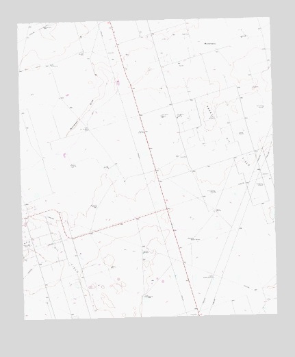
Parks, TX USGS Topographic Map
Click on map above to begin viewing in our Map Viewer.

This topographic map contains these locations and features:
Feature Name Type Latitude Longitude GNIS ID View Map
Bates FieldAirportN31.8309°W102.2485°1387260View Map
Boxcar WindmillLocaleN31.7940°W102.1554°1331151View Map
Camp Pasture WindmillLocaleN31.8348°W102.1804°1331996View Map
Chuck Houston WindmillLocaleN31.8021°W102.1546°1332814View Map
Corner WindmillPopulated PlaceN31.8337°W102.1543°1378162View Map
East Hensley WindmillLocaleN31.8376°W102.1299°1334946View Map
East WindmillLocaleN31.8626°W102.2182°1335032View Map
Hensley WindmillLocaleN31.8262°W102.1424°1337631View Map
Hi Estes WindmillLocaleN31.7774°W102.1910°1337663View Map
KODM-FM (Odessa)TowerN31.7946°W102.1793°1385959View Map
Lake WindmillLocaleN31.8132°W102.2068°1339524View Map
Little Star WindmillLocaleN31.8573°W102.2346°1340195View Map
Montgomery WindmillLocaleN31.8046°W102.1310°1341838View Map
North Benedict WindmillLocaleN31.7829°W102.1674°1342689View Map
North Estes WindmillLocaleN31.8299°W102.2165°1342720View Map
North WindmillLocaleN31.8732°W102.2376°1342841View Map
Parks Oil FieldOilfieldN31.8271°W102.1510°1343611View Map
Pliska Aircraft MuseumBuildingN31.7946°W102.1690°2014491View Map
South Benedict WindmillLocaleN31.7662°W102.1562°1347407View Map
South Estes WindmillLocaleN31.7590°W102.1907°1347435View Map
Two Section WindmillLocaleN31.7974°W102.2129°1348990View Map
Windmill in the FlatLocaleN31.8146°W102.2257°1350292View Map
Windmill on the HillLocaleN31.8282°W102.1890°1350293View Map

Note: Coordinates in the location and feature list above are referenced to NAD83 datum.


Copyright (C) 2008-2024 Ryan Niemi / Sunset Dynamics ... All Rights Reserved