TopoQuest Logo
Do you find TopoQuest useful?
Help keep TopoQuest running and adding new maps/features by donating!
Bitcoin:  19c7KJd3qBynnjoSw5npx9KScwjBe4ifkT
Litecoin:  LXs6TkuXGGXo1vDsWCkWVdjQX94eUKd6ui
Home View Maps Find Maps Find Places Resources & Links


South Cowden Ranch, Texas Topographic Map

USGS Map Title: South Cowden Ranch, TX
USGS Map MRC: 31102F3
DRG (GeoTIFF) Download: o31102f3.tif


Neighboring USGS Topographic Map Quads:


  Odessa SW, TX  
31102G4
 

  Odessa SE, TX  
31102G3
 

  Parks, TX  
31102G2
 

  Clark Brothers Ranch, TX  
31102F4
 

  South Cowden Ranch, TX  
31102F3
 

  Benge Corner NW, TX  
31102F2
 

  Doodle Bug Well, TX  
31102E4
 

  Perkins Lake, TX  
31102E3
 

  Benge Corner SW, TX  
31102E2


Map MRC Location:

N32°
W103°
N32°
W102°
H8 H7 H6 H5 H4 H3 H2 H1
G8 G7 G6 G5 G4 G3 G2 G1
F8 F7 F6 F5 F4 F3 F2 F1
E8 E7 E6 E5 E4 E3 E2 E1
D8 D7 D6 D5 D4 D3 D2 D1
C8 C7 C6 C5 C4 C3 C2 C1
B8 B7 B6 B5 B4 B3 B2 B1
A8 A7 A6 A5 A4 A3 A2 A1
N31°
W103°
N31°
W102°

South Cowden Ranch, TX USGS 1:24K Topographic Map Preview:
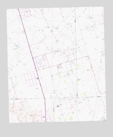
South Cowden Ranch, TX USGS Topographic Map
Click on map above to begin viewing in our Map Viewer.

This topographic map contains these locations and features:
Feature Name Type Latitude Longitude GNIS ID View Map
Concho Bluff North Oil FieldOilfieldN31.6465°W102.2946°1333206View Map
Double Well WindmillLocaleN31.7379°W102.2668°1334546View Map
East Eight Section WindmillLocaleN31.7321°W102.2965°1334902View Map
East Well WindmillLocaleN31.6324°W102.3474°1335019View Map
East Williams WindmillLocaleN31.6804°W102.2732°1335021View Map
Field WindmillLocaleN31.6510°W102.2726°1335776View Map
Frijol WindmillLocaleN31.7168°W102.2604°1336254View Map
Hillbilly WindmillLocaleN31.6324°W102.3068°1337794View Map
KODM-FM (Odessa)TowerN31.6596°W102.2943°1388047View Map
McElroy Trap WindmillLocaleN31.7468°W102.3496°1341192View Map
Moose Oil FieldOilfieldN31.7029°W102.2940°1341891View Map
North Kelly WindmillLocaleN31.7096°W102.3635°1342764View Map
Pleasant FarmsPopulated PlaceN31.6760°W102.3726°2034944View Map
Railway RanchLocaleN31.6254°W102.2524°1375614View Map
Sheep Camp WindmillLocaleN31.6571°W102.3151°1347005View Map
South Cowden RanchLocaleN31.7024°W102.3096°1376195View Map
South Ector County Volunteer Fire DepartmentBuildingN31.6741°W102.3706°2552105View Map
South Kelly WindmillLocaleN31.7060°W102.3643°1347481View Map
South Williams WindmillLocaleN31.6704°W102.2863°1347551View Map
Virey Oil FieldOilfieldN31.7271°W102.2638°1349305View Map
West Eight Section WindmillLocaleN31.7285°W102.3204°1349702View Map
West Williams WindmillLocaleN31.6768°W102.2985°1349829View Map
West WindmillLocaleN31.6618°W102.3385°1349834View Map

Note: Coordinates in the location and feature list above are referenced to NAD83 datum.


Copyright (C) 2008-2025 Ryan Niemi / Sunset Dynamics ... All Rights Reserved