TopoQuest Logo
Do you find TopoQuest useful?
Help keep TopoQuest running and adding new maps/features by donating!
Bitcoin:  19c7KJd3qBynnjoSw5npx9KScwjBe4ifkT
Litecoin:  LXs6TkuXGGXo1vDsWCkWVdjQX94eUKd6ui
Home View Maps Find Maps Find Places Resources & Links


Parmachenee Lake, Maine Topographic Map

USGS Map Title: Parmachenee Lake, ME
USGS Map MRC: 45070B8
DRG (GeoTIFF) Download: o45070b8.tif


Neighboring USGS Topographic Map Quads:


  Moose Bog, ME  
45071C1
 

  Twin Peaks, ME  
45070C8
 

  Northwest Pond, ME  
45070C7
 

  Rump Mountain, ME  
45071B1
 

  Parmachenee Lake, ME  
45070B8
 

  Little Kennebago Lake, ME  
45070B7
 

  Bosebuck Mountain, ME  
45071A1
 

  Lincoln Pond, ME  
45070A8
 

  Kennebago, ME  
45070A7


Map MRC Location:

N46°
W71°
N46°
W70°
H8 H7 H6 H5 H4 H3 H2 H1
G8 G7 G6 G5 G4 G3 G2 G1
F8 F7 F6 F5 F4 F3 F2 F1
E8 E7 E6 E5 E4 E3 E2 E1
D8 D7 D6 D5 D4 D3 D2 D1
C8 C7 C6 C5 C4 C3 C2 C1
B8 B7 B6 B5 B4 B3 B2 B1
A8 A7 A6 A5 A4 A3 A2 A1
N45°
W71°
N45°
W70°

Parmachenee Lake, ME USGS 1:24K Topographic Map Preview:
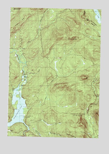
Parmachenee Lake, ME USGS Topographic Map
Click on map above to begin viewing in our Map Viewer.

This topographic map contains these locations and features:
Feature Name Type Latitude Longitude GNIS ID View Map
Big CanyonValleyN45.1476°W70.8904°562150View Map
Black Cat BrookStreamN45.1320°W70.9709°562422View Map
Bottle MountainSummitN45.1832°W70.8962°562772View Map
Cleveland PondLakeN45.1744°W70.9830°564091View Map
East Branch Cupsuptic RiverStreamN45.1256°W70.8828°565538View Map
First East Branch Magalloway RiverStreamN45.1978°W70.9781°566175View Map
Indian CoveBayN45.1706°W70.9881°568569View Map
Little Boy FallsFallsN45.1859°W70.9795°569706View Map
Lynx BrookStreamN45.1850°W70.9759°570601View Map
Moose BrookStreamN45.1517°W70.9773°571576View Map
Moose Brook Camp (historical)LocaleN45.1853°W70.9348°571585View Map
North Branch Black Cat BrookStreamN45.1328°W70.9637°572261View Map
Number Two Camp (historical)LocaleN45.1303°W70.8817°572186View Map
Otter PondLakeN45.1827°W70.9804°572837View Map
Oxbow TownshipCivilN45.2075°W70.8873°1987281View Map
Parmachenee ClubLocaleN45.1562°W70.9828°573010View Map
Parmachenee LakeLakeN45.1521°W70.9863°573011View Map
Saturday Pond (historical)LakeN45.1314°W70.9970°574934View Map
Snow Mountain BrookStreamN45.1667°W70.8798°575686View Map
South Branch Black Cat BrookStreamN45.1328°W70.9634°575769View Map
Thrasher PeaksSummitN45.2337°W70.9860°577047View Map
Township of ParmacheneeCivilN45.2084°W70.9578°579018View Map
Wells PondLakeN45.1797°W70.9805°578001View Map

Note: Coordinates in the location and feature list above are referenced to NAD83 datum.


Copyright (C) 2008-2025 Ryan Niemi / Sunset Dynamics ... All Rights Reserved