TopoQuest Logo
Do you find TopoQuest useful?
Help keep TopoQuest running and adding new maps/features by donating!
Bitcoin:  19c7KJd3qBynnjoSw5npx9KScwjBe4ifkT
Litecoin:  LXs6TkuXGGXo1vDsWCkWVdjQX94eUKd6ui
Home View Maps Find Maps Find Places Resources & Links


Parsnip Peak, Oregon Topographic Map

USGS Map Title: Parsnip Peak, OR
USGS Map MRC: 42117G1
DRG (GeoTIFF) Download: o42117g1.tif


Neighboring USGS Topographic Map Quads:


  Antelope Reservoir, OR  
42117H2
 

  Jordan Valley, OR  
42117H1
 

  Stonehouse Creek, ID  
42116H8
 

  Juniper Ridge, OR  
42117G2
 

  Parsnip Peak, OR  
42117G1
 

  Williams Creek, ID  
42116G8
 

  Whitehorse Butte, OR  
42117F2
 

  Juniper Point, OR  
42117F1
 

  Cliffs, ID  
42116F8


Map MRC Location:

N43°
W118°
N43°
W117°
H8 H7 H6 H5 H4 H3 H2 H1
G8 G7 G6 G5 G4 G3 G2 G1
F8 F7 F6 F5 F4 F3 F2 F1
E8 E7 E6 E5 E4 E3 E2 E1
D8 D7 D6 D5 D4 D3 D2 D1
C8 C7 C6 C5 C4 C3 C2 C1
B8 B7 B6 B5 B4 B3 B2 B1
A8 A7 A6 A5 A4 A3 A2 A1
N42°
W118°
N42°
W117°

Parsnip Peak, OR USGS 1:24K Topographic Map Preview:
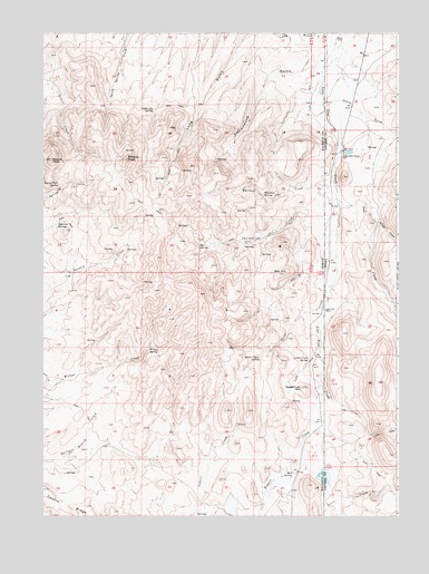
Parsnip Peak, OR USGS Topographic Map
Click on map above to begin viewing in our Map Viewer.

This topographic map contains these locations and features:
Feature Name Type Latitude Longitude GNIS ID View Map
Big SpringSpringN42.8207°W117.0696°1117672View Map
Castro RidgeRidgeN42.7524°W117.1101°1118674View Map
Cattle CreekStreamN42.8578°W117.0266°371921View Map
Chicken CreekStreamN42.8374°W117.0234°371988View Map
Coffee Pot SpringSpringN42.8549°W117.0874°1119082View Map
Cottonwood GulchValleyN42.8682°W117.0304°1119336View Map
Eiguren SpringSpringN42.8260°W117.1194°1120417View Map
Horse CreekStreamN42.8140°W117.0224°373140View Map
Horse Creek SpringSpringN42.7910°W117.0493°1121997View Map
Little CreekStreamN42.7935°W117.0282°1123168View Map
Little Creek SpringSpringN42.7907°W117.0319°1123172View Map
Lone Tree RanchLocaleN42.8038°W117.0262°373707View Map
Minear CreekStreamN42.8265°W117.0087°373968View Map
Mud SpringSpringN42.7606°W117.0372°1124477View Map
Owl CreekStreamN42.8321°W117.0218°374286View Map
Parsnip PeakSummitN42.8423°W117.0958°1125204View Map
Red HillSummitN42.8126°W117.0421°1158442View Map
Round PeakSummitN42.8421°W117.1221°1126328View Map
Round Peak SpringSpringN42.8359°W117.1196°1126329View Map
Sagebrush MountainSummitN42.7834°W117.0340°1126442View Map
Salt Lick DamDamN42.7599°W117.0276°1131309View Map
Salt Lick ReservoirReservoirN42.7608°W117.0282°1158809View Map
Whiskey CreekStreamN42.8383°W117.0232°375855View Map
Whiskey SpringSpringN42.8327°W117.0485°1128944View Map
Willow SpringSpringN42.7938°W117.0868°1129159View Map
Wroten Reservoir 2ReservoirN42.8655°W117.0976°1158663View Map

Note: Coordinates in the location and feature list above are referenced to NAD83 datum.


Copyright (C) 2008-2025 Ryan Niemi / Sunset Dynamics ... All Rights Reserved