TopoQuest Logo
Do you find TopoQuest useful?
Help keep TopoQuest running and adding new maps/features by donating!
Bitcoin:  19c7KJd3qBynnjoSw5npx9KScwjBe4ifkT
Litecoin:  LXs6TkuXGGXo1vDsWCkWVdjQX94eUKd6ui
Home View Maps Find Maps Find Places Resources & Links


Stonehouse Creek, Idaho Topographic Map

USGS Map Title: Stonehouse Creek, ID
USGS Map MRC: 42116H8
DRG (GeoTIFF) Download: o42116h8.tif


Neighboring USGS Topographic Map Quads:


  Hooker Creek, OR  
43117A1
 

  Swisher Mountain, ID  
43116A8
 

  De Lamar, ID  
43116A7
 

  Jordan Valley, OR  
42117H1
 

  Stonehouse Creek, ID  
42116H8
 

  Flint, ID  
42116H7
 

  Parsnip Peak, OR  
42117G1
 

  Williams Creek, ID  
42116G8
 

  Combination Ridge, ID  
42116G7


Map MRC Location:

N43°
W117°
N43°
W116°
H8 H7 H6 H5 H4 H3 H2 H1
G8 G7 G6 G5 G4 G3 G2 G1
F8 F7 F6 F5 F4 F3 F2 F1
E8 E7 E6 E5 E4 E3 E2 E1
D8 D7 D6 D5 D4 D3 D2 D1
C8 C7 C6 C5 C4 C3 C2 C1
B8 B7 B6 B5 B4 B3 B2 B1
A8 A7 A6 A5 A4 A3 A2 A1
N42°
W117°
N42°
W116°

Stonehouse Creek, ID USGS 1:24K Topographic Map Preview:
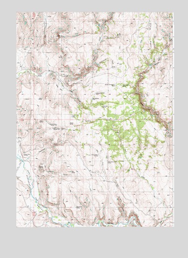
Stonehouse Creek, ID USGS Topographic Map
Click on map above to begin viewing in our Map Viewer.

This topographic map contains these locations and features:
Feature Name Type Latitude Longitude GNIS ID View Map
Big SpringsSpringN42.9863°W116.9179°371532View Map
Connors CanyonValleyN42.9090°W116.9882°372106View Map
Connors SpringSpringN42.9102°W116.9793°372107View Map
Cottonwood CreekStreamN42.9702°W116.9393°372156View Map
Cottonwood Trail PondReservoirN42.9527°W116.9374°376026View Map
Crossroads SpringSpringN42.9152°W116.9579°376027View Map
Dead Horse SpringSpringN42.8865°W116.9529°372330View Map
Duck CreekStreamN42.8796°W116.8829°372499View Map
East Fork Goose CreekStreamN42.9013°W116.9232°372557View Map
East Fork Trout CreekStreamN42.9913°W116.9332°372565View Map
East Goose Creek PondReservoirN42.9265°W116.9140°376030View Map
Five SpringSpringN42.9732°W116.9657°372714View Map
Goose CreekStreamN42.8771°W116.9140°372878View Map
Goose Creek SpringSpringN42.9165°W116.9357°372880View Map
Ibex SpringSpringN42.9074°W116.9571°376033View Map
Lone Tree CreekStreamN42.9138°W116.9957°373706View Map
Mud SpringsSpringN42.9377°W116.9426°374069View Map
Mud Springs PondReservoirN42.9485°W116.9404°376037View Map
Noble BasinBasinN42.9557°W116.9679°374158View Map
Pack Hook SpringSpringN42.9452°W116.9324°374296View Map
Pleasant Valley CemeteryCemeteryN42.9174°W116.9945°376038View Map
Sams PondReservoirN42.9396°W116.9587°376039View Map
Sheep SpringSpringN42.9368°W116.9790°374993View Map
South SpringSpringN42.9513°W116.9801°375179View Map
Split RockSummitN42.9863°W116.9654°375196View Map
Split Rock CanyonValleyN42.9674°W116.9746°375197View Map
Stonehouse CreekStreamN42.9127°W116.9937°375294View Map
Summit Spring Number OneSpringN42.9324°W116.9665°376042View Map
Summit Spring Number TwoSpringN42.9343°W116.9682°376043View Map
Thorne SpringSpringN42.9354°W116.9587°375499View Map
West Fork Goose CreekStreamN42.9013°W116.9232°375812View Map
West Fork Trout CreekStreamN42.9910°W116.9332°375822View Map
Williams CreekStreamN42.8760°W116.9296°375913View Map
Wood CanyonValleyN42.9618°W116.9665°375982View Map

Note: Coordinates in the location and feature list above are referenced to NAD83 datum.


Copyright (C) 2008-2024 Ryan Niemi / Sunset Dynamics ... All Rights Reserved