TopoQuest Logo
Do you find TopoQuest useful?
Help keep TopoQuest running and adding new maps/features by donating!
Bitcoin:  19c7KJd3qBynnjoSw5npx9KScwjBe4ifkT
Litecoin:  LXs6TkuXGGXo1vDsWCkWVdjQX94eUKd6ui
Home View Maps Find Maps Find Places Resources & Links


Pass Creek, Washington Topographic Map

USGS Map Title: Pass Creek, WA
USGS Map MRC: 48117G2
DRG (GeoTIFF) Download: o48117g2.tif


Neighboring USGS Topographic Map Quads:


  Boundary Dam, WA  
48117H3
 

  Gypsy Peak, WA  
48117H2
 

  Salmo Mountain, WA  
48117H1
 

  Metaline Falls, WA  
48117G3
 

  Pass Creek, WA  
48117G2
 

  Helmer Mountain, WA  
48117G1
 

  Scotchman Lake, WA  
48117F3
 

  Monumental Mountain, WA  
48117F2
 

  Orwig Hump, WA  
48117F1


Map MRC Location:

N49°
W118°
N49°
W117°
H8 H7 H6 H5 H4 H3 H2 H1
G8 G7 G6 G5 G4 G3 G2 G1
F8 F7 F6 F5 F4 F3 F2 F1
E8 E7 E6 E5 E4 E3 E2 E1
D8 D7 D6 D5 D4 D3 D2 D1
C8 C7 C6 C5 C4 C3 C2 C1
B8 B7 B6 B5 B4 B3 B2 B1
A8 A7 A6 A5 A4 A3 A2 A1
N48°
W118°
N48°
W117°

Pass Creek, WA USGS 1:24K Topographic Map Preview:
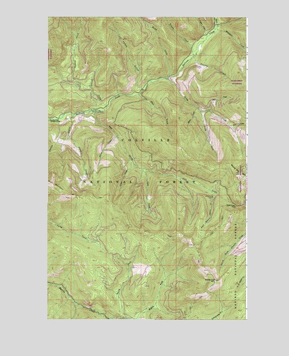
Pass Creek, WA USGS Topographic Map
Click on map above to begin viewing in our Map Viewer.

This topographic map contains these locations and features:
Feature Name Type Latitude Longitude GNIS ID View Map
Ace CreekStreamN48.8299°W117.1355°1515717View Map
Cascade CreekStreamN48.8374°W117.2130°1517436View Map
Colville National ForestForestN48.7769°W117.2305°1533347View Map
Conto GulchValleyN48.8335°W117.2344°1518034View Map
Copper CreekStreamN48.8666°W117.1505°1518078View Map
Fetus CreekStreamN48.8255°W117.2066°1519508View Map
Fireline CreekStreamN48.8585°W117.1591°1519559View Map
Grassy Top MountainSummitN48.7663°W117.1450°1520258View Map
Grease CreekStreamN48.8152°W117.1969°1520278View Map
Gypo CreekStreamN48.8121°W117.1913°1520422View Map
Gypsy CreekStreamN48.8710°W117.1441°1520423View Map
Jack CreekStreamN48.8363°W117.1486°1521284View Map
Johns CreekStreamN48.8258°W117.2369°1521413View Map
Kinyon CreekStreamN48.8585°W117.1594°1521697View Map
Last Chance CabinLocaleN48.8005°W117.1466°1521917View Map
Last Chance Cabin CreekStreamN48.8030°W117.1477°1521918View Map
Lookout CreekStreamN48.8463°W117.2236°1522426View Map
Mankato CreekStreamN48.8696°W117.1452°1522675View Map
Middle Fork Harvey CreekStreamN48.7505°W117.2116°1523069View Map
North Fork Harvey CreekStreamN48.7505°W117.2008°1523793View Map
Pass CreekStreamN48.8363°W117.2227°1524232View Map
Pass Creek PassGapN48.7969°W117.1319°1524239View Map
Queen CreekStreamN48.8374°W117.1569°1524756View Map
Rainy CreekStreamN48.8502°W117.1738°1524838View Map
Round Top MountainSummitN48.8102°W117.1302°1534604View Map
South Fork Stony CreekStreamN48.8358°W117.1544°1526261View Map
Stony CreekStreamN48.8491°W117.1755°1526590View Map
Sullivan Creek Campground Number 2LocaleN48.8327°W117.2486°1533234View Map
Sullivan Creek Campground Number 3LocaleN48.8360°W117.2216°1533235View Map
Thor CreekStreamN48.8435°W117.1930°1527117View Map
Totem GulchValleyN48.8446°W117.1905°1527318View Map

Note: Coordinates in the location and feature list above are referenced to NAD83 datum.


Copyright (C) 2008-2024 Ryan Niemi / Sunset Dynamics ... All Rights Reserved