TopoQuest Logo
Do you find TopoQuest useful?
Help keep TopoQuest running and adding new maps/features by donating!
Bitcoin:  19c7KJd3qBynnjoSw5npx9KScwjBe4ifkT
Litecoin:  LXs6TkuXGGXo1vDsWCkWVdjQX94eUKd6ui
Home View Maps Find Maps Find Places Resources & Links


Patmos Head, Utah Topographic Map

USGS Map Title: Patmos Head, UT
USGS Map MRC: 39110E3
DRG (GeoTIFF) Download: o39110e3.tif


Neighboring USGS Topographic Map Quads:


  Mount Bartles, UT  
39110F4
 

  Bruin Point, UT  
39110F3
 

  Twin Hollow, UT  
39110F2
 

  Sunnyside, UT  
39110E4
 

  Patmos Head, UT  
39110E3
 

  Summerhouse Ridge, UT  
39110E2
 

  Cedar, UT  
39110D4
 

  Lila Point, UT  
39110D3
 

  Lighthouse Canyon, UT  
39110D2


Map MRC Location:

N40°
W111°
N40°
W110°
H8 H7 H6 H5 H4 H3 H2 H1
G8 G7 G6 G5 G4 G3 G2 G1
F8 F7 F6 F5 F4 F3 F2 F1
E8 E7 E6 E5 E4 E3 E2 E1
D8 D7 D6 D5 D4 D3 D2 D1
C8 C7 C6 C5 C4 C3 C2 C1
B8 B7 B6 B5 B4 B3 B2 B1
A8 A7 A6 A5 A4 A3 A2 A1
N39°
W111°
N39°
W110°

Patmos Head, UT USGS 1:24K Topographic Map Preview:
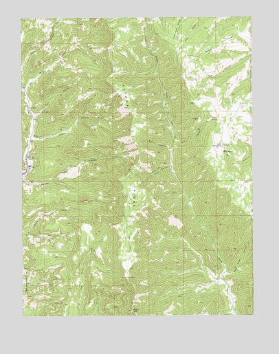
Patmos Head, UT USGS Topographic Map
Click on map above to begin viewing in our Map Viewer.

This topographic map contains these locations and features:
Feature Name Type Latitude Longitude GNIS ID View Map
Bear CanyonValleyN39.5950°W110.3732°1425343View Map
Beef Slide CanyonValleyN39.5175°W110.2657°1425399View Map
Bishop RidgeRidgeN39.6141°W110.2685°1425629View Map
Dalton CanyonValleyN39.5730°W110.2929°1427191View Map
Dalton SpringSpringN39.5821°W110.2726°1427192View Map
Mule CanyonValleyN39.5697°W110.2940°1430593View Map
North Willow SpringSpringN39.5712°W110.2673°1430875View Map
Pasture CanyonValleyN39.5736°W110.3707°1431133View Map
Patmos HeadSummitN39.5019°W110.3165°1431137View Map
Patmos RidgeRidgeN39.5794°W110.3129°1431138View Map
Pole CanyonValleyN39.5841°W110.3685°1431372View Map
Range Valley MountainSummitN39.5561°W110.2702°1433865View Map
South Willow SpringSpringN39.5686°W110.2668°1432771View Map
Sunnyside MineMineN39.5630°W110.3710°1433068View Map
Trail CanyonValleyN39.5627°W110.2949°1433630View Map
Upper SunnysidePopulated PlaceN39.5666°W110.3729°1450536View Map
Willow Spring Cow CampLocaleN39.5705°W110.2665°1434361View Map

Note: Coordinates in the location and feature list above are referenced to NAD83 datum.


Copyright (C) 2008-2025 Ryan Niemi / Sunset Dynamics ... All Rights Reserved