TopoQuest Logo
Do you find TopoQuest useful?
Help keep TopoQuest running and adding new maps/features by donating!
Bitcoin:  19c7KJd3qBynnjoSw5npx9KScwjBe4ifkT
Litecoin:  LXs6TkuXGGXo1vDsWCkWVdjQX94eUKd6ui
Home View Maps Find Maps Find Places Resources & Links


Sunnyside, Utah Topographic Map

USGS Map Title: Sunnyside, UT
USGS Map MRC: 39110E4
DRG (GeoTIFF) Download: o39110e4.tif


Neighboring USGS Topographic Map Quads:


  Pine Canyon, UT  
39110F5
 

  Mount Bartles, UT  
39110F4
 

  Bruin Point, UT  
39110F3
 

  Sunnyside Junction, UT  
39110E5
 

  Sunnyside, UT  
39110E4
 

  Patmos Head, UT  
39110E3
 

  Mounds, UT  
39110D5
 

  Cedar, UT  
39110D4
 

  Lila Point, UT  
39110D3


Map MRC Location:

N40°
W111°
N40°
W110°
H8 H7 H6 H5 H4 H3 H2 H1
G8 G7 G6 G5 G4 G3 G2 G1
F8 F7 F6 F5 F4 F3 F2 F1
E8 E7 E6 E5 E4 E3 E2 E1
D8 D7 D6 D5 D4 D3 D2 D1
C8 C7 C6 C5 C4 C3 C2 C1
B8 B7 B6 B5 B4 B3 B2 B1
A8 A7 A6 A5 A4 A3 A2 A1
N39°
W111°
N39°
W110°

Sunnyside, UT USGS 1:24K Topographic Map Preview:
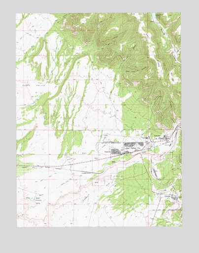
Sunnyside, UT USGS Topographic Map
Click on map above to begin viewing in our Map Viewer.

This topographic map contains these locations and features:
Feature Name Type Latitude Longitude GNIS ID View Map
B CanyonValleyN39.5847°W110.4763°1425215View Map
Bear CanyonValleyN39.6139°W110.4754°1425344View Map
Bull FlatFlatN39.5872°W110.3824°1426115View Map
City of East CarbonCivilN39.5301°W110.4374°2410386View Map
City of East Carbon-SunnysideCivilN39.5336°W110.4328°2746937View Map
City of SunnysideCivilN39.5532°W110.4033°2412007View Map
ColumbiaPopulated PlaceN39.5169°W110.3827°1426815View Map
Columbia JunctionPopulated PlaceN39.5316°W110.4438°1437530View Map
DragertonPopulated PlaceN39.5425°W110.4213°1427468View Map
East Carbon CemeteryCemeteryN39.5488°W110.4037°2769392View Map
East Carbon CityPopulated PlaceN39.5477°W110.4149°1455874View Map
East Carbon Fire DepartmentBuildingN39.5505°W110.3927°2627147View Map
East Carbon High School (historical)SchoolN39.5516°W110.4024°1427673View Map
East Carbon Police DepartmentBuildingN39.5428°W110.4204°2730347View Map
East Carbon Post OfficePost OfficeN39.5435°W110.4208°2769053View Map
East SpringSpringN39.5158°W110.4865°1427724View Map
Fan CanyonValleyN39.5680°W110.4010°1427877View Map
Good Shepherd Catholic ChurchChurchN39.5439°W110.4168°1436720View Map
Grassy Trail DamDamN39.6216°W110.3940°1434764View Map
Grassy Trail ReservoirReservoirN39.6243°W110.3960°1428356View Map
Left Fork A CanyonValleyN39.5908°W110.4240°1429524View Map
Number Two CanyonValleyN39.5577°W110.3752°1430888View Map
Peterson SchoolSchoolN39.5527°W110.3890°1436113View Map
Peterson SchoolSchoolN39.5525°W110.3888°1431193View Map
Pierson Ranch (historical)LocaleN39.5380°W110.4790°1436127View Map
Right Fork A CanyonValleyN39.5889°W110.4252°1431785View Map
Slaughter CanyonValleyN39.5586°W110.3813°1432535View Map
SunnydalePopulated PlaceN39.5333°W110.4007°1436449View Map
SunnysidePopulated PlaceN39.5514°W110.3879°1433066View Map
Sunnyside Ambulance ServiceBuildingN39.5505°W110.3925°2665431View Map
Sunnyside Fire DepartmentBuildingN39.5523°W110.3887°2627338View Map
Sunnyside Post OfficePost OfficeN39.5515°W110.3866°2769117View Map
Sunnyside Power Plant CemeteryCemeteryN39.5461°W110.3895°2769396View Map
The Church of Jesus Christ of Latter Day SaintsChurchN39.5455°W110.4185°1436899View Map
Trinity Episcopal ChurchChurchN39.5486°W110.4146°1436785View Map
Valley View CemeteryCemeteryN39.5496°W110.4016°1436450View Map
Water CanyonValleyN39.5205°W110.3952°1434005View Map
Water CanyonValleyN39.6014°W110.3779°1434006View Map
Whitmore CanyonValleyN39.5558°W110.3802°1434220View Map

Note: Coordinates in the location and feature list above are referenced to NAD83 datum.


Copyright (C) 2008-2025 Ryan Niemi / Sunset Dynamics ... All Rights Reserved