TopoQuest Logo
Do you find TopoQuest useful?
Help keep TopoQuest running and adding new maps/features by donating!
Bitcoin:  19c7KJd3qBynnjoSw5npx9KScwjBe4ifkT
Litecoin:  LXs6TkuXGGXo1vDsWCkWVdjQX94eUKd6ui
Home View Maps Find Maps Find Places Resources & Links


Paw Paw, Illinois Topographic Map

USGS Map Title: Paw Paw, IL
USGS Map MRC: 41088F8
DRG (GeoTIFF) Download: o41088f8.tif


Neighboring USGS Topographic Map Quads:


  Steward, IL  
41089G1
 

  Lee, IL  
41088G8
 

  Waterman, IL  
41088G7
 

  Compton, IL  
41089F1
 

  Paw Paw, IL  
41088F8
 

  Shabbona Grove, IL  
41088F7
 

  Mendota East, IL  
41089E1
 

  Earlville, IL  
41088E8
 

  Leland, IL  
41088E7


Map MRC Location:

N42°
W89°
N42°
W88°
H8 H7 H6 H5 H4 H3 H2 H1
G8 G7 G6 G5 G4 G3 G2 G1
F8 F7 F6 F5 F4 F3 F2 F1
E8 E7 E6 E5 E4 E3 E2 E1
D8 D7 D6 D5 D4 D3 D2 D1
C8 C7 C6 C5 C4 C3 C2 C1
B8 B7 B6 B5 B4 B3 B2 B1
A8 A7 A6 A5 A4 A3 A2 A1
N41°
W89°
N41°
W88°

Paw Paw, IL USGS 1:24K Topographic Map Preview:
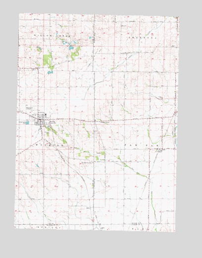
Paw Paw, IL USGS Topographic Map
Click on map above to begin viewing in our Map Viewer.

This topographic map contains these locations and features:
Feature Name Type Latitude Longitude GNIS ID View Map
Baptist ChurchChurchN41.6261°W88.9326°1718874View Map
Cyclone School (historical)SchoolN41.6564°W88.9790°1718876View Map
East Paw PawPopulated PlaceN41.6881°W88.9393°1816536View Map
East Paw Paw CemeteryCemeteryN41.6878°W88.9348°421771View Map
Ellsworth CemeteryCemeteryN41.7175°W88.9895°407913View Map
First Baptist ChurchChurchN41.6867°W88.9837°2042239View Map
First Presbyterian ChurchChurchN41.6889°W88.9831°2042240View Map
Howlett School (historical)SchoolN41.7234°W88.9606°1718878View Map
Illinois Copter Service HeliportAirportN41.6320°W88.9790°427653View Map
Johnson Grove CemeteryCemeteryN41.7322°W88.8815°422082View Map
Moffett School (historical)SchoolN41.7181°W88.9993°1718877View Map
Paw PawPopulated PlaceN41.6889°W88.9812°415463View Map
Paw Paw Bible ChurchChurchN41.6911°W88.9876°2042241View Map
Paw Paw Elementary SchoolSchoolN41.6900°W88.9773°1816575View Map
Paw Paw Fire Protection DistrictBuildingN41.6880°W88.9799°2640428View Map
Paw Paw Junior-Senior High SchoolSchoolN41.6914°W88.9773°1816576View Map
Paw Paw Post OfficePost OfficeN41.6888°W88.9800°2788196View Map
Paw Paw United Methodist ChurchChurchN41.6903°W88.9831°2042242View Map
RadleyPopulated PlaceN41.6378°W88.9412°423099View Map
Rogers Brothers Landing Strip (historical)AirportN41.6945°W88.9929°1718875View Map
RolloPopulated PlaceN41.6731°W88.8862°422018View Map
Rollo Congregational ChurchChurchN41.6723°W88.8870°2042235View Map
South Paw PawPopulated PlaceN41.6648°W88.9412°1816589View Map
South Paw Paw CemeteryCemeteryN41.6642°W88.9415°426988View Map
Stroyan LakeReservoirN41.7306°W88.9589°1691571View Map
Stroyan Lake DamDamN41.7317°W88.9584°1691570View Map
Township of Paw PawCivilN41.6738°W88.8795°429535View Map
Township of WyomingCivilN41.6721°W88.9960°429962View Map
Village of Paw PawCivilN41.6875°W88.9809°2399633View Map
Wyoming CemeteryCemeteryN41.6797°W88.9759°421542View Map

Note: Coordinates in the location and feature list above are referenced to NAD83 datum.


Copyright (C) 2008-2025 Ryan Niemi / Sunset Dynamics ... All Rights Reserved