TopoQuest Logo
Do you find TopoQuest useful?
Help keep TopoQuest running and adding new maps/features by donating!
Bitcoin:  19c7KJd3qBynnjoSw5npx9KScwjBe4ifkT
Litecoin:  LXs6TkuXGGXo1vDsWCkWVdjQX94eUKd6ui
Home View Maps Find Maps Find Places Resources & Links


Pawling, New York Topographic Map

USGS Map Title: Pawling, NY
USGS Map MRC: 41073E5
DRG (GeoTIFF) Download: o41073e5.tif


Neighboring USGS Topographic Map Quads:


  Verbank, NY  
41073F6
 

  Dover Plains, NY  
41073F5
 

  Kent, CT  
41073F4
 

  Poughquag, NY  
41073E6
 

  Pawling, NY  
41073E5
 

  New Milford, CT  
41073E4
 

  Lake Carmel, NY  
41073D6
 

  Brewster, NY  
41073D5
 

  Danbury, CT  
41073D4


Map MRC Location:

N42°
W74°
N42°
W73°
H8 H7 H6 H5 H4 H3 H2 H1
G8 G7 G6 G5 G4 G3 G2 G1
F8 F7 F6 F5 F4 F3 F2 F1
E8 E7 E6 E5 E4 E3 E2 E1
D8 D7 D6 D5 D4 D3 D2 D1
C8 C7 C6 C5 C4 C3 C2 C1
B8 B7 B6 B5 B4 B3 B2 B1
A8 A7 A6 A5 A4 A3 A2 A1
N41°
W74°
N41°
W73°

Pawling, NY USGS 1:24K Topographic Map Preview:
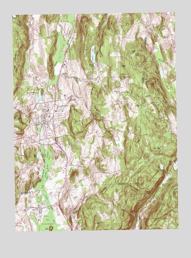
Pawling, NY USGS Topographic Map
Click on map above to begin viewing in our Map Viewer.

This topographic map contains these locations and features:
Feature Name Type Latitude Longitude GNIS ID View Map
Akin Family Burial GroundCemeteryN41.5601°W73.5457°2776875View Map
Akins CornersPopulated PlaceN41.5148°W73.5912°942223View Map
Baker CornerPopulated PlaceN41.5876°W73.5629°972192View Map
Birch HillSummitN41.5218°W73.5571°943996View Map
Brady BrookStreamN41.5290°W73.6029°944591View Map
Brady PondLakeN41.6007°W73.5326°944595View Map
Branch HillSummitN41.5718°W73.5301°944620View Map
Carroll CampLocaleN41.6023°W73.5335°945907View Map
Central Baptist Church of PawlingChurchN41.5617°W73.5986°2456100View Map
Christ Church on Quaker HillChurchN41.5578°W73.5511°2456101View Map
Conger HillSummitN41.5198°W73.5815°947280View Map
Corbin HillSummitN41.5956°W73.5971°947431View Map
Cranberry MountainSummitN41.5037°W73.5626°947666View Map
Deer PondLakeN41.5285°W73.5090°206656View Map
Duane Lake AcademySchoolN41.5524°W73.6100°2597660View Map
Dutchess Golf CourseLocaleN41.5556°W73.5964°2454165View Map
Edward R Murrow ParkParkN41.5678°W73.6136°2454164View Map
French LakeLakeN41.5951°W73.5618°950694View Map
Green Mountain LakeLakeN41.5776°W73.6047°951712View Map
Greenwood BrookStreamN41.5720°W73.5007°207511View Map
Hammersly RidgeRidgeN41.6106°W73.5687°952120View Map
Hiller BrookStreamN41.5895°W73.5926°952821View Map
Holy Trinity Episcopal ChurchChurchN41.5631°W73.5969°2456102View Map
Hurd CornersPopulated PlaceN41.5895°W73.5835°953514View Map
Jennings PondLakeN41.5466°W73.5120°208148View Map
Jones PondLakeN41.6247°W73.6233°954192View Map
Kingdom Hall of Jehovahs WitnessesChurchN41.5640°W73.5934°2597724View Map
Lovely Hill Nursing HomeBuildingN41.5761°W73.5914°2598682View Map
Lutheran Church of ChristChurchN41.5669°W73.5933°2456104View Map
Maple Avenue CemeteryCemeteryN41.5151°W73.6120°2420636View Map
Matthew Patterson Elementary SchoolSchoolN41.5066°W73.6067°2420647View Map
Mizzen TopSummitN41.5570°W73.5482°957457View Map
Mount TomSummitN41.5651°W73.6223°967610View Map
Observatory HillSummitN41.5879°W73.5412°959206View Map
Old Baptist Burying GroundCemeteryN41.5049°W73.6217°2420639View Map
PattersonPopulated PlaceN41.5137°W73.6062°959987View Map
Patterson LibraryBuildingN41.5133°W73.6023°2598985View Map
Patterson Town HallBuildingN41.5138°W73.6047°2598990View Map
Patterson Volunteer Fire Department Station 1BuildingN41.5148°W73.6020°2735162View Map
PawlingPopulated PlaceN41.5620°W73.6026°960006View Map
Pawling Elementary SchoolSchoolN41.5664°W73.5969°2456016View Map
Pawling Fire Department Engine Company 1BuildingN41.5523°W73.6026°2734997View Map
Pawling Fire Department Mizzentop Engine Company 3BuildingN41.5635°W73.5505°2734998View Map
Pawling Free LibraryBuildingN41.5633°W73.6022°2456099View Map
Pawling High SchoolSchoolN41.5783°W73.5847°2456018View Map
Pawling Middle SchoolSchoolN41.5808°W73.5853°2456017View Map
Pawling Post OfficePost OfficeN41.5638°W73.6021°2598732View Map
Pawling ReservoirReservoirN41.5759°W73.5755°960008View Map
Pawling Rural CemeteryCemeteryN41.5680°W73.5951°2776877View Map
Pawling StationLocaleN41.5647°W73.6003°2454166View Map
Pawling Town HallBuildingN41.5691°W73.6001°2598683View Map
Pawling United Methodist ChurchChurchN41.5615°W73.6030°2597696View Map
Pine IslandIslandN41.5009°W73.5973°970479View Map
Purgatory HillSummitN41.5629°W73.5782°961995View Map
Quaker BrookStreamN41.5001°W73.5326°210035View Map
Quaker HillPopulated PlaceN41.5795°W73.5429°972982View Map
Quaker Hill CemeteryCemeteryN41.5823°W73.5433°2776854View Map
Quaker Hill CemeteryCemeteryN41.5579°W73.5638°2776878View Map
Quaker Hill Country ClubLocaleN41.5886°W73.5464°2454163View Map
Quaker LakeLakeN41.6014°W73.5630°962049View Map
Ray LakeLakeN41.5437°W73.6054°962241View Map
Saint John's CemeteryCemeteryN41.5657°W73.5980°2456109View Map
Saint John's Roman Catholic ChurchChurchN41.5617°W73.6000°2456105View Map
School Number 2 (historical)SchoolN41.5092°W73.5864°2726327View Map
Seeley HillSummitN41.5945°W73.5423°964803View Map
Spring LakeLakeN41.5901°W73.5106°211085View Map
Spring Lake DamDamN41.5895°W73.5101°1770813View Map
Stephens BrookStreamN41.5026°W73.5935°966346View Map
The Great SwampSwampN41.5381°W73.5992°967248View Map
The Hill FarmLocaleN41.5542°W73.5464°2635801View Map
Timber LakeLakeN41.5362°W73.5119°211469View Map
Timber Lake DamDamN41.5351°W73.5112°1770809View Map
Town of PawlingCivilN41.5660°W73.5972°979347View Map
Tracy PondLakeN41.5667°W73.5575°967739View Map
Trinity-Pawling SchoolSchoolN41.5720°W73.5898°967837View Map
Turner MountainSummitN41.5837°W73.5190°211614View Map
Valley PondLakeN41.5291°W73.5081°211720View Map
Village of PawlingCivilN41.5633°W73.5987°2391054View Map
Village of Pawling Town HallBuildingN41.5624°W73.6007°2598647View Map
Watts CemeteryCemeteryN41.5541°W73.5932°2456108View Map
West MountainSummitN41.6015°W73.6215°970815View Map

Note: Coordinates in the location and feature list above are referenced to NAD83 datum.


Copyright (C) 2008-2024 Ryan Niemi / Sunset Dynamics ... All Rights Reserved