TopoQuest Logo
Do you find TopoQuest useful?
Help keep TopoQuest running and adding new maps/features by donating!
Bitcoin:  19c7KJd3qBynnjoSw5npx9KScwjBe4ifkT
Litecoin:  LXs6TkuXGGXo1vDsWCkWVdjQX94eUKd6ui
Home View Maps Find Maps Find Places Resources & Links


Poughquag, New York Topographic Map

USGS Map Title: Poughquag, NY
USGS Map MRC: 41073E6
DRG (GeoTIFF) Download: o41073e6.tif


Neighboring USGS Topographic Map Quads:


  Pleasant Valley, NY  
41073F7
 

  Verbank, NY  
41073F6
 

  Dover Plains, NY  
41073F5
 

  Hopewell Junction, NY  
41073E7
 

  Poughquag, NY  
41073E6
 

  Pawling, NY  
41073E5
 

  Oscawana Lake, NY  
41073D7
 

  Lake Carmel, NY  
41073D6
 

  Brewster, NY  
41073D5


Map MRC Location:

N42°
W74°
N42°
W73°
H8 H7 H6 H5 H4 H3 H2 H1
G8 G7 G6 G5 G4 G3 G2 G1
F8 F7 F6 F5 F4 F3 F2 F1
E8 E7 E6 E5 E4 E3 E2 E1
D8 D7 D6 D5 D4 D3 D2 D1
C8 C7 C6 C5 C4 C3 C2 C1
B8 B7 B6 B5 B4 B3 B2 B1
A8 A7 A6 A5 A4 A3 A2 A1
N41°
W74°
N41°
W73°

Poughquag, NY USGS 1:24K Topographic Map Preview:
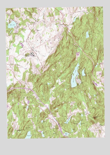
Poughquag, NY USGS Topographic Map
Click on map above to begin viewing in our Map Viewer.

This topographic map contains these locations and features:
Feature Name Type Latitude Longitude GNIS ID View Map
Ark And Dove PreschoolSchoolN41.5978°W73.7486°2460813View Map
Ballard - Milltown CemeteryCemeteryN41.5188°W73.6971°2776876View Map
Ballard Ground CemeteryCemeteryN41.5053°W73.6870°2420630View Map
Ballard LakeReservoirN41.5162°W73.7051°942924View Map
Ballard PondReservoirN41.5404°W73.6373°942925View Map
Barton OrchardsLocaleN41.6075°W73.7058°2516138View Map
Bear SwampSwampN41.5292°W73.6633°943312View Map
BeekmanPopulated PlaceN41.6109°W73.7129°943544View Map
Beekman Baptist ChurchChurchN41.6131°W73.7097°943548View Map
Beekman CemeteryCemeteryN41.6132°W73.6799°943546View Map
Beekman Fire CompanyBuildingN41.6116°W73.6846°2718582View Map
Beekman SchoolSchoolN41.6034°W73.7090°943552View Map
Beekman Town HallBuildingN41.6107°W73.6804°2598689View Map
Browns PondReservoirN41.5076°W73.6673°944956View Map
Bundy HillSummitN41.5167°W73.6281°2726326View Map
Camp AlamarLocaleN41.5295°W73.7246°945540View Map
Camp LudingtonLocaleN41.5495°W73.6882°945618View Map
Camp MerrywoodLocaleN41.5273°W73.6412°945623View Map
Denton LakeReservoirN41.5218°W73.6541°948329View Map
Depot HillSummitN41.5754°W73.6751°948338View Map
Faith Bible Fellowship ChurchChurchN41.5325°W73.6608°2456107View Map
First Pawling ChurchChurchN41.5501°W73.6687°950108View Map
Flagler CemeteryCemeteryN41.5882°W73.6978°950223View Map
Flat Rock BrookStreamN41.5790°W73.6993°950248View Map
Frog Hollow BrookStreamN41.5920°W73.7285°950752View Map
Gardner Hollow BrookStreamN41.6062°W73.6704°950894View Map
Grape HollowValleyN41.5342°W73.6992°951526View Map
Green HavenPopulated PlaceN41.5873°W73.7179°951680View Map
Green Haven CemeteryCemeteryN41.5861°W73.7161°2776880View Map
Green Haven Correctional FacilityBuildingN41.5819°W73.7179°974401View Map
Harmony LakeReservoirN41.5515°W73.6367°952245View Map
Harmony ParkPopulated PlaceN41.5003°W73.6264°2460777View Map
HolmesPopulated PlaceN41.5234°W73.6468°953012View Map
Holmes Post OfficePost OfficeN41.5278°W73.6466°2598738View Map
Holmes United Methodist ChurchChurchN41.5244°W73.6500°2456106View Map
Kent Cliffs Baptist Church Burial GroundCemeteryN41.5046°W73.6867°2420632View Map
Lake DutchessReservoirN41.5169°W73.6721°948872View Map
Leetown BrookStreamN41.5004°W73.7451°955177View Map
Little Whaley LakeReservoirN41.5620°W73.6514°955728View Map
LudingtonvillePopulated PlaceN41.5090°W73.6912°956138View Map
Ludingtonville Baptist Church CemeteryCemeteryN41.5042°W73.6865°2420634View Map
Mead CemeteryCemeteryN41.5230°W73.7397°956858View Map
Mill PondLakeN41.5129°W73.6853°957264View Map
Miller HillSummitN41.5126°W73.6951°957308View Map
Money Ledge HillSummitN41.5098°W73.7276°957507View Map
Mount Zion Baptist ChurchChurchN41.5841°W73.7164°2597670View Map
Nuclear LakeReservoirN41.5983°W73.6452°959055View Map
Parce PondLakeN41.5683°W73.6348°959853View Map
Pawling Fire Department Holmes Hose Company 2BuildingN41.5293°W73.6468°2734996View Map
Pawling MountainSummitN41.5718°W73.6435°960007View Map
PecksvillePopulated PlaceN41.5193°W73.6957°960089View Map
Pine Grove TerracePopulated PlaceN41.6208°W73.6778°2460786View Map
PoughquagPopulated PlaceN41.6090°W73.6818°961060View Map
Poughquag Post OfficePost OfficeN41.6248°W73.6880°2599638View Map
Saint Denis CemeteryCemeteryN41.5975°W73.7467°2460817View Map
Saint Denis ChurchChurchN41.5979°W73.7482°963458View Map
Sanita Hills CampLocaleN41.5518°W73.6565°964459View Map
School Number 1 (historical)SchoolN41.6093°W73.7199°974862View Map
Second Kent Baptist ChurchChurchN41.5043°W73.6862°964769View Map
Shady Lane Mobile Home ParkPopulated PlaceN41.6237°W73.6845°2598714View Map
South LakeReservoirN41.5055°W73.7061°965799View Map
StormvillePopulated PlaceN41.5704°W73.7454°966602View Map
Stormville AirportAirportN41.5782°W73.7306°978323View Map
Stormville Fire CompanyBuildingN41.5699°W73.7447°2460942View Map
Stormville Fire Company SubstationBuildingN41.5331°W73.7177°2718323View Map
Stormville Full Gospel ChapelChurchN41.5692°W73.7447°2597672View Map
Stormville MountainSummitN41.5426°W73.7446°966603View Map
Stormville Post OfficePost OfficeN41.5638°W73.7412°2598746View Map
Stump PondReservoirN41.5039°W73.6739°966661View Map
Sunset LakeReservoirN41.5529°W73.6550°966843View Map
Sylvan LakeLakeN41.6088°W73.7418°966957View Map
Sylvan LakePopulated PlaceN41.6076°W73.7346°966958View Map
Town of BeekmanCivilN41.6037°W73.6950°978718View Map
West PattersonPopulated PlaceN41.5101°W73.6307°975775View Map
West PawlingPopulated PlaceN41.5870°W73.6601°973247View Map
Westminster CampLocaleN41.5134°W73.6587°970926View Map
Westminster LakeReservoirN41.5140°W73.6565°970928View Map
Whaley LakeLakeN41.5583°W73.6627°970972View Map
Whaley Lake Baptist CemeteryCemeteryN41.5494°W73.6686°2776879View Map
Whaley Lake StreamStreamN41.6168°W73.7040°970973View Map
White PondLakeN41.5011°W73.7234°971127View Map
Willow LakeReservoirN41.5558°W73.6573°971363View Map
WMJV-FM (Patterson)TowerN41.5218°W73.6346°978580View Map
WoodinvillePopulated PlaceN41.5706°W73.6301°971645View Map

Note: Coordinates in the location and feature list above are referenced to NAD83 datum.


Copyright (C) 2008-2024 Ryan Niemi / Sunset Dynamics ... All Rights Reserved