TopoQuest Logo
Do you find TopoQuest useful?
Help keep TopoQuest running and adding new maps/features by donating!
Bitcoin:  19c7KJd3qBynnjoSw5npx9KScwjBe4ifkT
Litecoin:  LXs6TkuXGGXo1vDsWCkWVdjQX94eUKd6ui
Home View Maps Find Maps Find Places Resources & Links


Berlin West, Georgia Topographic Map

USGS Map Title: Berlin West, GA
USGS Map MRC: 31083A6
DRG (GeoTIFF) Download: o31083a6.tif


Neighboring USGS Topographic Map Quads:


  Moultrie, GA  
31083B7
 

  Pineboro, GA  
31083B6
 

  Ellenton, GA  
31083B5
 

  Coolidge, GA  
31083A7
 

  Berlin West, GA  
31083A6
 

  Berlin East, GA  
31083A5
 

  Patten, GA  
30083H7
 

  Pavo, GA  
30083H6
 

  Pebble Hill, GA  
30083H5


Map MRC Location:

N32°
W84°
N32°
W83°
H8 H7 H6 H5 H4 H3 H2 H1
G8 G7 G6 G5 G4 G3 G2 G1
F8 F7 F6 F5 F4 F3 F2 F1
E8 E7 E6 E5 E4 E3 E2 E1
D8 D7 D6 D5 D4 D3 D2 D1
C8 C7 C6 C5 C4 C3 C2 C1
B8 B7 B6 B5 B4 B3 B2 B1
A8 A7 A6 A5 A4 A3 A2 A1
N31°
W84°
N31°
W83°

Berlin West, GA USGS 1:24K Topographic Map Preview:
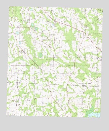
Berlin West, GA USGS Topographic Map
Click on map above to begin viewing in our Map Viewer.

This topographic map contains these locations and features:
Feature Name Type Latitude Longitude GNIS ID View Map
Adlai School (historical)SchoolN31.0199°W83.6874°345503View Map
Brice PondLakeN31.0041°W83.6343°311775View Map
Culbertson SchoolSchoolN31.1102°W83.7157°313205View Map
Emerald Hill ChurchChurchN31.0566°W83.7085°313936View Map
Hog CreekStreamN31.0596°W83.7068°315499View Map
Hopewell CemeteryCemeteryN31.1071°W83.7224°343973View Map
Hopewell ChurchChurchN31.1071°W83.7221°315640View Map
Indian Creek ChurchChurchN31.1194°W83.6468°315899View Map
IonePopulated PlaceN31.0124°W83.7338°332063View Map
Ione ChurchChurchN31.0113°W83.7324°345554View Map
Library Faith ChurchChurchN31.0944°W83.6882°343980View Map
Little CreekStreamN31.0571°W83.6493°317020View Map
Magnolia ChurchChurchN31.0110°W83.6902°317607View Map
Mount Olive Church (historical)ChurchN31.0991°W83.7404°343995View Map
New Jerusalem ChurchChurchN31.1085°W83.6966°319454View Map
Odom Elementary SchoolSchoolN31.1163°W83.6655°344004View Map
Pineview ChurchChurchN31.0252°W83.7243°320674View Map
Pleasant Hill ChurchChurchN31.0388°W83.6393°320863View Map
Prosperity CemeteryCemeteryN31.0252°W83.7349°345592View Map
Prosperity Church (historical)ChurchN31.0249°W83.7343°345593View Map
Sardis ChurchChurchN31.1032°W83.6477°322534View Map
Shelly School (historical)SchoolN31.0044°W83.7374°343823View Map
Sunbelt StripAirportN31.1123°W83.6866°351858View Map
Weldon (historical)Populated PlaceN31.1096°W83.6877°344029View Map
Wesley ChapelChurchN31.0360°W83.6288°325002View Map

Note: Coordinates in the location and feature list above are referenced to NAD83 datum.


Copyright (C) 2008-2025 Ryan Niemi / Sunset Dynamics ... All Rights Reserved