TopoQuest Logo
Do you find TopoQuest useful?
Help keep TopoQuest running and adding new maps/features by donating!
Bitcoin:  19c7KJd3qBynnjoSw5npx9KScwjBe4ifkT
Litecoin:  LXs6TkuXGGXo1vDsWCkWVdjQX94eUKd6ui
Home View Maps Find Maps Find Places Resources & Links


Pemaquid Point, Maine Topographic Map

USGS Map Title: Pemaquid Point, ME
USGS Map MRC: 43069G5
DRG (GeoTIFF) Download: o43069g5.tif


Neighboring USGS Topographic Map Quads:


  Westport, ME  
43069H6
 

  Bristol, ME  
43069H5
 

  Louds Island, ME  
43069H4
 

  Boothbay Harbor, ME  
43069G6
 

  Pemaquid Point, ME  
43069G5
 

  New Harbor, ME  
43069G4


Map MRC Location:

N44°
W70°
N44°
W69°
H8 H7 H6 H5 H4 H3 H2 H1
G8 G7 G6 G5 G4 G3 G2 G1
F8 F7 F6 F5 F4 F3 F2 F1
E8 E7 E6 E5 E4 E3 E2 E1
D8 D7 D6 D5 D4 D3 D2 D1
C8 C7 C6 C5 C4 C3 C2 C1
B8 B7 B6 B5 B4 B3 B2 B1
A8 A7 A6 A5 A4 A3 A2 A1
N43°
W70°
N43°
W69°

Pemaquid Point, ME USGS 1:24K Topographic Map Preview:
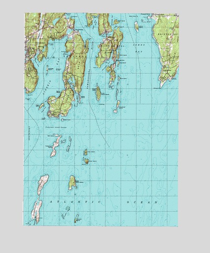
Pemaquid Point, ME USGS Topographic Map
Click on map above to begin viewing in our Map Viewer.

This topographic map contains these locations and features:
Feature Name Type Latitude Longitude GNIS ID View Map
Appalachie PondLakeN43.8537°W69.6089°561275View Map
Appalachie Pond DamDamN43.8527°W69.6108°1774342View Map
Barrett ParkParkN43.8484°W69.6178°1909708View Map
BayvillePopulated PlaceN43.8598°W69.6028°561756View Map
Bayville Post OfficePost OfficeN43.8600°W69.6022°1909710View Map
Beaver IslandIslandN43.8731°W69.5356°561931View Map
Birch IslandIslandN43.8501°W69.5509°562296View Map
Boothbay Harbor Census Designated PlaceCensusN43.8556°W69.6233°2377891View Map
Boothbay Volunteer Fire Station East BoothBuildingN43.8637°W69.5846°2552852View Map
Bristol Fire Department New HarborBuildingN43.8744°W69.5011°2552871View Map
Cabbage IslandIslandN43.8420°W69.6070°563334View Map
Card CoveBayN43.8179°W69.6084°563503View Map
Card LedgeBarN43.8126°W69.6084°563504View Map
Christmas CoveBayN43.8445°W69.5598°563975View Map
Christmas CovePopulated PlaceN43.8470°W69.5537°563976View Map
Clifford PointCapeN43.8448°W69.5664°580278View Map
Congregational Church of Boothbay HarborChurchN43.8567°W69.6248°1909754View Map
Corvette LedgeBarN43.8715°W69.5467°581712View Map
Corvette LedgeBenchN43.8704°W69.5467°578931View Map
Crow IslandIslandN43.8368°W69.5498°564597View Map
Damariscotta RiverStreamN43.8181°W69.5709°564755View Map
Damariscove HarborBayN43.7537°W69.6150°564756View Map
Damariscove IslandIslandN43.7656°W69.6128°564757View Map
Damariscove Lifesaving StationLocaleN43.7548°W69.6150°1909765View Map
Davis PointCapeN43.8667°W69.5506°581407View Map
Decker RockBarN43.8148°W69.5837°580279View Map
Dictator LedgeBarN43.8081°W69.6062°581724View Map
Dictator LedgeBenchN43.8084°W69.6070°578928View Map
Dry PointCapeN43.8223°W69.5812°565319View Map
East BoothbayPopulated PlaceN43.8651°W69.5864°565525View Map
East Boothbay Post OfficePost OfficeN43.8655°W69.5848°1909774View Map
East Boothbay ShipyardsLocaleN43.8665°W69.5834°1909775View Map
East Boothbay United Methodist ChurchChurchN43.8645°W69.5837°1909776View Map
Farnham CemeteryCemeteryN43.8554°W69.5746°566058View Map
Farnham PointCapeN43.8587°W69.5759°566060View Map
Fish Hawk IslandIslandN43.8556°W69.6025°566199View Map
Fish PointCapeN43.8729°W69.5259°566209View Map
Fisherman IslandIslandN43.7970°W69.5998°566235View Map
Fisherman Island PassageChannelN43.8079°W69.6003°566238View Map
Fishermans Memorial ParkParkN43.8473°W69.6239°1909794View Map
Fishermans Museum and Art GalleryBuildingN43.8370°W69.5067°1909795View Map
Foster PointCapeN43.8431°W69.5664°566458View Map
Gangway LedgeBarN43.8087°W69.6025°581744View Map
Gem IslandIslandN43.8667°W69.5542°566732View Map
Grand Banks Schooner MuseumBuildingN43.8031°W69.5989°1909804View Map
Green IslandIslandN43.8120°W69.5942°567211View Map
Hay IslandIslandN43.8459°W69.5503°567797View Map
Heron IslandPopulated PlaceN43.8304°W69.5670°567962View Map
Heron Island South LedgeBarN43.7687°W69.5828°581778View Map
Holbrook LedgeBarN43.8417°W69.5995°581439View Map
Inner Heron IslandIslandN43.8279°W69.5662°568649View Map
Inner Heron Island LedgeBarN43.8226°W69.5692°581784View Map
Inner IslandIslandN43.7934°W69.5750°568650View Map
Inner White Island PreserveParkN43.7929°W69.5745°1909821View Map
Johns BayBayN43.8542°W69.5323°568892View Map
Johns IslandIslandN43.8670°W69.5353°568895View Map
Johns RiverStreamN43.8684°W69.5437°568906View Map
Jones CoveBayN43.8690°W69.5709°568957View Map
Jones PointCapeN43.8673°W69.5750°568967View Map
Knowles RocksBarN43.8709°W69.5298°569261View Map
Levison PreserveParkN43.8484°W69.5809°1909832View Map
Lewis CoveBayN43.8451°W69.6148°569497View Map
Lighthouse CoveBayN43.8359°W69.5092°1909833View Map
LinekinPopulated PlaceN43.8392°W69.5912°569633View Map
Linekin BayBayN43.8379°W69.6023°569634View Map
Linekin NeckCapeN43.8387°W69.5839°569635View Map
Little RiverStreamN43.8279°W69.5853°570006View Map
Little River Dam PreserveParkN43.8342°W69.5856°1909845View Map
Long CoveBayN43.8576°W69.5620°581385View Map
Lookout HillSummitN43.8708°W69.5022°570350View Map
Main CemeteryCemeteryN43.8741°W69.5611°1909906View Map
McFarlands CoveBayN43.8740°W69.5564°581457View Map
Meadow BrookStreamN43.8512°W69.6145°571071View Map
Meadow CoveBayN43.8740°W69.5912°571093View Map
Montgomery PointCapeN43.8720°W69.5895°571523View Map
Mount PisgahPopulated PlaceN43.8531°W69.6217°571772View Map
Negro IslandIslandN43.8201°W69.6112°572087View Map
Oaklawn CemeteryCemeteryN43.8679°W69.6124°572650View Map
Ocean HarborBayN43.8237°W69.5834°572660View Map
Ocean PointPopulated PlaceN43.8159°W69.5959°572663View Map
Ocean Point ChapelChurchN43.8143°W69.5987°1909890View Map
Our Lady Queen of Peace Roman Catholic ChurchChurchN43.8470°W69.6231°1909896View Map
Outer Heron IslandIslandN43.7759°W69.5850°572864View Map
Outer Heron Island LedgeBarN43.7698°W69.5642°581852View Map
Outer IslandIslandN43.7879°W69.5742°572865View Map
Paradise PointCapeN43.8520°W69.5914°572961View Map
Pemaquid BeachBeachN43.8712°W69.5195°1909900View Map
Pemaquid BeachPopulated PlaceN43.8745°W69.5214°573140View Map
Pemaquid LedgeBarN43.8162°W69.5206°581855View Map
Pemaquid LighthouseLocaleN43.8368°W69.5062°573143View Map
Pemaquid Lighthouse ParkParkN43.8370°W69.5064°1909905View Map
Pemaquid PointCapeN43.8315°W69.5150°573145View Map
Pemaquid PointPopulated PlaceN43.8406°W69.5098°573146View Map
Perch IslandIslandN43.8506°W69.5937°573189View Map
Pollock RockBarN43.8684°W69.5420°581867View Map
Pumpkin IslandIslandN43.7534°W69.5825°573886View Map
Pumpkin Island Northeast LedgeBarN43.7618°W69.5792°581875View Map
Pumpkin LedgesBarN43.7584°W69.5903°573890View Map
Ram IslandIslandN43.8031°W69.5984°573987View Map
Ram Island Light StationLocaleN43.8031°W69.5989°1909921View Map
Reeds IslandIslandN43.8254°W69.5809°574134View Map
Rutherford IslandIslandN43.8548°W69.5581°574621View Map
Rutherford LibraryBuildingN43.8702°W69.5604°2738444View Map
Seal RockBarN43.8487°W69.6028°575119View Map
Shipley PointCapeN43.8333°W69.5561°2566162View Map
South BristolPopulated PlaceN43.8640°W69.5612°575817View Map
South Bristol Elementary SchoolSchoolN43.8679°W69.5600°1909944View Map
South Bristol Post OfficePost OfficeN43.8588°W69.5562°2768937View Map
South Bristol Volunteer Fire StationBuildingN43.8575°W69.5561°2552749View Map
Spruce PointCapeN43.8273°W69.6223°576154View Map
Spruce Point LedgesBarN43.8237°W69.6195°576160View Map
Spruce ShoresPopulated PlaceN43.8281°W69.5956°576164View Map
SpruceworldPopulated PlaceN43.8417°W69.6203°1909960View Map
The BulldogBarN43.8215°W69.5662°576775View Map
The GutGutN43.8620°W69.5598°576811View Map
The HypocritesBarN43.7970°W69.5892°576834View Map
The MotionsBarN43.7512°W69.6189°576848View Map
Thread of Life LedgesBarN43.8298°W69.5509°580795View Map
Thrumcap IslandIslandN43.8204°W69.5503°577069View Map
Thrumcap LedgeBarN43.8243°W69.5423°581935View Map
Tibbits LedgeBarN43.8356°W69.5984°581937View Map
Town of BoothbayCivilN43.8101°W69.6025°582358View Map
Turnip IslandIslandN43.8315°W69.5545°577441View Map
Union Church of South BristolChurchN43.8590°W69.5556°1909970View Map
Wall PointCapeN43.8462°W69.6120°1909974View Map
White Island LedgeBarN43.7937°W69.5567°581961View Map
White IslandsIslandN43.7893°W69.5756°578361View Map
White PointCapeN43.7865°W69.5745°578367View Map
Witch IslandIslandN43.8698°W69.5534°578617View Map
Woods EndLocaleN43.7737°W69.6095°1909995View Map
Wylie RockBarN43.8006°W69.6139°580280View Map

Note: Coordinates in the location and feature list above are referenced to NAD83 datum.


Copyright (C) 2008-2024 Ryan Niemi / Sunset Dynamics ... All Rights Reserved