TopoQuest Logo
Do you find TopoQuest useful?
Help keep TopoQuest running and adding new maps/features by donating!
Bitcoin:  19c7KJd3qBynnjoSw5npx9KScwjBe4ifkT
Litecoin:  LXs6TkuXGGXo1vDsWCkWVdjQX94eUKd6ui
Home View Maps Find Maps Find Places Resources & Links


Penelope, Texas Topographic Map

USGS Map Title: Penelope, TX
USGS Map MRC: 31096G8
DRG (GeoTIFF) Download: o31096g8.tif


Neighboring USGS Topographic Map Quads:


  Abbott, TX  
31097H1
 

  Malone, TX  
31096H8
 

  Irene, TX  
31096H7
 

  West, TX  
31097G1
 

  Penelope, TX  
31096G8
 

  Hubbard, TX  
31096G7
 

  Elm Mott, TX  
31097F1
 

  Axtell, TX  
31096F8
 

  Prairie Hill, TX  
31096F7


Map MRC Location:

N32°
W97°
N32°
W96°
H8 H7 H6 H5 H4 H3 H2 H1
G8 G7 G6 G5 G4 G3 G2 G1
F8 F7 F6 F5 F4 F3 F2 F1
E8 E7 E6 E5 E4 E3 E2 E1
D8 D7 D6 D5 D4 D3 D2 D1
C8 C7 C6 C5 C4 C3 C2 C1
B8 B7 B6 B5 B4 B3 B2 B1
A8 A7 A6 A5 A4 A3 A2 A1
N31°
W97°
N31°
W96°

Penelope, TX USGS 1:24K Topographic Map Preview:
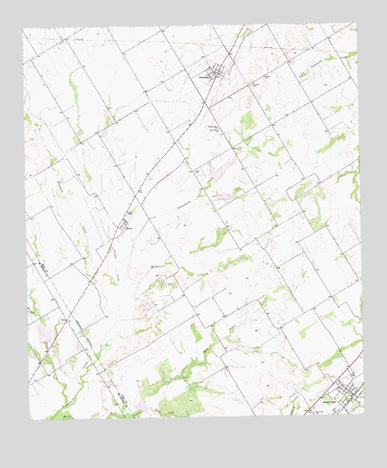
Penelope, TX USGS Topographic Map
Click on map above to begin viewing in our Map Viewer.

This topographic map contains these locations and features:
Feature Name Type Latitude Longitude GNIS ID View Map
Ash CreekStreamN31.7838°W96.9975°1329793View Map
BiromePopulated PlaceN31.8132°W96.9628°1378009View Map
Birome LakesLakeN31.8143°W96.9610°1330714View Map
Brookeen CreekStreamN31.7816°W96.9672°1372733View Map
Brushy CreekStreamN31.7899°W96.9667°1331433View Map
City of Mount CalmCivilN31.7566°W96.8817°2411177View Map
Crooked CreekStreamN31.7535°W96.9564°1373288View Map
Czech National CemeteryCemeteryN31.8418°W96.9273°1333856View Map
George Newton CemeteryCemeteryN31.8424°W96.9269°1336480View Map
HoenPopulated PlaceN31.7816°W96.9856°1378462View Map
Mesquite CemeteryCemeteryN31.7924°W96.9481°1341405View Map
Mesquite CreekStreamN31.7916°W96.9633°1341407View Map
Mount CalmPopulated PlaceN31.7563°W96.8792°1375023View Map
Mount Calm CemeteryCemeteryN31.7504°W96.8939°1342010View Map
Mount Calm City HallBuildingN31.7573°W96.8799°2753277View Map
Mount Calm Post OfficePost OfficeN31.7595°W96.8862°2732283View Map
Mount Calm Volunteer Fire DepartmentBuildingN31.7571°W96.8794°2552292View Map
PenelopePopulated PlaceN31.8602°W96.9267°1343826View Map
Penelope City HallBuildingN31.8594°W96.9274°2753825View Map
Penelope Post OfficePost OfficeN31.8594°W96.9267°2732022View Map
Penelope Volunteer Fire DepartmentBuildingN31.8593°W96.9272°2552481View Map
Saint Joseph CemeteryCemeteryN31.8554°W96.9147°1345961View Map
Soil Conservation Service Site 1 DamDamN31.8202°W96.9286°1855079View Map
Soil Conservation Service Site 1 ReservoirReservoirN31.8202°W96.9286°1855080View Map
Soil Conservation Service Site 1a DamDamN31.8252°W96.9303°1855077View Map
Soil Conservation Service Site 1a ReservoirReservoirN31.8252°W96.9303°1855078View Map
Soil Conservation Service Site 6 DamDamN31.7735°W96.9936°1862368View Map
Soil Conservation Service Site 6 ReservoirReservoirN31.7735°W96.9936°1862369View Map
Soil Conservation Service Site 7 DamDamN31.7535°W96.9586°1855081View Map
Soil Conservation Service Site 7 ReservoirReservoirN31.7535°W96.9586°1855082View Map
Soil Conservation Service Site 92a DamDamN31.8168°W96.8803°1863024View Map
Soil Conservation Service Site 92a ReservoirReservoirN31.8159°W96.8803°1863025View Map
Soil Conservation Service Site 92c DamDamN31.8235°W96.8853°1863326View Map
Soil Conservation Service Site 92c ReservoirReservoirN31.8235°W96.8853°1863327View Map
Sweat CreekStreamN31.7538°W96.9869°1348124View Map
Tabola CemeteryCemeteryN31.8285°W96.9361°1348194View Map
The LandingAirportN31.8371°W96.9622°2675911View Map
Town of PenelopeCivilN31.8585°W96.9281°2413124View Map
Whitesboro Public LibraryBuildingN31.8557°W96.9125°2014756View Map

Note: Coordinates in the location and feature list above are referenced to NAD83 datum.


Copyright (C) 2008-2025 Ryan Niemi / Sunset Dynamics ... All Rights Reserved