TopoQuest Logo
Do you find TopoQuest useful?
Help keep TopoQuest running and adding new maps/features by donating!
Bitcoin:  19c7KJd3qBynnjoSw5npx9KScwjBe4ifkT
Litecoin:  LXs6TkuXGGXo1vDsWCkWVdjQX94eUKd6ui
Home View Maps Find Maps Find Places Resources & Links


Penitentiary Mountain, Arizona Topographic Map

USGS Map Title: Penitentiary Mountain, AZ
USGS Map MRC: 35113A4
DRG (GeoTIFF) Download: o35113a4.tif


Neighboring USGS Topographic Map Quads:


  Tin Mountain, AZ  
35113B5
 

  Bull Spring, AZ  
35113B4
 

  Fort Rock Ranch, AZ  
35113B3
 

  Austin Peak, AZ  
35113A5
 

  Penitentiary Mountain, AZ  
35113A4
 

  Devils Hump, AZ  
35113A3
 

  Tom Brown Canyon, AZ  
34113H5
 

  Gonzales Wash, AZ  
34113H4
 

  Mohon Peak, AZ  
34113H3


Map MRC Location:

N36°
W114°
N36°
W113°
H8 H7 H6 H5 H4 H3 H2 H1
G8 G7 G6 G5 G4 G3 G2 G1
F8 F7 F6 F5 F4 F3 F2 F1
E8 E7 E6 E5 E4 E3 E2 E1
D8 D7 D6 D5 D4 D3 D2 D1
C8 C7 C6 C5 C4 C3 C2 C1
B8 B7 B6 B5 B4 B3 B2 B1
A8 A7 A6 A5 A4 A3 A2 A1
N35°
W114°
N35°
W113°

Penitentiary Mountain, AZ USGS 1:24K Topographic Map Preview:
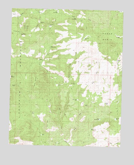
Penitentiary Mountain, AZ USGS Topographic Map
Click on map above to begin viewing in our Map Viewer.

This topographic map contains these locations and features:
Feature Name Type Latitude Longitude GNIS ID View Map
Alkali SpringSpringN35.0103°W113.4638°22802View Map
Aquarius MountainsRangeN35.0833°W113.4591°753View Map
Ash CreekStreamN35.0042°W113.4460°829View Map
Basin TankReservoirN35.1242°W113.3769°22819View Map
Campos Water SpringSpringN35.0786°W113.4691°22858View Map
Cedar BasinBasinN35.1014°W113.3916°22865View Map
Cedar Basin TankReservoirN35.0983°W113.4197°22867View Map
Cement TankSpringN35.0400°W113.3910°22871View Map
Chalk SpringSpringN35.0375°W113.4138°22873View Map
Cornwall BasinBasinN35.1033°W113.4966°22886View Map
Cornwall Basin SpringSpringN35.1020°W113.4905°22887View Map
East Ash CreekStreamN35.0542°W113.4466°22922View Map
Farrel MountainSummitN35.0575°W113.4730°22935View Map
Grapevine TankReservoirN35.0786°W113.3813°22961View Map
Hay Fever TankReservoirN35.0256°W113.3818°22980View Map
Lower Bald Mountain TankReservoirN35.0150°W113.4099°23066View Map
Lower Water SpringSpringN35.1228°W113.4499°23070View Map
McGee WashValleyN35.0028°W113.4347°23079View Map
Middle Water SpringSpringN35.1172°W113.4291°23084View Map
North Burn SpringSpringN35.0550°W113.4969°23111View Map
Pasa Robles WellWellN35.1008°W113.3791°23136View Map
Penitentiary MountainSummitN35.1078°W113.4847°23140View Map
Penitentiary SpringSpringN35.1128°W113.4688°23141View Map
Penitentiary TanksReservoirN35.1092°W113.4577°23142View Map
Pony MesaSummitN35.0181°W113.4574°23149View Map
Ray Cowden TankSpringN35.0425°W113.4249°23156View Map
Ruth Cowden WellWellN35.0567°W113.4277°23181View Map
Upper Bald Mountain TankReservoirN35.0251°W113.3995°23262View Map
Upper Live Water SpringSpringN35.0906°W113.4569°23266View Map

Note: Coordinates in the location and feature list above are referenced to NAD83 datum.


Copyright (C) 2008-2024 Ryan Niemi / Sunset Dynamics ... All Rights Reserved